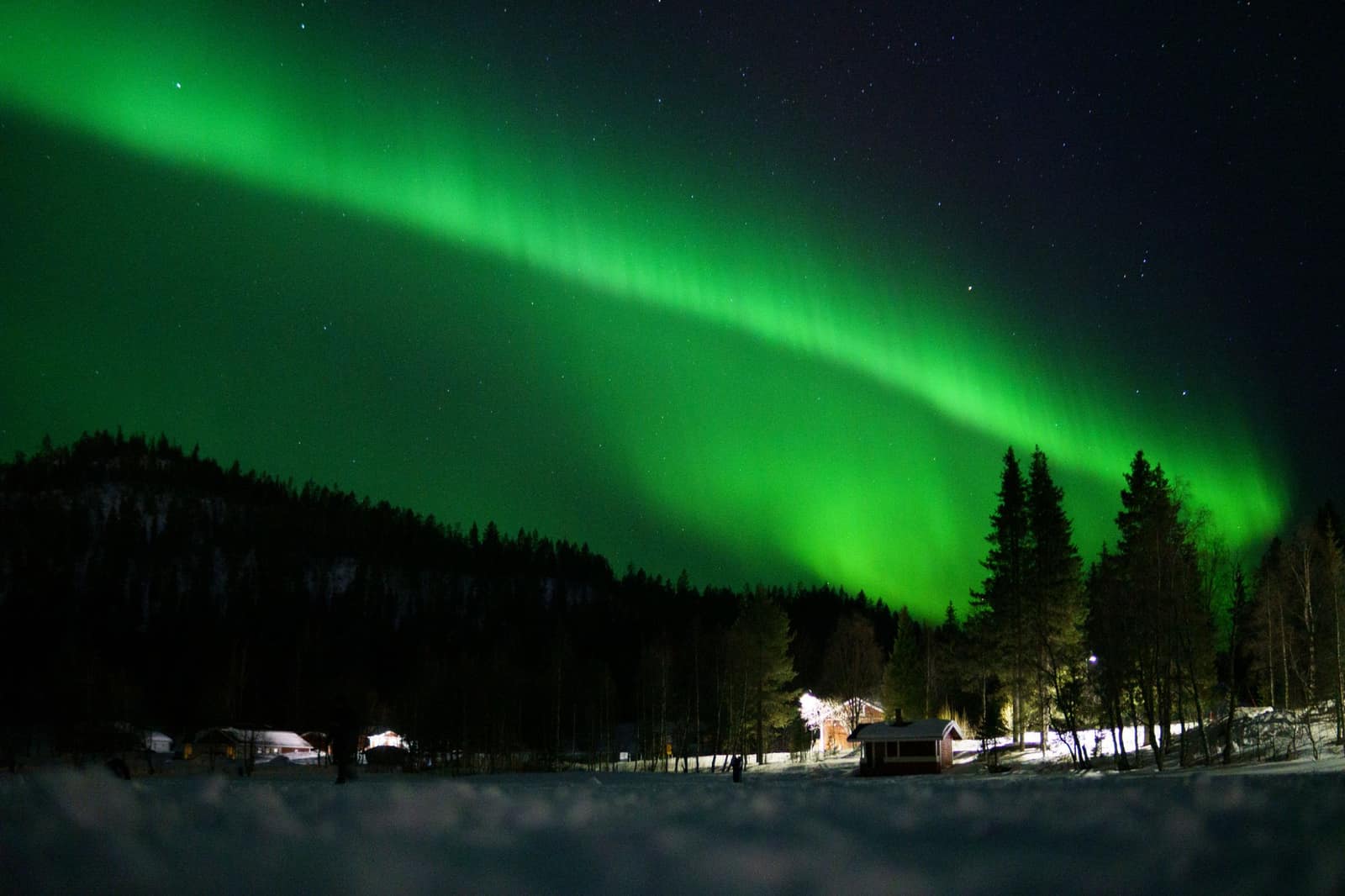
From the Gulf of Bothnia over the Arctic Circle, through the ice hotel country and across the river border into Finnish Lapland, with nights chosen for the northern lights.
In short: Eight winter days from Luleå to Ivalo across the Arctic Circle and the Muonio river, self-drive with a person of ours on the ground.
Length
8 days
Season
Mid-February to mid-March
Longest day
Day 4 · 324 km · 4 h 33 min
A self-drive journey is the lighter alternative to our curated journeys, offered on request, with the same highest level of service. About self-drive journeys
Route
Luleå, Harads, the Arctic Circle, Jokkmokk, Gällivare, Kiruna and Jukkasjärvi, Vittangi, Karesuando, across the Muonio river into Finland at Kaaresuvanto, Muonio, Levi, Kittilä, Sodankylä, Saariselkä, Inari, Ivalo
Total driving
About 1,110 km and 16 hours of pure driving
Repeats on the road
The main route runs from the Gulf of Bothnia north and east into Finnish Lapland and ends at a different airport. One short repeat, named honestly: Day 4 drives back about 42 km of Day 2, from Jukkasjärvi to Svappavaara, before turning north on the E45. One spur returns on the same road by design: Inari from Saariselkä (Day 7).
Ferries
None
Time zone
Finland is one hour ahead of Sweden. The clock moves forward at the river on Day 4; the schedule shows both.
The car
Range Rover, Land Rover Discovery, Mercedes-Benz GLS, Volvo XC90, or a Mercedes-Benz V-Class for larger groups, or comparable, chosen for comfort on every road we send you. Or similar: a vehicle of the same class and standard.
Crossing the border
One car from Luleå to Ivalo where our supplier allows the one-way drop. Otherwise the car is changed at the river bridge between Karesuando and Kaaresuvanto, by our person on the ground, in about 30 minutes and never at a rental desk.
The whole journey, day by day. The numbered points mark where each day ends and the night is spent; select one to jump to that day.
Day 4, Jukkasjärvi to Levi: 324 km and 4 h 33 min of pure driving on winter roads, crossing a border and a time zone. With stops it runs from 08:30 Swedish time to about 16:05 Finnish time, ending before sunset in late February.
Day 2, Harads to Jukkasjärvi (295 km, 4 h 04 min), is the other long day. Both are followed by a full day without driving.
The car
Range Rover, Land Rover Discovery, Mercedes-Benz GLS, Volvo XC90, or a Mercedes-Benz V-Class for larger groups, or comparable, chosen for comfort on every road we send you.
Or similar: a vehicle of the same class and standard.
Grade A, 4x4 SUV, automatic, current or previous model year, studded winter tyres for the whole rental, an engine block heater with its cable (outdoor sockets are standard at Lapland hotels), ice scraper and snow brush, and the supplier’s written authorisation to cross into Finland. Fuel stations are far apart in the north; the guests are asked to refill above half a tank.
Both countries are covered: your car carries the supplier’s written authorisation to cross into Finland, and the border day is arranged for you.
On the ground, every day
The vehicle is handed over at Luleå airport by our ground contact or a supplier agent, with a 20-minute winter briefing: studs, block heater, reindeer on the road, what to do if a car goes into a snowbank. Collection at Ivalo airport.
One named person on the ground for the whole trip, reachable at any hour by phone and message.
The evening pulse: tomorrow’s road conditions from Trafikverket in Sweden and Fintraffic in Finland, temperature, the aurora forecast, the first departure time; a morning check before the car leaves.
A route pack: day cards, offline maps, the Google Earth file of the route, a data connection that works in both countries and a satellite messenger.
Curated stays chosen for the night sky, with a wake-up call for the aurora where the stay offers it.
Evenings at the table
Chef evenings: Night 5 in a private cabin at Levi and Night 7 at Saariselkä.
With a private guide
We recommend a private driver-guide for the two long days in winter, and we say so on the first call. The roads are well kept, but the light is short, the cold is serious and the distances between villages are long. Three levels are offered: guided activities only, a driver-guide for Days 2 and 4, or a driver-guide for the whole crossing. Guests who drive themselves do it with the ground contact watching both countries’ road services for them.
Guided days to add
Guided days: dog sledding or a snowmobile run on the Torne river (Day 3), a reindeer day with a herding family or a husky day near Levi (Day 5), snowshoes to the old wilderness church at Pielpajärvi near Inari (Day 7), and an aurora evening with a guide on any night.
The days
Day 1 Luleå to Harads
91 km, 1 h 19 min.
Luleå sits on the Gulf of Bothnia, where the sea itself freezes in winter and the locals drive on the ice roads across the bay. Our ground contact meets you at the airport with the car and takes twenty minutes over the winter briefing, then the road runs north up the Lule river valley through pine forest and snow.
Harads is a village in the forest above the river, and the night is spent in a room built among the trees, each one designed by a different Scandinavian architect, with the forest floor several metres below. The sky here is dark, and if the aurora comes, the room has the window for it.
Along the way
Luleå Start of the day
In winter the sea ice at Luleå carries a free track of about 10 km that encircles the city. Once the ice is thicker than 50 cm, roads are ploughed for cars to link several islands of the archipelago, which Visit Sweden says has 1,312 islands along its coastline.
Gammelstad On the way
Gammelstad is a church town on the edge of Luleå, and it has been on the UNESCO World Heritage List since 1996. Around 400 cottages and parish storage houses stand here, and Visit Sweden calls it the largest and best preserved church town in Sweden.
Parishioners who lived far from the church could not travel back and forth on a Sunday, so they were allowed to build a house on land owned by the church.
Rödbergsfortet, Boden On the way
Rödbergsfortet is part of Bodens fästning, the Boden Fortress. Blasting for the fortress began in 1901.
Today guided tours lead through some of the former secret military spaces. Little of the fortress shows above ground, where only steel and concrete hint at it against the bare rock.
Harads End of the day
Harads lies just under 50 km north-west of Boden on road 97, along the Lule river. It is the main village of Edefors parish, the smallest parish in the Diocese of Luleå.
The first church of the parish was consecrated in 1888 and was lost to a fire in May 1918. The present church was consecrated on Midsummer Day 1928, with about 300 seats against the first church’s 1,000.
The road of the day, on the coast. Select a point to read about the place.
The day, hour by hour (Swedish time)
On arrival: Land at Luleå; vehicle handover and winter briefing
14:30Leave Luleå
15:50Arrive Harads
19:00Dinner reserved
21:00Aurora watch (when the sky allows)
Plan B. In a late arrival after dark, the ground contact drives the first stretch with the guests, or a car service takes them to Harads and the vehicle is delivered there the next morning.
Night: Harads
Day 2 Harads to Jukkasjärvi, across the Arctic Circle
295 km, 4 h 04 min.
North of Harads the road crosses the Arctic Circle, marked by the roadside: the line beyond which, in principle, the midwinter sun does not rise and the midsummer sun does not set. Jokkmokk is the old meeting place of the Sámi in this region. Its winter market has been held since 1605, in the first week of February, and the museum of the mountains and the Sámi people tells the story of reindeer herding, the seasons of migration and the land the road is crossing.
Gällivare is a mining town under the fell of Dundret. The last leg runs north through forest and frozen marsh toward Kiruna, and at Jukkasjärvi, on the Torne river, a hotel is built each winter from blocks of the river’s own ice, with rooms carved by artists and a chapel of ice. The village’s wooden church dates from the 17th century.
Along the way
Harads Start of the day
The second day starts in Harads, the main village of Edefors parish. The church here was consecrated on Midsummer Day 1928, and its white outside dates from a repainting in the 1950s, when it replaced the earlier red-brown.
Inside, the ceiling carries paintings of the apostles and of animals that carry Christian symbols.
The Arctic Circle A stop
The Arctic Circle crossing on the E45 lies about 7 km from the centre of Jokkmokk. A summer café and shop beside the road sells souvenirs and Arctic Circle certificates.
The circle marks the southernmost point from which the centre of the sun can be seen at the summer solstice. Swedish Lapland notes that its position moves slightly from year to year.
Jokkmokk A stop
Ájtte, the Swedish Mountain and Sámi Museum, opened in Jokkmokk in June 1989. It calls itself the main museum for Sámi culture in Sweden, and it tells of people in their environment, with nature and culture seen as a whole.
The town’s winter market will be its 422nd in 2027, from 4 to 6 February. The market’s own history says the Swedish crown established permanent marketplaces near the Sámi winter residences in the early 1600s.
Porjus On the way
Porjus has a place in Swedish engineering history. Its power station was built to supply electricity to the Malmbanan, the railway that carries iron ore, and it lies below ground on a site blasted out of the rock, with tunnels for water in and out.
Work began in 1910, the station went into operation in 1914, and in 1915 King Gustaf V declared it officially open by telephone.
Gällivare A stop
Dundret dominates the view from the centre of Gällivare. It rises 820 m above sea level, far above the tree line, and Swedish Lapland says the Sarek mountains and Kebnekaise can be seen from the top on a clear day.
At Malmberget, 5 km north of the town, the iron ore mine is one of the world’s two largest underground iron ore mines, together with Kiirunavaara in Kiruna.
Jukkasjärvi End of the day
Jukkasjärvi lies by the Torne river, 17 km outside Kiruna. The red wooden church includes parts from 1607, and the national heritage register records that it stands on an old Sámi church site.
The register also describes it as the only preserved church of its log-pillar type in Sweden.
The road of the day, on the coast. Select a point to read about the place.
The day, hour by hour (Swedish time)
08:30Leave Harads
09:30The Arctic Circle marker
09:45Jokkmokk; the mountain and Sámi museum; lunch
12:15Leave Jokkmokk
13:35Gällivare; coffee and fuel
14:10Leave Gällivare
15:45Arrive Jukkasjärvi
21:00Aurora watch (when the sky allows)
Plan B. In heavy snowfall the museum stop is shortened and the guests reach Jukkasjärvi before dark. In the early-February variant, if the guests travel in the market week, the Jokkmokk stop becomes the market and the museum is skipped.
Night: Jukkasjärvi
Day 3 Jukkasjärvi: the river and the ice
No driving.
The day is on the frozen Torne river. A dog team runs at the speed of a fast skier, and from the sled you hear nothing but the runners and the dogs’ breath; or a snowmobile goes up the river and out onto the open fell, with a guide in front. Lunch is cooked over a fire in a tent on the ice.
The afternoon is for the ice hotel itself, its rooms and the way it is built, cut from the river in spring, stored through the summer and raised again each November. In the evening, if the sky is clear, the aurora is watched from the river, away from the lights.
Along the way
Jukkasjärvi Start of the day
Jukkasjärvi is a village by the Torne river, 17 km outside Kiruna. Kiruna municipality notes that the parish celebrated 400 years of its church in 2007.
The Torne river runs for 520 km, from above Lake Torneträsk to the Bothnian Bay at Haparanda. Swedish Lapland counts it among Sweden’s four national rivers, and at Junosuando more than half of its water flows off through the Tärendö bifurcation to the Kalix river.
Jukkasjärvi Church A stop
Jukkasjärvi church is a red-painted log building with a separate bell tower. Its middle part dates from about 1607, the present choir and porch were added when it was rebuilt in 1726, and the bell tower was built in the 1740s.
The altarpiece is a triptych in teak by Bror Hjorth, handed over in 1958 for the church’s 350th anniversary.
Kiruna On the way
Kiruna Church was built between 1909 and 1912 to a design by Gustaf Wickman, and its form blends Norwegian stave churches and Sámi goahti dwellings. In 2001 it was voted the best building built before 1950 in a public vote.
On 19 and 20 August 2025 the whole church, weighing 672.4 tons, was moved in one piece along a route of 5 km to its new site between the cemetery and the new town centre.
The road of the day, on the coast. Select a point to read about the place.
The day, hour by hour
09:30Guided dog sledding or snowmobile on the Torne river (option, about 3 hours)
13:00Lunch in a tent on the ice
15:00Guided tour of the ice hotel
19:00Dinner reserved
21:00Aurora evening with a guide (option, when the sky allows)
Plan B. In extreme cold (below about minus 30), the outdoor programme is shortened and moved to midday, and the afternoon is spent indoors.
Night: Jukkasjärvi
Day 4 Jukkasjärvi to Levi, across the Muonio river
324 km, 4 h 33 min. Longest drive of the tour. The clock moves one hour forward at the border.
From Jukkasjärvi the road runs back past the mine at Svappavaara, then turns north on the E45 and runs for two hours through a white country of birch, fell and frozen lakes, with reindeer at the roadside and sometimes on it. Karesuando is the last Swedish village on the road, and the bridge over the Muonio river takes you into Finland at Kaaresuvanto. The river is the border, and the clock moves forward an hour.
On the Finnish side the road follows the river south to Muonio, through villages of red and yellow wooden houses, and then east into the fells. Levi is a fell with a village at its foot, and the evening is spent in a cabin with a sauna and a stove, and the dark outside.
Along the way
Jukkasjärvi Start of the day
The day starts in Jukkasjärvi, a village by the Torne river, 17 km outside Kiruna.
The Torne river forms, together with the Kalix river, the largest unregulated water system in Europe, according to Swedish Lapland, and its main tributaries include the Rautas, Vittangi, Lainio and Muonio rivers. Kiruna municipality counts the church here as built in 1607.
Svappavaara On the way
Svappavaara is a village in Kiruna municipality, where ore is mined in the Leveäniemi surface mine and one of the pelletising plants of the mining company stands.
The mine here was inaugurated in 1965, together with pelletising plants at Svappavaara and Kiruna and a new harbour at Luleå.
Karesuando A stop
Swedish Lapland calls Karesuando Sweden’s northernmost church village. Here the river takes the name Muonio, and it is the border river with Finland. The wooden church was built in 1905, and it holds an altarpiece by Bror Hjorth.
The priest Lars Levi Laestadius lived in the village from 1826 to 1849. Karesuando was a municipality of its own until 1971, when it became part of Kiruna.
Kaaresuvanto A stop
Kaaresuvanto is the Finnish side of a village on the banks of the Muonionjoki river, partly in Finland and partly in Sweden (Karesuando). The border bridge is a good place to see the river, which can rise to the bridge in spring floods.
From the village it is 88 km to Muonio along highway 21, according to the municipality of Enontekiö.
Muonio A stop
Muonio lies in Fell Lapland near the Swedish border, and the municipality says its services sit in the arms of Pallas-Yllästunturi National Park. Highways 21 (E8) and 79 pass through it.
A bridge and road connect Muonio with Muodoslompolo in Sweden over the Muonionjoki, which locals also call Väylä. Pajala lies 107 km to the west and Kittilä 80 km to the east.
Levi End of the day
Levi is a fell with a village at its foot, in the centre of Sirkka village in Kittilä. The peak is about 530 m above sea level, and two scenic cabin lifts take visitors to the top, where you can step out and walk around the summit.
Kittilä municipality calls Levi Finland’s leading year-round tourism and event centre, and Kittilä Airport is 15 km from Levi.
The road of the day, on the coast. Select a point to read about the place.
The day, hour by hour
08:30(Swedish time) Leave Jukkasjärvi
10:50Karesuando; coffee and fuel
11:15Cross the bridge to Kaaresuvanto. Clock forward: 12:15 Finnish time
12:30(Finnish time from here) Lunch in Kaaresuvanto
13:30Leave Kaaresuvanto
14:50Muonio
15:10Leave Muonio
16:05Arrive Levi
Plan B. If the cross-border arrangement is the vehicle change (see "Vehicle"), it happens at the bridge during the lunch stop. If the E45 is closed by snow, the guests stay a second night in Jukkasjärvi, the ground contact moves the Levi nights, and Day 5 becomes the drive day.
Night: Levi
Day 5 Levi: reindeer and the fells
No driving.
A day with a reindeer-herding family is the way to understand what this country is for: the herds, the seasons of the year they follow, the language of the work. It is arranged per trip with a family we choose for the season. For those who prefer speed, a husky team runs through the forest from a kennel outside the village.
The afternoon is free on the fell, on skis or on foot, or in the sauna. If a chef evening is booked, it is in the cabin tonight, with the food of the north: reindeer, Arctic char, cloudberries and lingonberries.
Along the way
Levi Start of the day
Levitunturi, the fell above the village, rises to about 530 m: the municipality gives 530.3 m and the resort’s own site 531 m. Sirkka village at its foot belongs to the municipality of Kittilä.
Two scenic cabin lifts run to the top, a return trip takes about 20 minutes, and you can step out at the top and walk around the summit.
Kittilä A stop
Kittilä is a large municipality of 8,263.9 km2, of which 168.6 km2 is water. The church village lies about 174 m above sea level, and the municipality gives about 12,000 reindeer, a 2013 figure from the Reindeer Herders’ Association.
The large and free Ounasjoki river flows through the municipality, and about a third of Pallas-Yllästunturi National Park lies within it.
The road of the day, on the coast. Select a point to read about the place.
The day, hour by hour
09:30Reindeer day with a herding family, or a husky run (option, about 4 hours)
14:00Free on the fell
19:30Private chef evening in the cabin (option)
Plan B. If the herding family cannot host on the day, the guide moves the visit to a nearby reindeer farm, or the day becomes the husky run.
Night: Levi
Day 6 Levi to Saariselkä, by Sodankylä
237 km, 3 h 34 min.
The road runs east through Kittilä and across a long stretch of forest and frozen bog to Sodankylä, a village by the Kitinen river with a wooden church from 1689, one of the oldest in Finland, standing beside the newer stone one. Lunch is in Sodankylä.
North of Sodankylä the forest thins and the fells begin. Saariselkä is a village at the edge of a large national park, a quiet country of rounded fells and old pine. Before dark, the road to the top of Kaunispää gives the view over the fells in every direction.
Along the way
Levi Start of the day
The day starts at Levi. Kittilä municipality gives the peak as 530.3 m above sea level, and says it stands in the centre of Sirkka village.
Kittilä Airport is 15 km from Levi, and the municipality calls Levi Finland’s leading year-round tourism and event centre. From here the day’s road runs east.
Kittilä On the way
Kittilä was linked to Sodankylä as a chapel parish in 1828, and the first municipal meeting under the new administration was held on 11 July 1868.
About a third of Pallas-Yllästunturi National Park lies within the municipality, and the free Ounasjoki river flows through it. The church village is at about 174 m above sea level.
Sodankylä A stop
Sodankylä is the second largest municipality in Finland by area, at 12,417 km2, with a little over 8,000 residents. The municipality includes Pyhä-Luosto and Urho Kekkonen national parks.
The church village lies between two rivers, the Kitinen and the Jeesiö, and the old wooden church there is one of the oldest preserved wooden churches in Lapland.
Tankavaara On the way
Tankavaara is a gold prospectors’ village directly on the E75 road, 30 km south of Saariselkä and 230 km north of Rovaniemi. Its Gold Prospector Museum was founded in 1973.
The museum describes itself as the only international museum in the world on the past and present of gold panning and prospecting. Its basic exhibition covers the history of gold prospecting in Lapland, and a section called Golden World presents more than twenty countries.
Kaunispää A stop
Kaunispää is a fell of about 440 m in Saariselkä, and the only nearby hill whose top can be reached by car. You can also reach the summit on foot, on skis or by ski lift.
From the top the view takes in Urho Kekkonen National Park, the Sompio Nature Reserve and the tundra around Hammastunturi Fell.
Saariselkä End of the day
Urho Kekkonen National Park extends eastwards from the resort of Saariselkä all the way to the Russian border. The park was established in 1983, covers 2,549 km2 and lies in the municipalities of Inari, Sodankylä and Savukoski.
Finavia describes Saariselkä as the northernmost outdoor resort in Europe.
The road of the day, on the coast. Select a point to read about the place.
The day, hour by hour (Finnish time)
09:30Leave Levi
09:55Kittilä
11:20Sodankylä; the old church; lunch
13:00Leave Sodankylä
14:45Kaunispää fell top
15:30Arrive Saariselkä
21:00Aurora watch (when the sky allows)
Plan B. In poor visibility the Kaunispää stop is skipped. In heavy snow the departure moves earlier and the Sodankylä stop is shortened.
Night: Saariselkä
Day 7 Inari and the lake
140 km, 2 h 12 min, Saariselkä to Inari and back. Spur by design.
Inari sits on a lake with more than three thousand islands, frozen solid in winter. Siida, the museum of the Sámi people and of northern nature, sets out the seasons of the north, the clothes, the tools and the long history of living here. In the afternoon, snowshoes take you through the forest to an 18th-century wooden church on the shore of Pielpajärvi, reached only on foot.
The drive back to Saariselkä is in the last light. If a chef evening is booked, it is tonight, the last night of the trip.
Along the way
Saariselkä Start of the day
The spur to Inari starts at Saariselkä, at the edge of Urho Kekkonen National Park. The park was established in 1983 after a campaign of nearly 20 years, and it honours Urho Kekkonen, Finland’s longest-serving president.
Parliament unanimously passed the national park act in December 1982, and it took effect on 1 May 1983.
Ivalo On the way
The Ivalojoki river runs to Ivalo, and its 70 km stretch from Kuttura has several white-water rapids. It is called the golden river because, Visit Finland says, the first gold rush in Finland took place here.
The gold land was officially found by an expedition sent by the Senate in September 1868. Luontoon says close to a thousand people pan for gold in the river each summer.
Siida, Inari A stop
Siida in Inari is both the Sámi Museum and the Northern Lapland Nature Centre, and its building opened in 1998. The museum says it tells the story of the Sámi, past, present and future, and an open-air museum shows Sámi heritage and traditional livelihoods.
Nearby is Lake Inari, the third largest and second deepest lake in Finland, with 3,318 islands.
Pielpajärvi Church A stop
The wooden wilderness church at Pielpajärvi dates from around 1760. Siida describes it as built in a Sámi winter village as the parish church of Inari, and it is one of the oldest buildings in northern Lapland.
The church is always open and can be visited freely. It is reached by boat in summer, or on skis or by snowmobile in winter, and special services are held there at Easter and Midsummer.
Saariselkä End of the day
Finavia describes Saariselkä as the northernmost outdoor resort in Europe. Urho Kekkonen National Park extends eastwards from the resort all the way to the Russian border.
The national parks’ marked routes lie around Saariselkä, according to Visit Finland, which makes the village a base for day walks.
The road of the day, on the coast. Select a point to read about the place.
The day, hour by hour (Finnish time)
09:30Leave Saariselkä
10:40Siida
12:30Lunch in Inari
13:30Snowshoe walk to the Pielpajärvi wilderness church with a guide (option, about 3 hours)
17:00Leave Inari
18:10Back in Saariselkä
19:30Private chef evening (option)
Plan B. If the snowshoe walk is too cold or the light too short, the afternoon goes to a guided snowmobile run on the lake ice, or back to Saariselkä for the sauna.
Night: Saariselkä
Day 8 Saariselkä to Ivalo airport
27 km, 24 min.
The last morning is short. The car goes north to Ivalo airport, a small terminal in the forest, and our ground contact or the supplier’s agent takes the keys.
From the window of the plane the country you drove through lies white to the horizon: fell, forest, frozen lake, and the road running through it all.
Along the way
Saariselkä Start of the day
The last morning starts in Saariselkä, which Finavia describes as easy to reach from Ivalo Airport. The national parks’ marked routes lie around the resort, and Urho Kekkonen National Park extends eastwards from it all the way to the Russian border.
The park covers 2,549 km2.
Kaunispää On the way
Kaunispää has downhill skiing and Finland’s longest toboggan slope, according to Visit Finland, which also says the fell is suitable for a visit all year and that admission is free.
You can reach the summit on foot, on skis, by car or by ski lift, and the view from the top takes in Urho Kekkonen National Park.
Ivalo Airport End of the day
Finavia calls Ivalo Airport the northernmost airport in Finland. It is served with flights from major European cities, and it has daily connections from Helsinki.
The airport lies near Ivalo, which stands on the Ivalojoki river, the golden river of Finland’s first gold rush.
The road of the day, on the coast. Select a point to read about the place.
The day, hour by hour (Finnish time)
2 h before departure: Leave Saariselkä
90 min before departure: Vehicle handed back at Ivalo airport
Plan B. If the flight from Ivalo is cancelled, the ground contact books the next flight and a night at Saariselkä.
Request this journey
Tell us your month and your party, and a founder replies within 24 hours with the journey shaped to you. Prices are shared in that reply.