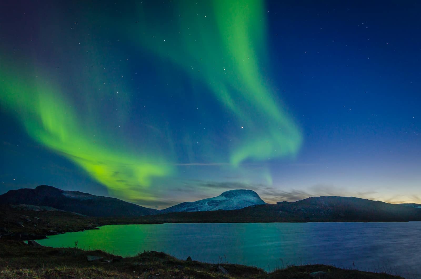
Iceland: South Coast to the Eastern Fjords, Winter
Waterfalls wearing ice, a guided walk inside a glacier, and dark lodge skies for the northern lights, then east through the fjords to Egilsstaðir and a flight back to Reykjavík.
In short: Eight winter days on the south and east coast of Iceland, self-drive with studded tyres, a guided ice cave and a person of ours on the ground.
Length
8 days
Season
November to March
Longest day
Day 7 · 273 km · 4 h 18 min
A self-drive journey is the lighter alternative to our curated journeys, offered on request, with the same highest level of service. About self-drive journeys
Route
Keflavík, Reykjavík, Þingvellir, Geysir, Gullfoss, the greenhouse restaurant, Hella, Seljalandsfoss, Skógafoss, Sólheimajökull, Dyrhólaey, Vík, Fjaðrárgljúfur, Kirkjubæjarklaustur, Skaftafell, the glacier lodge, Jökulsárlón, Stokksnes, Höfn, Djúpivogur, the eastern fjords, Egilsstaðir; domestic flight back to Reykjavík
Total driving
About 1,010 km and 16 hours of pure driving
Repeats on the road
The route is one-way along the south and east coast; the car is handed back at Egilsstaðir airport and the guests fly to Reykjavík. Three short repeats, named honestly: the 30-minute lodge-to-lagoon road on Days 5 and 6 (a spur by design); about 8 km past Geysir on Day 2, on the way from Gullfoss to the greenhouse restaurant; and about 10 km of Route 1 between Höfn and the Stokksnes turn, driven out and back on Day 6 and again on Day 7.
Ferries
None
One-way, and why
The south coast is a single road. Returning by car would mean driving the same 600 km twice in winter light. The domestic flight replaces that day.
The car
Range Rover, Land Rover Discovery, Mercedes-Benz GLS, Volvo XC90, or a Mercedes-Benz V-Class for larger groups, or comparable, chosen for comfort on every road we send you. In Iceland, electric and plug-in hybrid versions can be arranged where a comparable luxury model is available, charged on Iceland’s renewable power. Or similar: a vehicle of the same class and standard.
The whole journey, day by day. The numbered points mark where each day ends and the night is spent; select one to jump to that day.
Day 7, Höfn to Egilsstaðir airport: 273 km and 4 h 18 min of pure driving, through the eastern fjords in winter, ending at a flight. It is the day with the least margin in the tour, and it is the reason the ground contact checks the road at 07:00 that morning and holds a fallback night (Plan B, Day 7).
The glacier lagoon is not asked of you in a single day from Reykjavík. The journey stays beside it instead: the lodge is a short morning drive from the lagoon, so you meet the ice with time to spare.
The car
Range Rover, Land Rover Discovery, Mercedes-Benz GLS, Volvo XC90, or a Mercedes-Benz V-Class for larger groups, or comparable, chosen for comfort on every road we send you.
In Iceland, electric and plug-in hybrid versions can be arranged where a comparable luxury model is available, charged on Iceland’s renewable power.
Or similar: a vehicle of the same class and standard.
Grade A, full-size 4x4 SUV, automatic, current or previous model year, studded winter tyres fitted for the whole rental, engine pre-heating where offered, ice scraper and snow brush, a second set of keys held by the ground contact. Winter driving in Iceland is about wind and ice more than snow depth; the guests receive a 20-minute briefing at handover on wind gusts, car doors and passing on snow.
On the ground, every day
Vehicle handover and briefing in the arrivals hall at Keflavík by our ground contact; handback at Egilsstaðir airport to a supplier agent or our contact.
One named person on the ground for the whole trip, reachable at any hour by phone and message.
The evening pulse: each evening, tomorrow’s road conditions, wind and weather from road.is and vedur.is, the aurora forecast, the first departure time and anything that has changed; a 07:00 road check on every driving day.
A route pack: day cards, offline maps and the Google Earth file of the route, a local data connection and a satellite messenger.
Stays chosen for dark skies away from town lights, with a wake-up call when the aurora shows where the lodge offers one.
Evenings at the table
Chef evening: Night 5 at the glacier lodge.
With a private guide
In winter we recommend a private driver-guide more strongly than in any other season, and we say so on the first call. Ice, wind and short light are where local knowledge earns its keep. Three levels are offered: guided activities only (Days 3 and 5), a driver-guide for Days 3 to 6 on the south coast, or a driver-guide for the whole trip. Guests who choose to drive themselves do it with the ground contact watching the road and the weather on their behalf every day.
Guided days to add
Guided days: the ice walk on Sólheimajökull (Day 3) and the ice cave (Day 5), both guided by necessity; an aurora evening with a guide on any night.
The days
Day 1 Keflavík to Reykjavík
53 km, 55 min.
A winter arrival from North America lands in the dark, and the first daylight comes up over the lava of Reykjanes on the way into the city. Our ground contact meets you in arrivals with the keys, fits the route pack and takes 20 minutes over the car: the studded tyres, how wind takes a door, where the road information sits on the screen.
The first day stays in Reykjavík. The room is ready early, the morning is for sleep, and the afternoon for a walk along the harbour in low winter light that stays golden for hours. A geothermal pool is close to the hotel, and dinner is reserved in the city.
Along the way
Keflavík International Airport Start of the day
Keflavík International Airport is Iceland’s main gateway for international travel, and it is where this journey begins. It lies on the Reykjanes peninsula in the south-west, roughly 48 km from Reykjavík.
The main terminal is the Leifur Eiríksson Air Terminal. From here the road leads north-east along the peninsula towards the capital.
Grindavík On the way
Grindavík lies on the south coast of the Reykjanes peninsula, a short detour off the main road to Reykjavík. The town has a fishing harbour, and the mountain Þorbjörn rises to the north of it with wide views over the peninsula.
The Old Church in the town was consecrated in 1909. A monument called Vonin, which means hope, honours men from Grindavík who drowned at sea. Access on the Reykjanes peninsula can change with volcanic activity, and we check the current conditions before every departure.
Hafnarfjörður On the way
Hafnarfjörður lies just south of Reykjavík, about 10 minutes away by road. It is built on ancient lava flows, and lava fields run through its neighbourhoods and parks, which is why it is known as the Lava Town.
Hellisgerði, a park of moss-covered lava rock, is named for the small caves in its twisting lava. The first plantings were made in 1924. Local belief says that hidden people, the huldufólk, live in the park.
Hallgrímskirkja A stop
Hallgrímskirkja is the largest church in Iceland and towers over the centre of Reykjavík. The tower is 73 m high and gives a panoramic view of the city, the surrounding mountains and the ocean.
The state architect Guðjón Samúelsson began designing the church in 1937, and the design is reminiscent of columnar rocks, Icelandic mountains and glaciers. Building started in 1945, and the church was consecrated on 26 October 1986.
Reykjavík Old Harbour End of the day
The Old Harbour is where Reykjavík’s seafaring story took shape. Ingólfur Arnarson, widely considered Iceland’s first settler, is said to have been drawn to the spot partly by its excellent natural harbour.
The islands of Engey and Örfirisey shelter the harbour from the open sea. In the early 20th century it became one of the centres of the Icelandic trawling industry, and in recent decades shops and restaurants have taken over the old warehouses along the quay.
The road of the day, on the coast. Select a point to read about the place.
The day, hour by hour (morning arrival from North America)
06:45Land at Keflavík
07:30Vehicle handover and winter briefing
08:30Drive to Reykjavík; check in early, held
13:00Lunch in the city
14:30Harbour walk; geothermal pool
19:30Dinner reserved
Plan B. In a storm warning on arrival, the ground contact drives the guests and their car to the hotel, and the guests take the wheel the next morning.
Night: Reykjavík
Day 2 The Golden Circle to Hella
205 km, 3 h 17 min.
The car leaves before sunrise and reaches Þingvellir as the light comes. In winter the rift between the continental plates fills with snow, and the path through Almannagjá runs between two walls of rock rimed with frost. Iceland’s parliament met in the open here from 930, and on a still morning the plain below is completely quiet.
At Geysir the hot spring Strokkur breaks the frozen ground every few minutes in a column of steam that hangs in the cold air. Gullfoss in winter is half frozen, the river falling between curtains of ice into its gorge. Lunch is among the tomato vines in a greenhouse restaurant. Hella is a farming town on the Rangá plain, away from city lights, and the evening is for watching the sky.
Along the way
Reykjavík Start of the day
Reykjavík is where the Golden Circle begins. Ingólfur Arnarson, widely considered Iceland’s first settler, arrived here and named the place. Digs in central streets such as Aðalstræti and Lækjargata have found human remains dating to around 870, which supports the old account.
From the city the route heads inland to Þingvellir, the first stop of the day.
Þingvellir A stop
Þingvellir is where the Alþing general assembly was established around 930, and it continued to meet here until 1798. Today it is a protected national shrine.
The park is part of the Atlantic Ocean ridge that runs through Iceland. A path leads down into Almannagjá, a gorge and fissure, from the viewing platform at Hakið, beside the visitor centre. Þingvellir was accepted as a UNESCO World Heritage site in 2004 for its cultural value.
Laugarvatn On the way
Laugarvatn is a village of over 300 inhabitants on the shore of a shallow lake of about 2 km². It lies roughly halfway between Þingvellir, Gullfoss and Geysir.
Hot springs under the lake floor keep the water warm enough for bathing all year round. The Grammar School of Laugarvatn is also here, so the village has long been a place of learning as well as a pause on the Golden Circle.
Geysir and Strokkur A stop
The Geysir area is a high-temperature geothermal area of about 3 km². The local name Geysir has given the geyser its name in foreign languages. Geysir itself has been dormant for years, and it was last known to have erupted in 2016.
Strokkur takes over. It does not empty between eruptions, so it erupts at regular intervals, and according to the Environment Agency of Iceland the eruptions can reach up to 30 m in height.
Gullfoss A stop
Gullfoss is two separate waterfalls in the river Hvítá, the upper with a drop of 11 m and the lower of about 20 m. The river carries an average of 109 cubic metres of water a second over them.
The Icelandic state bought the falls in 1945, and they were protected in 1979. Sigríður Tómasdóttir of Brattholt, born in 1871, is remembered here, and a memorial to her was put up beside the falls in 1978.
Skálholt On the way
Skálholt was the seat of Iceland’s first bishop, Ísleifur Gissurarson, and the site’s own history describes it as the capital of Iceland for about 750 years. His son Gissur built a cathedral here, and a school and for a time a print shop stood on the site.
The first church dates from shortly after the year 1000. The present cathedral was consecrated in 1963 and is the tenth church to stand in the same place.
Hella End of the day
Hella lies on the river Ytri-Rangá in the municipality of Rangárþing ytra, where about 2,000 people live. The river rises north of Mount Hekla, and is described as one of the best salmon rivers in the country.
Hekla rises 1,491 m above sea level and is one of Iceland’s most active volcanoes, with six eruptions in the last century, in 1947, 1970, 1980, 1981, 1991 and 2000. It is a quiet town, and a calm place to end a long day.
The road of the day, on the coast. Select a point to read about the place.
13:30Greenhouse restaurant; lunch among the tomato vines (kitchen closes at 16:00)
15:00Leave the greenhouse restaurant
16:00Arrive Hella area
21:00Aurora watch from the lodge (when the sky allows)
Plan B. If the road to Gullfoss is icy, Gullfoss is seen from the upper car park only. In December, Þingvellir is seen on the way out in the dark and revisited from the viewpoint above Almannagjá, and Gullfoss is dropped.
Night: Hella area
Day 3 Hella to Vík, by the waterfalls and the ice
120 km, 2 h 07 min.
Seljalandsfoss in winter often wears a cone of ice at its foot, and the path behind the water is closed when it freezes. Skógafoss drops sixty metres in one sheet, and in cold weather the spray freezes on the grass around it. These two waterfalls come off the southern edge of the old sea cliffs that once marked the coastline.
Sólheimajökull is a tongue of ice coming down from Mýrdalsjökull, and the walk on it is always guided: crampons, helmet, an ice axe and a guide who reads the surface. Three hours on the ice show the layers of ash it carries. At the end of the day the headland of Dyrhólaey looks down on the black beach of Reynisfjara, where the waves run further up the sand than they seem to, so we ask you to stay well back from the water, and the sea stacks of Reynisdrangar stand off the shore at Vík.
Along the way
Hella on the Rangá Start of the day
The morning starts in Hella, on the river Ytri-Rangá. Twelve man-made caves have been found on the Ægissíða land near the town, and four of them are open to the public.
A few kilometres down the river, the waterfall Ægissíðufoss can be reached on a hiking trail along the bank. From here the Ring Road runs south-east towards the first of the south coast waterfalls.
Seljalandsfoss A stop
Seljalandsfoss is a waterfall of about 60 m in the river Seljalandsá, which begins on the western side of the Eyjafjöll mountain range. It drops over old sea cliffs, cut by waves during and after the last Ice Age, when the sea stood much higher. The sea has since withdrawn and left the cliffs far inland.
A footpath leads behind the fall, and in cold weather the spray freezes on the cliffs.
Skógafoss A stop
Skógafoss is a waterfall of about 60 m in the river Skógá. It is the last of a series of falls on the river, which has more than 30 smaller waterfalls.
Legend says that Þrasi Þórólfsson, the first settler at Skógar, hid a chest of gold beneath the falls. Three men got hold of a handle on the chest, but it broke off, and the chest sank again. The ring is said to be on the door of the Skógar Folk Museum. A path leads to the top of the fall.
Sólheimajökull A stop
Sólheimajökull is an outlet glacier of Mýrdalsjökull, about 11 km long and 1 to 2 km wide, flowing from roughly 1,350 m down to about 100 m above sea level.
It advanced from 1969 to 1995 and has been retreating since. By 2010 the front lay about 1 km farther up the valley than in 1930. The glacier is part of the Katla UNESCO Global Geopark, which asks visitors to stay on the marked trail from the car park.
Dyrhólaey A stop
Dyrhólaey is a promontory 120 m high, not far from Vík. Its name comes from the massive arch the sea has eroded from the headland, and when the sea is calm, big boats can sail through it.
A Swedish iron-frame lighthouse was put up here in 1910, and a concrete one followed in 1927. The area has been a nature reserve since 1978, and some parts are closed for part of the year to protect wildlife. Puffins and eider ducks are the most common species.
Reynisfjara A stop
Reynisfjara is the black sand beach below Reynisfjall, a tuff mountain 340 m high that rose from a volcanic eruption under a glacier in the second to last Ice Age. The mountain has layers of tuff, pillow lava and columnar basalt, and basalt formations stand on the beach.
Offshore, the Reynisdrangar are rock pillars 66 m high that rise out of the sea. The cave Hálsanefshellir lies on the beach.
Vík End of the day
Vík í Mýrdal is called the southernmost village in Iceland, and around 320 people live here. It lies directly south of Mýrdalsjökull, the glacier that sits on top of the volcano Katla.
The village grew up without a natural harbour. The sea stacks of Reynisdrangar can be seen clearly from the village, and the glacier gives Vík its rain, which makes it unofficially the rainy capital of Iceland.
The road of the day, on the coast. Select a point to read about the place.
Plan B. If the ice walk is cancelled for wind, the guide leads a walk below the glacier front, and the afternoon goes to the beach at Vík. In December, Seljalandsfoss is the stop that is dropped.
Night: Vík
Day 4 Vík to the glacier lodge, by Skaftafell
175 km, 2 h 36 min.
East of Vík the road crosses Mýrdalssandur and then Eldhraun, a lava field from the eruption of 1783, now covered in moss so deep that in winter it lies under the snow like a quilt. Fjaðrárgljúfur is a canyon cut a hundred metres deep, walked along its rim when the path is open. At Kirkjubæjarklaustur, Kirkjugólf is a floor of basalt columns worn flat, which looks laid by hand and was not.
The road then runs below the ice. Skaftafell sits at the foot of Vatnajökull, and the path to Svartifoss, a waterfall hung among black columns, is walked when it is safe underfoot. The glacier lodge is half an hour further east, in open country with no town lights, where the sky is watched all night.
Along the way
Víkurkirkja Start of the day
Víkurkirkja is the church of Vík, a red-roofed building on a hill along the street Hátún, and one of the defining images of the village. The church stands high up, and it is believed to be the only building in the village that would survive a flood from the volcano Katla.
Katla lies under the glacier Mýrdalsjökull, and it has not erupted since 1918. From the church the Ring Road leads east.
Eldhraun On the way
Eldhraun, the fire lava, is one of two great lava tongues from the Laki eruption of 1783 to 1784. About 12 cubic km of lava flowed from Lakagígar, a row of more than 130 craters over 29 km long.
The eruption sent toxic ash and gases across much of Iceland as a mist, and the period is called Móðuharðindin, the mist hardships. About three quarters of the country’s livestock died, and one in five Icelanders. Today the craters are covered in moss.
Fjaðrárgljúfur A stop
Fjaðrárgljúfur is a canyon about 2 km long with sheer, winding walls. The river Fjaðrá rises on the mountain Geirlandshraun, drops over the edge of the heath into the canyon, and flows on to the river Skaftá.
The bedrock is mostly palagonite from the cold periods of the Ice Age. The canyon itself is thought to have formed about 9,000 years ago, at the end of the last Ice Age. The walk along the edge is short and relatively easy, on a marked path.
Kirkjubæjarklaustur A stop
In 1186 a nunnery was founded at Kirkjubær á Síðu, later called Kirkjubæjarklaustur, and the names Systrastapi and Systrafoss, the sisters’ hill and falls, go back to that time.
Just east of the village, Kirkjugólf, the church floor, is an expanse of columnar basalt slabs of about 80 m², protected as a natural monument. It looks laid by hand, but no church ever stood there. In 1783 the pastor Jón Steingrímsson held his Fire Mass in the church here, and many believe it halted a lava stream.
Skeiðarársandur On the way
Skeiðarársandur is a large black sand plain of about 1,300 km², running from the glacier Skeiðarárjökull to the sea. Glacial rivers carried the debris, which came from sub-glacial eruptions in Vatnajökull.
The bridge over the Skeiðará opened in 1974, marking the opening of the Ring Road. In 1996 an eruption in Grímsvötn under the glacier caused massive floods, and floodwater and house-sized icebergs severely damaged the bridge. Two twisted girders of the old bridge stand beside the road as a monument.
Skaftafell A stop
Skaftafell National Park was formally established on 15 September 1967, and it became part of Vatnajökull National Park when that park was founded in 2008. In the Middle Ages Skaftafell was a manor farm and a local assembly site.
Short and easy trails lead to Svartifoss, which is framed by symmetric, thick basalt columns. The lava that formed them flowed onto the plain about 300,000 years ago. The 5.8 km loop also passes the old sod house at Sel, and the outlet glacier Skaftafellsjökull feeds the river Skaftafellsá.
Hnappavellir End of the day
Hnappavellir is a farm area in the Öræfi district of south-east Iceland, in the municipality of Hornafjörður, beside the Ring Road between Skaftafell and the glacier lagoon Jökulsárlón. It is known as a popular climbing area.
The district lies under Öræfajökull, a glacier-capped stratovolcano that rises to 2,110 m. Its summit, Hvannadalshnjúkur, is the highest point in Iceland.
The road of the day, on the coast. Select a point to read about the place.
Plan B. If Fjaðrárgljúfur is closed, the time goes to the visitor centre walk at Skaftafell toward the glacier tongue. In December, Svartifoss is dropped and the guests reach the lodge in the last light.
Night: Glacier lodge, Hnappavellir area
Day 5 Inside the glacier
60 km, 56 min, lodge to Jökulsárlón and back. Spur by design.
The ice caves of Breiðamerkurjökull form in summer when meltwater runs under the glacier and are only safe to enter when the cold has set in. No cave is the same two winters running, which is why it is always done with a guide who has checked it that week. Inside, the light comes through the ice in a blue you will not see anywhere else, and the walls show the bands of ash and air the glacier has carried for centuries.
After the cave, the afternoon is at Jökulsárlón, where icebergs stand frozen into the lagoon, and on the black beach across the road, where pieces of ice lie in the surf. In winter the waves on that beach are at their strongest; stay well back from the water’s edge. If a chef evening is booked, it is tonight at the lodge.
Along the way
Öræfi Start of the day
Öræfi is the district around the volcano Öræfajökull, and the name roughly translates as Wastelands. The area has been called Öræfi since the eruption of 1362, which was the largest explosive eruption in Iceland in historical time.
The Icelandic Met Office says it formed about 10 cubic km of silicic tephra, and that places within 20 km saw total devastation from floods, ash fall and pyroclastic currents. The Ring Road runs through the district today.
Fjallsárlón On the way
Fjallsárlón is a glacier lagoon in front of Fjallsjökull, on the plain of Breiðamerkursandur, about 10 km from Jökulsárlón. Vatnajökull National Park describes it as a place with a unique view over a glacier lagoon, birdlife and glacial landscapes.
It is popular with travellers who want a quieter visit. The 15 km Breiðármörk trail joins Fjallsárlón to Jökulsárlón, and the park lists it as a challenging walk of 4 to 5 hours.
Jökulsárlón A stop
Jökulsárlón is a glacier lagoon beside the Ring Road, within Vatnajökull National Park. It is fed by Breiðamerkurjökull, an outlet glacier of Vatnajökull, and the icebergs drift across the lagoon before floating on towards the Atlantic Ocean.
Seals can sometimes be seen in the lagoon or resting on the ice, though sightings vary by season and conditions. The ice caves in Breiðamerkurjökull are looked after by the park rangers.
Diamond Beach A stop
Diamond Beach is Fellsfjara, a black sand beach on Breiðamerkursandur, next to Jökulsárlón and south of the Ring Road. Chunks of glacier ice from the lagoon often drift onto the beach, and travellers call it Diamond Beach because the ice glints on the dark sand.
There are car parks at both the beach and the lagoon. Breiðamerkursandur is also an important nesting ground for several bird species.
The road of the day, on the coast. Select a point to read about the place.
09:30Meet the ice cave guide near Jökulsárlón; transfer by the guide’s vehicle
10:00Ice cave, about 3 to 4 hours including transfer
13:45Lunch at the lagoon
14:45Jökulsárlón and the black beach
16:00Back at the lodge
19:30Private chef evening (option)
Plan B. If the cave is closed on the day for safety, the guide offers a glacier walk on a nearby outlet glacier, and the cave moves to the morning of Day 6 if it reopens.
Night: Glacier lodge
Day 6 Jökulsárlón to Höfn, by Stokksnes
123 km, 2 h 05 min.
A second look at the lagoon in morning light, when the icebergs throw long shadows on the frozen water, is the first stop. The road east then runs below the outlet glaciers that reach down from Vatnajökull one after another, each with its own lagoon.
Stokksnes is a spit of black sand under Vestrahorn, a jagged mountain that rises straight from the dunes; the track crosses private land and is paid at the café. In winter the snow lies on the mountain and the dunes, and the light is low all day. Höfn is the harbour town where Iceland lands its langoustine. The afternoon is short and the evening is the harbour and the hot tubs.
Along the way
Öræfajökull Start of the day
Öræfajökull is a stratovolcano with a 12 km² caldera, and it rises to 2,110 m, forming the highest peak in Iceland, Hvannadalshnjúkur. The Icelandic Met Office calls it one of the highest volcanoes in Europe.
It has erupted twice in the last 1,100 years. The eruption of 1362 was the largest explosive eruption in Iceland in historical time, and the most recent one was in 1727.
Jökulsárlón in morning light On the way
A second look at the lagoon is worth the stop. Vatnajökull National Park counts it among the most visited places in the country for watching retreating glaciers and icebergs.
As the glacier retreats, the glacial rivers change course. Large seal colonies are found where the rivers flow to the sea, and harbour seals are listed among the features of the area.
Stokksnes and Vestrahorn A stop
Vestrahorn is a 454 m mountain on the Stokksnes peninsula, about a ten-minute drive from Höfn. It is made mainly of gabbro with some granophyre, and the outcrop Brunnhorn extends from its east side towards the sea.
During the Second World War the area was used as a British army base, and a NATO radar station was built at Stokksnes later. The peninsula is known for its black sand beaches.
Höfn End of the day
Höfn grew from a small village into a town because of its fishing industry, which is more varied than in many other Icelandic fishing towns. The catch includes the Norway lobster, also called langoustine, and a large share of Iceland’s catch is landed here.
The town holds a lobster festival in summer. Höfn lies near the biggest glacier in Europe, Vatnajökull, and the national park’s outlet glaciers are a short drive away.
The road of the day, on the coast. Select a point to read about the place.
Plan B. If Stokksnes is closed or snowbound, the view of Vestrahorn from the main road is the stop, and the afternoon is free in Höfn.
Night: Höfn
Day 7 Höfn to Egilsstaðir, and the flight to Reykjavík
273 km, 4 h 18 min. Longest drive of the tour.
The eastern fjords are driven one by one, each a long arm of the sea with a village at its head. Djúpivogur keeps a row of granite eggs along its harbour, one for each of the birds that nest nearby. At Breiðdalsvík and Stöðvarfjörður the mountains stand in layers of old lava, stacked like the pages of a book, and in Fáskrúðsfjörður the street signs are in French and Icelandic for the French fishermen who once worked from here.
At Egilsstaðir the car is handed back at the airport, and the domestic flight crosses the interior to Reykjavík in about an hour. If the flight leaves in daylight and the sky is clear, it shows from above what the drive showed from the ground: the ice cap, the black sands and the coast. A car meets the guests at the domestic airport.
Along the way
Höfn, the start of the east Start of the day
The name Höfn means harbour, and repeated dredging keeps the harbour entrance clear of sand. Near the harbour, in the historic store building Gamlabúð, is the visitor centre of Vatnajökull National Park, with a regional geology exhibit.
The town sits at the edge of the national park. From here the Ring Road turns east towards the fjords of East Iceland.
Djúpivogur A stop
Djúpivogur sits on the Búlandsnes peninsula, between the fjords Hamarsfjörður and Berufjörður, and is a Cittaslow town, part of the international network of places where living is good.
On the shore of the bay Gleðivík, the artwork Eggin í Gleðivík, the eggs in Merry Bay, shows replicas of 34 eggs of bird species that nest in the area, by the artist Sigurður Guðmundsson, born in 1942. The old store Langabúð, built in 1790, is the oldest building in the town and now serves as a cultural centre.
Breiðdalsvík A stop
Breiðdalsvík is a relatively young fishing village on the east coast, with black sand beaches. The river Breiðdalsá, which runs through the valley to the sea, is well known for salmon fishing.
A geology exhibit in the village shows how drill cores reveal the hidden depths of Iceland’s geology, including the island Surtsey. The mountain pass Breiðdalsheiði, which Route 95 climbs, is an ancient, eroded volcano.
Stöðvarfjörður On the way
Stöðvarfjörður is the only town in the Eastfjords that the Ring Road passes directly through. Mountains rise on both sides of the fjord: Steðji and Hellufjall to the north, and Súlur to the south.
The geology here is rich. A local woman, Petra Sveinsdóttir, began collecting stones and minerals in earnest in 1946, and her home and garden now hold the collection, the best way to see the variety of stones and minerals found in East Iceland.
Fáskrúðsfjörður A stop
Fáskrúðsfjörður became a trading post in 1880 and, from the late 19th century until 1935, was the main hub for French fishermen working off the east coast of Iceland. The French hospital, built in 1903, has been restored.
The French connection still shows: the village road signs are even in French. Just outside the village, a monument at the cemetery lists the names of 49 French and Belgian sailors who died in Iceland.
Egilsstaðir End of the day
Egilsstaðir is the hub of the east and the largest town in the region. It lies by Lagarfljót, one of Iceland’s deepest lakes, and its airport has daily flights to and from Reykjavík.
At Hallormsstaður, in the district, the forest is described as Iceland’s first national forest and its oldest.
The road of the day, on the coast. Select a point to read about the place.
07:00Ground contact checks road.is and the flight; message to the guests
09:00Leave Höfn
10:35Djúpivogur
12:00Breiðdalsvík; lunch
13:30Fáskrúðsfjörður
14:45Egilsstaðir; fuel
15:15Vehicle handed back at Egilsstaðir airport
At flight time: Domestic flight to Reykjavík, about 1 hour
On arrival: Private car to the hotel; dinner reserved
Plan B. If the coast road is closed or the wind is too high, the guests stay a night in Höfn or Djúpivogur (held in advance as a fallback) and the ground contact moves the domestic flight to the first one on Day 8. The Reykjavík night is then lost, so the international flight home must leave Keflavík in the afternoon of Day 8, not the morning; that is a booking rule for this tour. If the domestic flight is cancelled, the ground contact books the first morning flight and a night in Egilsstaðir.
Night: Reykjavík
Day 8 Reykjavík to Keflavík
No driving. Private transfer to Keflavík.
The last morning is free in the city. The private car leaves the hotel in time for the flight, and the guests cross Reykjanes for the last time with no wheel to hold.
The day, hour by hour
09:00Morning free
On departure: Private transfer to Keflavík, about 50 minutes
Plan B. If Day 7 was delayed and the guests are in Egilsstaðir, the ground contact books the earliest domestic flight and the transfer runs from the domestic airport to Keflavík.
Request this journey
Tell us your month and your party, and a founder replies within 24 hours with the journey shaped to you. Prices are shared in that reply.