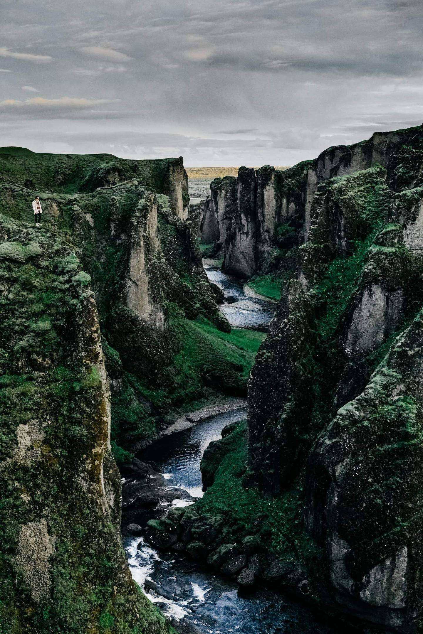
Once around the island, clockwise, in the light that does not leave the sky: Snæfellsnes, the north, the eastern fjords, the glacier lagoon and the south coast, with a guided walk on the ice at Skaftafell.
In short: Eleven days around Iceland in the midnight sun, self-drive with a person of ours on the ground every day. The longest day is 368 km.
Length
11 days
Season
Mid-June to mid-September
Longest day
Day 3 · 368 km · 5 h 28 min
A self-drive journey is the lighter alternative to our curated journeys, offered on request, with the same highest level of service. About self-drive journeys
Route
Keflavík, Reykjavík, Snæfellsnes (clockwise, Kirkjufell last), Stykkishólmur, Skagafjörður, Akureyri, Goðafoss, Mývatn, Dettifoss, Ásbyrgi, Húsavík, the eastern fjords, Djúpivogur, Stokksnes, Höfn, Jökulsárlón, Skaftafell, Vík, Skógafoss, Seljalandsfoss, the Golden Circle, Reykjavík, Keflavík
Total driving
About 2,180 km and 34 hours of pure driving over 11 days
Repeats on the road
None on the main route: the Ring is driven once, clockwise. Two short spurs return on the same road by design: Skaftafell from the glacier lodge (Day 8) and the airport roads at each end.
Ferries
None
Gravel
Short sections are possible on Route 54 at Skógarströnd (Day 3) and on the access tracks to Stokksnes and some car parks. No F-road anywhere on the route.
The car
Range Rover, Land Rover Discovery, Mercedes-Benz GLS, Volvo XC90, or a Mercedes-Benz V-Class for larger groups, or comparable, chosen for comfort on every road we send you. In Iceland, electric and plug-in hybrid versions can be arranged where a comparable luxury model is available, charged on Iceland’s renewable power. Or similar: a vehicle of the same class and standard.
The whole journey, day by day. The numbered points mark where each day ends and the night is spent; select one to jump to that day.
Day 3, Stykkishólmur to Akureyri: 368 km and 5 h 28 min of pure driving. With a harbour walk, coffee, a turf-farm visit and lunch, the guests are in the car or on their feet from 08:30 to about 16:30.
Day 2, Reykjavík around Snæfellsnes to Stykkishólmur, is the longest day door to door: 317 km and 5 h 24 min of pure driving, eight stops, about 9 h 45 min from hotel to hotel. It is long because the peninsula is the point of the day, not a transit.
Days 6 and 9 are the other two long days (330 km, 4 h 59 min; 282 km, 4 h 24 min). No day has more than 6 hours of pure driving. Days 2 and 3 run back to back; Day 4 is short by design so the guests recover, and Days 8 and 11 are short as well.
The car
Range Rover, Land Rover Discovery, Mercedes-Benz GLS, Volvo XC90, or a Mercedes-Benz V-Class for larger groups, or comparable, chosen for comfort on every road we send you.
In Iceland, electric and plug-in hybrid versions can be arranged where a comparable luxury model is available, charged on Iceland’s renewable power.
Or similar: a vehicle of the same class and standard.
Grade A, full-size 4x4 SUV, automatic, current or previous model year, for two to four guests with luggage. Chosen for long days on Route 1, crosswinds on the south coast and the gravel access roads. The rental contract must allow gravel roads; the route needs no F-road, and the guests are told plainly that F-roads are outside the plan. Insurance is arranged with gravel, sand-and-ash and wind damage to doors in mind.
On the ground, every day
The vehicle is handed over in the arrivals hall at Keflavík by our ground contact, with a 30-minute walk-through, and collected the same way on the last day. No rental desk.
One named person on the ground for the whole trip, reachable at any hour by phone and message.
The evening pulse: a short message each evening with tomorrow’s road, wind and weather from road.is and vedur.is, the first departure time and anything that has changed; a morning check before the car leaves.
A route pack: day cards, offline maps and the Google Earth file of the route, a local data connection and a satellite messenger for the stretches without coverage.
Curated stays with rooms assigned before arrival and dinner held.
Evenings at the table
Chef evenings: Night 5 at Mývatn and Night 8 at the glacier lodge, where a private dining room or a private house can be secured.
With a private guide
We recommend a private guide on this route, and we say so on the first call. Three levels are offered: a guide for the two longest days only (Days 2 and 3), a guide for the guided days listed above, or a private driver-guide for the whole Ring, which turns the long days into the best days of the trip. Self-drive is the option for guests who want the wheel and the silence of their own car; the ground contact and the evening pulse are there so that they are never on their own.
Guided days to add
Guided days: Snæfellsnes with a guide (Day 2), whale watching from Húsavík (Day 5), the glacier walk at Skaftafell (Day 8, guided by necessity).
The days
Day 1 Keflavík to Reykjavík
53 km, 55 min.
The flight comes in over Reykjanes, a peninsula of moss-covered lava where the plates of the Atlantic floor surface and pull apart, and the first drive crosses it. The lava fields on either side of the road are younger than many of the churches in Europe; in places the moss is thick enough to swallow a hand. Our ground contact meets you in the arrivals hall with the keys, walks you round the vehicle and sets the route pack on the seat.
The first day is kept quiet on purpose. A morning soak at a geothermal lagoon on the peninsula is held for you before the drive into the city, and the room in Reykjavík is ready early. In the evening the old harbour is a ten-minute walk from the hotel, and the light in June and July does not leave the sky.
Along the way
Keflavík Start of the day
The trip begins at Keflavík, on the Reykjanes Peninsula, a key geological region where the Mid-Atlantic Ocean Ridge is exposed onshore. The whole peninsula is a UNESCO Global Geopark.
Reykjanes was accepted into the European Geoparks Network in September 2015, as its 66th member, and the sights of the peninsula lie at close distances from one another, so the first look at the land comes soon after landing.
Bridge Between Continents A stop
At Sandvík on the Reykjanes Peninsula a small footbridge, built in 2002, crosses a major fissure that shows the tectonic plates are moving apart. It stands as a symbol of the link between Europe and North America.
The ground here can change: new cracks open and are hard to spot, so the local tourist board asks visitors to stay on marked trails and paths and to keep away from visible cracks and edges.
Gunnuhver On the way
Gunnuhver is an area of mud pools and steam vents on the Reykjanes Peninsula. Its main mud pool, about 20 m across, is described as the largest in Iceland, and temperatures of more than 300°C have been recorded here.
The groundwater is formed solely of sea water, because of the nearness to the ocean. By folk tale, the name comes from Gunna, a ghost who stayed at the site after she supposedly fell into the boiling water.
Reykjavík Old Harbour End of the day
The Old Harbour is the heart of Reykjavík. The first settler of Iceland, Ingólfur Arnarson, chose to settle here, and the harbour is credited as one reason: the islands of Engey and Örfirisey protected it from the waves of the open sea.
In the early 20th century it was one of the centres of the Icelandic trawling industry. The modern harbour area is the creation of extensive landfill, and the original shoreline lies roughly where the street Hafnarstræti is today. Shops and restaurants now occupy the old warehouses.
The road of the day, on the coast. Select a point to read about the place.
The day, hour by hour (morning arrival from North America; for an afternoon arrival from Europe, start at the 15:00 line)
06:45Land at Keflavík
07:30Vehicle handover in arrivals; route-pack walk-through
08:30Geothermal lagoon on Reykjanes, time held for you
12:00Lunch at the lagoon
14:00Drive to Reykjavík
15:00Check in; rest
19:30Dinner reserved in the city
Plan B. If the flight is late or the guests are tired, the lagoon moves to the last morning (Day 11), which sits on the way back to the airport. If access on Reykjanes is restricted on the day, the soak moves to a geothermal lagoon in the Reykjavík area.
Night: Reykjavík
Day 2 Reykjavík to Stykkishólmur, around Snæfellsnes
317 km, 5 h 24 min pure driving. Door to door about 9 h 45 min. Longest day door to door.
From Reykjavík on a clear morning there is a white cone on the far side of the bay. That is Snæfellsjökull, and the whole day is spent walking round it. From the capital it looks like a perfect volcano; up close, on the peninsula, the summit splits into offset peaks of ice, and the mountain stops being a picture and becomes a place. Jules Verne sent his travellers down its crater in 1864 to find the centre of the earth. Above Arnarstapi the coast is basalt columns and arches, and the cliff path toward Hellnar runs above the nesting birds, half an hour out and half an hour back.
At Djúpalónssandur the black pebbles roll in the surf, the iron of a trawler wrecked in 1948 lies where the sea left it, and the four lifting stones that once sorted fishermen by strength are still on the beach. Saxhóll is a crater you climb by a staircase. The day is driven clockwise so that Kirkjufell comes last, in the late light over Grundarfjörður, with the waterfall in front of it. Stykkishólmur is a harbour town of old timber houses at the edge of Breiðafjörður and its thousands of islands.
Along the way
Hallgrímskirkja Start of the day
Hallgrímskirkja is the largest church in Iceland and towers over the centre of Reykjavík. It is both a parish church and a national sanctuary, named after the 17th-century clergyman Hallgrímur Pétursson, author of Hymns of the Passion.
Its stepped concrete façade is an ode to modernism and a reminder of the Icelandic landscape, a fitting way to leave the city for the mountains of Snæfellsnes.
Borgarnes On the way
The Settlement Center in Borgarnes is based in two of the town’s oldest buildings, and it opened its doors to the public on 13 May 2006. The Settlement Exhibition tells how the Nordic Vikings began to sail on an open ocean, and its audio guide is available in 15 languages.
A second exhibition is devoted to Egils saga and its hero Egil Skalla-Grímsson, one of the best-known heroes of the Icelandic Sagas, with artworks by many different artists.
Búðir A stop
The church at Búðir has a long story. In 1703 Bent Lárusson built a church here, and the present building dates from a rebuilding in 1848. It was moved in 1984.
Around Búðir spreads Búðahraun, a lava field protected as a nature reserve in 1977. Its lava flowed some 5,000 to 8,000 years ago, and moss spreads across it, with patches and fields of flowers.
Arnarstapi A stop
A coastal path of 2.5 km links Arnarstapi and Hellnar through moss-draped lava fields, and the walk takes about 30 minutes. On the way you pass Gatklettur, a natural stone arch with a circular hole that frames the waves.
The harbour at Arnarstapi is surrounded by basalt columns, fissures and small caves, and the shore here has been protected since 1979. Near the harbour a large statue by Ragnar Kjartansson shows Bárður Snæfellsás, the half-troll guardian spirit of the region.
Djúpalónssandur A stop
Djúpalónssandur is a black pebble beach famous for its lifting stones, which fishermen once used to test their strength. Four stones lie here, and a man who could not lift the stone called Weakling was deemed unsuitable for a life as a fisherman.
The rusted iron of the British trawler Epine, which ran aground in March 1948, still lies at the shore, and visitors are asked not to move the wreckage.
Saxhóll A stop
Saxhóll is a volcanic crater in Snæfellsjökull National Park. A low metal staircase, built from 3 m modules that link along the slope, follows the path to the top, and the crater is described as easy to climb.
The view from the rim is described as spectacular. Nearby rises Snæfellsjökull itself, a stratovolcano of 1,446 m that gives the national park its name.
Kirkjufell A stop
Kirkjufell rises 463 m above its surroundings, and glacial erosion carved away the rock around it. The town of Grundarfjörður is the nearest settlement, a two-minute drive away.
In front of the mountain the waterfall Kirkjufellsfoss drops in three tidy tiers, and a path leads across a footbridge to the far side of the falls.
Stykkishólmur End of the day
Stykkishólmur lies on the northern shore of the Snæfellsnes Peninsula and looks out over Breiðafjörður Bay, with its thousands of islands and skerries. The harbour is the heart of the town.
Beside it is Súgandisey, once an island and now connected to land. You cross a causeway to reach it, and a sturdy, bright red lighthouse stands on it.
The road of the day, on the coast. Select a point to read about the place.
12:10Arnarstapi; an hour on the cliff path toward Hellnar and back
13:10Lunch at Arnarstapi
13:40Leave Arnarstapi
14:00Djúpalónssandur
15:00Saxhóll crater
16:25Kirkjufell and the falls
17:45Arrive Stykkishólmur
Plan B. In strong wind or rain on the north shore, the Hellnar walk is shortened and Kirkjufell moves to the next morning: it is 45 minutes back along the coast, a deliberate short spur. If the guests are tired, Saxhóll is dropped first.
Night: Stykkishólmur
Day 3 Stykkishólmur to Akureyri, by the Dalir and Skagafjörður
368 km, 5 h 28 min pure driving. Longest drive of the tour. Door to door about 8 hours.
The morning starts with ten minutes up the basalt island of Súgandisey above the harbour, where the whole of Breiðafjörður opens out. The road then runs east along Skógarströnd, a quiet coast of farms and skerries; some of it may still be gravel, so the speed comes down and the eye goes out to sea. The Dalir valleys behind Búðardalur are saga country, the farmland the sagas give to the family of Erik the Red.
North of the heath the road drops into Skagafjörður, a wide valley known for its horses, and at Glaumbær a row of turf-roofed farmhouses shows how Icelanders lived under grass until the last century. The last stretch climbs over Öxnadalsheiði and comes down to Akureyri at the head of Eyjafjörður in the late afternoon.
Along the way
Súgandisey Start of the day
Súgandisey is the island at Stykkishólmur, once separate and now connected to land. A well-maintained staircase leads up the basalt cliffs to a sturdy, bright red lighthouse.
From there you can look south at the town’s colourful roofs or north across the vast Breiðafjörður Bay.
Búðardalur On the way
Búðardalur is the main administrative and service centre of the Dalabyggð region. In the village a centre has exhibitions and stories about Erik the Red and his son Leif Eiríksson, and it holds a tourist information desk.
The reconstructed farmhouse of Erik the Red, Eiríksstaðir, is listed under Búðardalur. Erik founded the first Norse settlements in Greenland, and Eiríksstaðir is named as the birthplace of his son Leif, considered the first European to set foot on North American soil.
Víðimýri On the way
The turf church at Víðimýri in Skagafjörður was built in 1834 and has turf walls, with timber gables at the back and the front. It is one of the few preserved turf churches in Iceland.
A church has probably stood here since Christianity was adopted in Iceland. The present one remains a parish church to this day, and the National Museum of Iceland has been responsible for it since 1936.
Glaumbær A stop
Glaumbær is a turf farm of thirteen interconnected buildings, covering about 730 square metres. Its oldest parts, the kitchen and pantry, date from the mid-18th century, and two of the newest buildings from 1879. The farmstead has likely stood on the same mound for about a thousand years.
Stone was scarce, so turf was the main building material. The last residents moved out in 1947, and the farm is now part of the Skagafjörður Heritage Museum, founded in 1948.
Akureyri End of the day
The church of Akureyri, Akureyrarkirkja, is the symbol of the town. It was designed by the architect Guðjón Samúelsson and consecrated in 1940, and it stands above the town centre.
It is a Lutheran church, and it is closed when funerals or other services are taking place, so it is best to plan a visit around them.
The road of the day, on the coast. Select a point to read about the place.
Plan B. If road.is reports Skógarströnd in poor condition, the route takes the longer paved way, south over Vatnaleið and north again over Bröttubrekka to Búðardalur; the ground contact sends the new times the evening before. On a day of fatigue, Glaumbær is kept and the harbour walk is dropped.
Night: Akureyri
Day 4 Akureyri to Mývatn, by Goðafoss
85 km, 1 h 20 min.
After two long days this one is short by design. The morning belongs to Akureyri: the botanical garden, the steps up to the church, a coffee on the main street. Whale watching on Eyjafjörður is the option for those who want the water.
In the early afternoon the road crosses to Goðafoss, the waterfall where, by tradition, the lawspeaker threw the old gods into the river after Iceland took Christianity around the year 1000. Mývatn is a shallow lake in a volcanic basin; on the south shore the pseudocraters of Skútustaðir are the marks of lava that flowed over wet ground and boiled it. The evening is in the warm water of the nature baths above the lake.
Along the way
Akureyrarkirkja Start of the day
Akureyrarkirkja looks over the town. Inside, the bas-reliefs on the nave balcony are by the sculptor Ásmundur Sveinsson, and the baptismal font is a replica of a work by the sculptor Bertel Thorvaldsen.
The central stained-glass window above the altar formed part of a set that came from England.
Goðafoss A stop
Goðafoss is the waterfall of the river Skjálfandafljót, about 30 m wide. The Icelandic word for gods is goð, and the waterfall has been called Goðafoss ever since the story of Þorgeir.
The law speaker Þorgeir Ljósvetningagoði decided that the official religion of the country should be Christianity, and tradition says that he afterwards threw his idols of the old gods into the falls. The waterfall was protected as a natural monument on 11 June 2020.
Skútustaðagígar A stop
Skútustaðagígar are rare lava formations that come from steam explosions, where thinly flowing lava ran over lakes or wetlands. They were placed under protection in 1973 and are thought to have been created 2,300 years ago.
There are two easy marked footpaths: Gígahringur, of 1.5 km, and Tjarnarhringur, of 3.5 km. The closeness of Lake Mývatn and Stakhólstjörn makes the area interesting for birdwatchers.
Lake Mývatn End of the day
Mývatn is the 4th largest lake in Iceland, 37 km² in area, and its surface is dotted with around 50 small islets and skerries.
Volcanic eruptions shaped the landscape around it, and Dimmuborgir, close by, is described as one of the most distinctive lava formations in Iceland. The lake is a legally protected conservation area.
The road of the day, on the coast. Select a point to read about the place.
Plan B. If whale watching is cancelled for sea state, the morning moves to the Christmas house and the fjord road south of Akureyri, and the afternoon is unchanged.
Night: Mývatn
Day 5 Mývatn loop: Dettifoss, Ásbyrgi, Húsavík
208 km, 3 h 08 min. A loop that ends where it started; no road is driven twice.
Dettifoss is reached from the west side on Route 862. The river Jökulsá á Fjöllum carries glacial water from Vatnajökull, grey with the ground rock of the ice, and the spray stands over the canyon long before the falls come into view. North along the same road, Ásbyrgi is a horseshoe canyon with walls a hundred metres high; the old story says it is the hoofprint of Óðinn’s eight-legged horse.
Húsavík sits on Skjálfandi bay, where humpbacks and minke feed in summer. The afternoon is on the water if the guests want it, three hours out of the old harbour. The drive back to Mývatn crosses open moorland in the evening light, and if a chef evening is booked it is tonight.
Along the way
Mývatn Start of the day
Mývatn gets its name from its midges: the swarms of these tiny flies give the lake its name, and midges of the Chironomidae family are abundant here.
The lake is a habitat for many lake and marsh birds. In summer a greater variety of duck species gathers on and around the lake than anywhere else in the world.
Dettifoss A stop
Dettifoss is 44 to 45 m high and about 100 m wide, and lies in the Jökulsárgljúfur area of Vatnajökull National Park.
The west side is reached by the paved Route 862, between Mývatnsöræfi and Kelduhverfi, which is not in winter service from January until the beginning of April. The east side is served by the gravel Route 864, which closes when snow begins in autumn and reopens in spring once the wet mud has dried.
Ásbyrgi A stop
Ásbyrgi is a horseshoe-shaped hollow, 3.5 km long and approximately 1.1 km wide, with cliffs as high as 100 m at the innermost part. A rock called Eyjan stands in the middle.
A legend says it is the hoofprint of Sleipnir, Óðinn’s eight-legged horse. Ásbyrgi was probably formed by outburst floods from Vatnajökull, about 8,000 to 10,000 and about 3,000 years ago.
Húsavík A stop
Húsavík lies on the eastern side of Skjálfandi Bay in northern Iceland, and it is known at home and abroad as a centre for whale watching. Its name is thought to come from the house that the Viking Garðar Svavarsson built here when he spent a winter, according to the Book of Settlements.
The church, designed by Rögnvaldur Ólafsson and consecrated in 1907, is a wooden building in the so-called Swiss chalet style, with a view over the harbour and the bay.
Mývatn, evening End of the day
The loop closes at Mývatn. The lake and its wetlands are protected as a nature reserve, the Mývatn-Laxá Nature Conservation Area, and they are registered as internationally important wetlands, along with the Laxá river, which flows out of the lake.
Nearby, the craters of Skútustaðagígar were placed under protection in 1973 for their rare geological remnants.
The road of the day, on the coast. Select a point to read about the place.
Plan B. If Route 862 is closed, Dettifoss is dropped, the loop runs Mývatn, Húsavík, Ásbyrgi and back by Route 85 and 87, and the morning goes to Dimmuborgir and the Hverfjall crater instead.
Night: Mývatn
Day 6 Mývatn to Djúpivogur, through the eastern fjords
330 km, 4 h 59 min. Door to door about 8 hours.
East of the lake the road climbs past Námaskarð, where the ground steams and boils in shades of ochre and the air smells of sulphur. Then comes the highland desert of Möðrudalsöræfi, an hour of black sand and distant table mountains with nothing between you and them. Egilsstaðir, on the long lake of Lagarfljót, is the place for coffee and fuel.
From there Route 1 takes the fjords one by one. In Fáskrúðsfjörður the street signs are in French and Icelandic, a memory of the French fishermen who worked these waters. In Stöðvarfjörður a woman spent a lifetime gathering the stones of the east coast in her garden, and the collection is open to visitors. At Djúpivogur, at the end of the day, a row of granite eggs stands along the harbour, one for each of the birds that nest nearby.
Along the way
Mývatn Start of the day
Mývatn is a shallow lake in the north of Iceland. It covers about 37 km², with around 50 islands and islets, and an average depth of about 2.5 m. The name comes from the myriad of midges in the area.
The lake and the river Laxá are protected by law and listed as internationally important wetlands. South of the lake, the pseudocraters of Skútustaðagígar are about 2,300 years old: they came from steam explosions where thin lava ran over wetland. This morning the road leaves the lake and climbs east.
Námaskarð and Hverir A stop
Hverir, also called Hverarönd, lies east of the mountain Námafjall, beside the pass of Námaskarð. The ground here is bleached by alteration, and there are more mud pots and steam vents than on the mountain itself.
The largest steam vents are old boreholes from an attempt to mine sulphur. A popular walking route climbs from Hverir up Námafjall, past the sulphur mounds of Námakolla.
Möðrudalur On the way
Möðrudalur is a farm out on the highland of north-east Iceland, 469 m above sea level. The East Iceland tourist board describes it as the highest settled farm in the country. It has been inhabited since the early settlement and was a church seat for centuries.
A small church here dates from 1949, built by the farmer Jón A. Stefánsson, who also made its altarpiece. Askja, Herðubreiðarlindir and Kverkfjöll are among the places listed nearby.
Egilsstaðir and Lagarfljót A stop
Egilsstaðir is the largest town in East Iceland, known as the hub of the east. Across the bridge lies its twin town Fellabær, and together they have nearly 3,000 residents.
The town sits at the doorstep of Lagarfljót, one of Iceland’s deepest lakes, which stretches about 140 km from the glacier Eyjabakkafjökull to the bay Héraðsflói. Locals say the lake may or may not be home to a monster. Nearby, the birchwood of Hallormsstaður was protected in 1905, which made it Iceland’s first national forest.
Fáskrúðsfjörður A stop
From the late 19th century until 1935, Fáskrúðsfjörður was the main base for French fishermen working off the east coast of Iceland. Most of them sailed from Gravelines in northern France, the village’s sister city, and the village road signs are in French as well as Icelandic.
The French hospital, built in 1903, has been restored, and an award-winning museum on the site tells the story of French seafaring in East Iceland. Just outside the village, a monument lists the names of 49 French and Belgian sailors who died in Iceland.
Stöðvarfjörður A stop
Stöðvarfjörður is a village in the East Fjords, and home to Petra’s Stone Collection, described as one of the largest private mineral collections in Iceland. Ljósbjörg Petra María Sveinsdóttir was born in 1922 and began collecting stones in earnest in 1946.
She opened her home to visitors in 1974 and died in 2012. The house and its garden hold thousands of stones from mountains, quarries and coastal cliffs, among them zeolites, agates, jasper and quartz crystals, shown both raw and polished.
Djúpivogur End of the day
Djúpivogur is a small harbour village in the East Fjords, where trading dates back to 1589. It belongs to Cittaslow, the international network of towns where living is good.
In the bay of Gleðivík (Merry Bay) stand the Eggin í Gleðivík: 34 replicas of the eggs of birds that nest near the village, made by the artist Sigurður Guðmundsson. They stand on concrete pillars that once supported a landing pipe between the pier and the smelter.
The road of the day, on the coast. Select a point to read about the place.
Plan B. In fog on the fjord road the stone collection is dropped and the day ends earlier. If the guests want a shorter day, the night moves to the Egilsstaðir area and Djúpivogur becomes a morning stop on Day 7.
Night: Djúpivogur area
Day 7 Djúpivogur to the glacier lodge, by Stokksnes and Jökulsárlón
213 km, 3 h 25 min.
Stokksnes is a spit of black sand under Vestrahorn, a jagged mountain that drops straight into the dunes. The track runs over private land, paid at the café, and it is worth the hour: the sand, the grass on the dunes and the mountain behind make the picture people come to Iceland for, and most of the morning it is quiet. Höfn, the harbour town round the corner, is where Iceland lands its langoustine, and lunch is on the quay.
Jökulsárlón is the lagoon where the ice of Breiðamerkurjökull breaks off and floats to the sea. The icebergs turn, ground down and blue where they have been underwater, and seals hunt among them. Across the road the river carries the smaller pieces onto the black beach, where they lie in the surf like glass; the waves there run further up the sand than they seem to, and we ask you to stay well back from the water. The lodge is half an hour west.
Along the way
Djúpivogur harbour Start of the day
The day starts where the last one ended, at Djúpivogur, where trading dates back to 1589. In the village stands Langabúð, built in 1790 and the oldest house in Djúpivogur, which today serves as a cultural centre.
From here the road follows the coast south and west toward Höfn and the glaciers.
Stokksnes and Vestrahorn A stop
Stokksnes is a headland on the south-east coast, and above it stands Vestrahorn, a mountain 454 m high. It is built of unlayered plutonic rock, mostly gabbro with some granophyre.
A stretch of sand below the mountain is a place where seals often rest. The area lies about a ten-minute drive from Höfn, and it is worth taking your time here to look back at the mountain from the shore.
Höfn A stop
Höfn is a fishing town on the south-east coast. It grew from a small village into a town on a fairly varied fishing industry, and its catch includes the high-value Norway lobster, the langoustine. A good part of the Icelandic lobster catch is landed here.
The town promotes lobster as part of its image, with a lobster festival each summer. It lies at the base of Vatnajökull.
Jökulsárlón A stop
Jökulsárlón is a glacial lagoon beside the Ring Road, within Vatnajökull National Park. It is fed by Breiðamerkurjökull, an outlet glacier of Vatnajökull, and icebergs drift across the lagoon before they float out toward the Atlantic.
Seals can sometimes be seen in the lagoon or resting on the ice, though sightings vary with the season and conditions. The lagoon can be reached from the Ring Road all year round.
Hvannadalshnúkur End of the day
As the road comes west, the ice-capped mass of Öræfajökull fills the horizon. Vatnajökull National Park calls it Iceland’s highest volcano, and calls its summit, Hvannadalshnúkur, the country’s highest peak.
A hiking trail to the top starts at Háalda. The mountain lies in the national park, which was added to the UNESCO World Heritage List in 2019.
The road of the day, on the coast. Select a point to read about the place.
Plan B. If the lagoon boats are not running for wind, the time goes to a longer walk along the lagoon shore, where the ice comes closest to the bank.
Night: Glacier lodge, Hnappavellir area
Day 8 Skaftafell: on the glacier with a guide
56 km, 51 min, lodge to Skaftafell and back. Spur by design.
Today you walk on a glacier, and that is always done with a guide: crampons, harness, an ice axe and someone who reads the crevasses for a living. The outlet glaciers at Skaftafell flow down from Vatnajökull, the largest ice cap in Iceland, and three hours on one teaches more about the country than any museum. The ice is ribbed with ash from old eruptions.
The afternoon is the path to Svartifoss, a waterfall framed in black basalt columns that look cast rather than grown, and back to the lodge for an early evening. If a chef evening is booked, it is tonight, with the glacier in the window.
Along the way
Öræfajökull Start of the day
Öræfajökull is Iceland’s highest volcano, and its summit, Hvannadalshnúkur, is also the country’s highest peak.
The volcano erupted in 1362, in a large pumice eruption that destroyed the Öræfi settlement, and again in 1727. Today you drive west to Skaftafell, which lies in the same national park.
Skaftafell A stop
Skaftafell National Park was formally established on 15 September 1967. In 2008 it became part of Vatnajökull National Park, whose region was registered as a UNESCO World Heritage Site in 2019.
The visitor centre in Skaftafell is open all year, and rangers and visitor centre assistants give information about the nature and the hiking trails. Short, easy trails lead to the waterfall Svartifoss and to the glacier Skaftafellsjökull.
Svartifoss A stop
Svartifoss is a waterfall 20 m high in Skaftafell, bordered on both sides by tall black basalt columns. The columns formed about 300,000 years ago, when lava spread over the Skaftafellsheiði plain and filled an old river channel. As it cooled, the rock shrank and split into columns.
The hike starts at the visitor centre and is about 1.9 km, around 45 minutes one way.
Skaftafellsjökull End of the day
Skaftafellsjökull is the glacier at the end of the short, easy trail the national park calls the Glacier trail. It is a loop of 4.1 km that takes 1 to 1.5 hours and is rated easy.
The glacier lies in Vatnajökull National Park, which was founded on 7 June 2008 and is the largest of the national parks in Iceland.
The road of the day, on the coast. Select a point to read about the place.
09:30Skaftafell visitor centre; meet the glacier guide
10:00Guided glacier walk, about 3 hours
13:30Lunch at Skaftafell
14:30Svartifoss path, about 1 h 30 min return
16:30Back at the lodge
19:30Private chef evening (option)
Plan B. If the glacier walk is cancelled for weather, the guide leads a walk below the ice front at Svínafellsjökull instead, or the morning goes to a boat on the lagoon. The afternoon is kept.
Night: Glacier lodge
Day 9 The south coast to Hella
282 km, 4 h 24 min. Door to door about 8 h 30 min.
The road west crosses Skeiðarársandur, a plain of glacial outwash so wide that the bridges look out of scale, and then the moss-covered lava of Eldhraun. Fjaðrárgljúfur is a canyon cut a hundred metres deep into soft rock, walked along its rim. At Vík the sea stacks of Reynisdrangar stand off the beach, and from the headland of Dyrhólaey you look down on the black sand of Reynisfjara and the arch the sea has cut through the rock.
On Reynisfjara the waves come further up the beach than they seem to; we keep you well back from the water, and so does every sign. Skógafoss drops sixty metres in a single sheet, and a staircase climbs to the top. At Seljalandsfoss the path goes behind the falling water. Hella is a farming town on the Rangá river, and the evening is quiet.
Along the way
Skeiðarársandur Start of the day
West of Skaftafell the road crosses Skeiðarársandur, a black sand plain of about 1,300 km² that stretches from Skeiðarárjökull, a part of Vatnajökull, to the sea.
In 1996 a volcanic eruption in Grímsvötn, under the glacier, caused massive floods and melting. The bridge Skeiðarárbrú, opened in 1974, was badly damaged by the floodwater and icebergs, and two twisted girders of it remain beside the new road as a monument.
Eldhraun On the way
Eldhraun is one of the two lava tongues that flowed from the Lakagígar craters in the Skaftáreldar eruptions of 1783 and 1784. The other is Brunahraun. About 12 cubic kilometres of lava came from the craters, which form a row more than 29 km long with over 130 craters.
Mosses and lichens have since settled on the lava, and Visit Iceland describes the result as a green blanket that softens the stark black rock.
Fjaðrárgljúfur A stop
Fjaðrárgljúfur is a canyon about 100 m deep and about 2 km long. The river Fjaðrá, which has its source in the mountain Geirlandshraun, runs through it and on into the river Skaftá.
The canyon lies about 6 km from the Ring Road, and it is worth a short detour to stand at its edge and look down at the river.
Vík and Reynisdrangar A stop
Vík í Mýrdal sits on the south coast between the glacier Mýrdalsjökull and the stormy Atlantic, a village of nearly 900 residents. Above it rises Reynisfjall, a mountain 340 m high, and a walk to its summit gives a good view of the area.
From Vík you can see Reynisdrangar, the sea stacks that stand off Reynisfjara beach. Icelandic folklore says they are the remains of two trolls caught in the rising sun as they tried to drag a ship ashore.
Dyrhólaey A stop
Dyrhólaey is a promontory 120 m high not far from Vík. The name means the hill with the door-hole, for the arch the sea has eroded through the rock, and a lighthouse built in 1927 stands on the highest point.
It has been a nature reserve since 1978. Some areas close for part of the year to protect nesting birds, usually from around mid-May to late June, and others stay closed all year because of fragile natural features. Puffins and eider ducks are the most common birds here.
Skógafoss A stop
Skógafoss, on the river Skógá, is a broad waterfall that drops about 60 m from the line of the region’s former sea cliffs.
A staircase beside the falls leads up to a higher viewpoint, and a path along the river above runs on past several more waterfalls. From here a trail of about 10 km climbs the Fimmvörðuháls pass, between the glaciers Eyjafjallajökull and Mýrdalsjökull, to the mountain oasis of Þórsmörk.
Seljalandsfoss A stop
Seljalandsfoss is a waterfall about 60 m high, and what makes it special is the chance to walk behind it. A path curves behind the tall curtain of water, which gives a very different view of the falls.
Visit South Iceland calls it the only known waterfall of its kind where it is possible to walk behind. You will get wet, so a waterproof jacket is a good idea.
Hella End of the day
Hella lies on the river Ytri-Rangá, which flows past the village and is described as one of the best salmon rivers in the country. It stands in the municipality of Rangárþing ytra, one of the largest in Iceland by area, with around 2,000 residents.
The district lies across the middle of South Iceland, in a volcanic zone with geothermal heat, especially near Torfajökull.
The road of the day, on the coast. Select a point to read about the place.
Plan B. If Fjaðrárgljúfur’s path is closed, the stop moves to Kirkjugólf at Kirkjubæjarklaustur. If parts of Dyrhólaey are closed for nesting, the guests drive to the lighthouse road that is open or take the beach at Vík instead.
Night: Hella area
Day 10 The Golden Circle to Reykjavík
216 km, 3 h 25 min.
Gullfoss falls in two steps into a gorge, and on a sunny morning the spray carries a rainbow. Ten minutes on, at Geysir, Strokkur erupts every few minutes and the ground around it steams. Lunch is in a greenhouse restaurant, among tomato vines grown under lamps through the dark months, at a table reserved for you.
Þingvellir is where the gap between the North American and Eurasian plates runs above ground, a rift you walk through on a path between two walls of rock. Iceland’s parliament met in the open here from 930. The drive back to Reykjavík takes about 50 minutes, and the farewell dinner is in the city.
Along the way
Hella and the Ytri-Rangá Start of the day
The day begins at Hella, where the river Ytri-Rangá flows past the village. The river is a popular fishing river, and its source lies north of the mountain Hekla, in Rangárbotnar at Landmannafréttur.
Hekla rises 1,491 m and has erupted six times since 1947. From here the road turns inland and north toward the Golden Circle.
Gullfoss A stop
Gullfoss is two separate waterfalls on the river Hvítá. The upper one drops 11 m and the lower one 21 m, so the river falls 32 m in all.
The Hvítá rushes over the two stages before disappearing into a rugged canyon, sending spray high above the falls. The rock of the riverbed here formed during an interglacial period.
Geysir and Strokkur A stop
The Geysir area in the valley of Haukadalur is a high-temperature field of about 3 km². The local name Geysir gave the geyser its name in foreign languages, and the Icelandic word means gusher.
Strokkur does not empty between eruptions, so it refills quickly and erupts every few minutes, with jets reaching up to 30 m. Stand and watch two or three eruptions, and you will learn the rhythm of it.
Þingvellir A stop
The Alþing, the assembly of Iceland, was set up around 930 at Þingvellir and met here until 1798. The park lies along the Atlantic ridge that runs through Iceland, and gorges and cracks show how the earth’s crust is pulling apart.
Þingvellir is a national park and a UNESCO World Heritage site. The rift valley stretches about 10 km, and the plates diverge by about 2 cm a year.
Reykjavík End of the day
Reykjavík is Iceland’s capital, set on the shores of Faxaflói Bay, and the world’s northernmost capital of a sovereign state. Ingólfur Arnarson, the city’s first permanent settler, made his home here in 874. The name means smoky bay, for the steam that rose from hot ground.
A statue of Ingólfur by the sculptor Einar Jónsson stands at the top of the hill Arnarhóll, unveiled in February 1924. The Old Harbour is sheltered by the islands of Engey and Örfirisey, and that shelter is credited as one reason he chose the site.
The road of the day, on the coast. Select a point to read about the place.
12:30Greenhouse restaurant; lunch among the tomato vines
14:00Leave the greenhouse restaurant
15:00Þingvellir; Almannagjá and Öxarárfoss
16:30Leave Þingvellir
17:20Arrive Reykjavík
19:30Farewell dinner reserved
Plan B. The Golden Circle is open all summer; if the guests are tired, Geysir is the stop that is shortened, and the greenhouse lunch is kept.
Night: Reykjavík
Day 11 Reykjavík to Keflavík
52 km, 55 min.
The morning is free in the city. For an afternoon flight to North America the car leaves Reykjavík at about 12:30, and our ground contact takes the keys at the terminal; there is no desk and no queue.
If the lagoon on Reykjanes was moved from Day 1, it is this morning, on the way to the airport. The last view of the trip is the lava field you crossed on the first morning, and it looks different after eleven days.
Along the way
Hallgrímskirkja Start of the day
Hallgrímskirkja has a tower 73 m high, the tallest building in Reykjavík. Guðjón Samúelsson, the State Architect, began designing the church in 1937, and it was his last work. It is reminiscent of columnar rocks, Icelandic mountains and glaciers.
Construction began in 1945, and the church was consecrated on 26 October 1986. A last look at it from the street is a quiet way to begin the final morning.
Hafnarfjörður On the way
Hafnarfjörður is a harbour town known for its Viking heritage, lava landscapes and cosy charm, ten minutes south of Reykjavík. It is built on ancient lava flows and nicknamed the Lava Town, and lava formations run through its neighbourhoods and parks.
The harbour has a marina and restaurants serving local seafood. The road passes the edge of the town on the way to the Reykjanes peninsula.
Bridge Between Continents On the way
The Bridge Between Continents is a symbolic footbridge across a wide tension crack on the Reykjanes peninsula. The crack formed from the divergent movement of the North American and Eurasian plates, which rift at about 2 cm a year, though in bursts.
The peninsula sits on the Mid-Atlantic Ridge, the only place in the world where that ridge is visible above sea level. It lies in the Reykjanes UNESCO Global Geopark, recognised in 2015.
Keflavík End of the day
Keflavík is a district of Reykjanesbær, the largest town on the Reykjanes peninsula, with about 14,100 residents. It has a town centre, a marina and a church built in 1914.
Keflavík International Airport lies in the Reykjanesbær area and is the main international gateway for the region. Here the journey ends where it began.
The road of the day, on the coast. Select a point to read about the place.
13:30Vehicle handed back at Keflavík by the ground contact
14:00Check in for the flight
Plan B. In a storm on Reykjanes the ground contact moves the handback earlier and arranges the hotel’s car service to the terminal if the guests prefer not to drive.
Request this journey
Tell us your month and your party, and a founder replies within 24 hours with the journey shaped to you. Prices are shared in that reply.