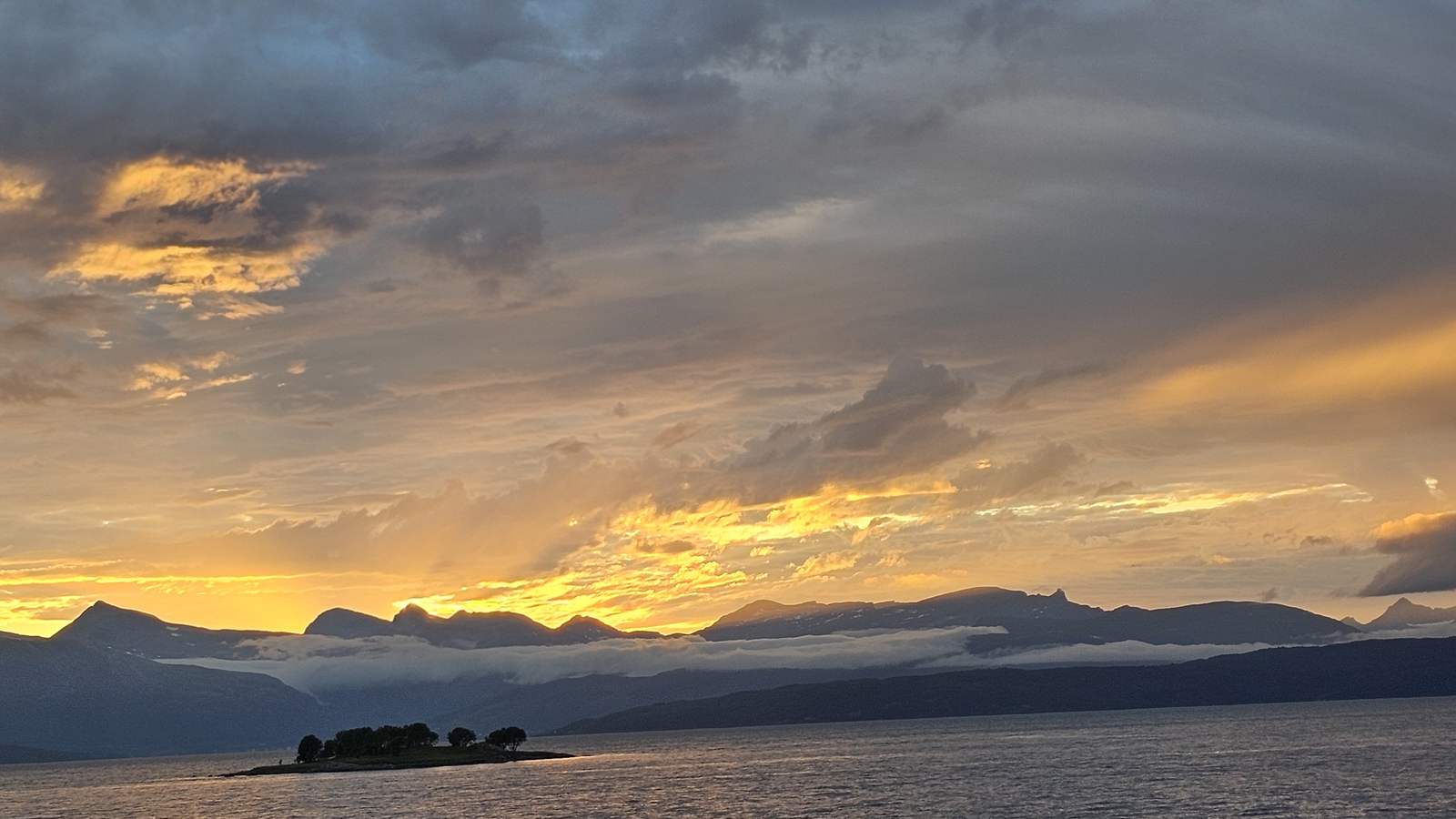
Norway with private guides: from Bergen to the Arctic, south to north
Your west-coast guide meets you at Bergen Airport and takes you through Hardanger, the Sognefjord, Loen, Trollstigen and the Atlantic Road, then hands you to the Arctic guide at Tromsø for the glacier in the midnight sun and the rock art at Alta, with dinner together each evening and a guide at each airport.
Pickup: Bergen airport or your hotel in Bergen. Drop-off: Alta airport or your hotel in Alta.
The route: Bergen Airport Flesland, then Bergen, then Vøringsfossen, then Lofthus, then Lærdal Tunnel, then Solvorn, then Fjærland, then Briksdalsbreen, then Loen, then Dalsnibba, then Geiranger, then Trollstigen, then Åndalsnes, then Kristiansund Airport and on.
The journey at a glance
In short: Norway with private guides: from Bergen to the Arctic, south to north. Best in summer. Pickup at Bergen airport or at your hotel in Bergen.
Length
8 days
Season
summer
Style
An available journey, adaptable to your dates
Every journey here is a starting point: we adapt the days, the pace and the places to each guest. All the journeys
The whole journey, day by day. The numbered points mark where each day ends and the night is spent; select one to jump to that day.
Day 1 Bergen, and your west-coast guide at the airport
20 km, 0 h 30 min.
Your west-coast guide meets you at Bergen Airport Flesland and takes you into the city, 20.2 km and 30 min by the routing estimate. Bergen’s Fløibanen funicular opened in 1918, and its line is 848 metres long, lifting you to 320 metres above sea level in about 6 minutes, so the first afternoon stays short, with the city seen from above and then at street level. The funicular is the first thing because it shows you the whole city at once, and your guide can tell you which streets to walk down through, so the first afternoon has a shape without a schedule.
The long light of the season keeps the harbour bright into the evening. Tonight your guide sits down to dinner with you, and tells you how the next six days run: the same guide drives you through the fjords, and hands you to the Arctic guide at Tromsø, since the guide changes by region. Rest is part of the plan after the flight. The harbour is a short walk from the hotel, the light is long, and your guide leaves the evening open until dinner, which is at a table reserved for you.
Along the way
Bergen Airport Flesland Start of the day
Bergen Airport Flesland is where your west-coast guide meets you. The drive into the city is 20.2 km and 30 minutes by the routing estimate, and the afternoon is kept short on purpose after the flight. Your guide tells you which streets are worth walking down, so the first afternoon has a shape without a schedule.
Bergen End of the day
Bergen is your first night. The harbour is a short walk from the hotel, and the long light of the season keeps it bright into the evening. Your guide sits down to dinner with you at a table reserved for you, and tells you how the next six days run through the fjords.
The road of the day, on the coast. Select a point to read about the place.
The day, hour by hour
14:00Land at Bergen Airport Flesland and meet your guide
15:00Drive into the city, 20.2 km and 30 min
16:30The Fløibanen funicular to 320 metres
18:00Walk down through the city at street level
19:30Dinner with your guide
The Fløibanen opened in 1918; its line is 848 metres long and takes about 6 minutes.
Your west-coast guide drives you through the fjords and hands you to the Arctic guide at Tromsø.
The same guide can travel the whole way on request.
Plan B. If the cloud is low, the funicular moves to the next morning and the afternoon is spent at street level.
Night: Bergen
Day 2 Hardanger: Steinsdalsfossen and Vøringsfossen
277 km, 4 h 59 min.
Steinsdalsfossen drops 50 metres, and a path leads behind the falling water, so you can walk it without getting wet. So the day opens with a short walk, before the road east along the Hardangerfjord. The day, with the spur to Vøringsfossen, is 276.6 km and 4 h 59 min by the routing estimate, the longest day of the west. Your guide knows the road along the Hardangerfjord and chooses where to stop, so the long day is made of short walks and a slow lunch, and nothing is timed to a booking.
Vøringsfossen drops 182 metres into the Måbødalen valley, and a stair and footbridge opened in 2020 let you stand above the fall. Your guide chooses the stops by the weather and the light, and dinner is at a table your guide has reserved at Lofthus, with the fjord outside the window. Keep a layer for the spray at the falls and a dry pair of shoes in the car, since the paths are wet. The night at Lofthus is quiet, and the long light of the season keeps the fjord visible until late.
Along the way
Bergen Start of the day
Bergen is where the long day begins, with the west-coast guide leaving the city at 08:30. The day with the spur to Vøringsfossen is 276.6 km and 4 h 59 min by the routing estimate, the longest day of the west. Your guide knows the road along the Hardangerfjord and chooses where to stop.
Vøringsfossen A stop
Vøringsfossen drops 182 metres into the Måbødalen valley, and a stair and footbridge opened in 2020 let you stand above the fall. Your guide chooses the stops by the weather and the light, so the long day is made of short walks and a slow lunch.
Lofthus End of the day
Lofthus is your night on the Hardangerfjord. Dinner is at a table your guide has reserved, with the fjord outside the window. The night is quiet, and the long light of the season keeps the fjord visible until late.
The road of the day, on the coast. Select a point to read about the place.
The day, hour by hour
08:30Leave Bergen with your west-coast guide
09:45Steinsdalsfossen, the path behind the falling water
12:30Lunch on the Hardangerfjord
14:30Vøringsfossen, the stair and the footbridge
19:00Dinner with your guide at Lofthus
Steinsdalsfossen drops 50 metres and you can walk behind it without getting wet.
Vøringsfossen drops 182 metres into the Måbødalen valley.
It is the longest day of the west, and your guide can shorten it at the lunch stop.
Plan B. If rain closes the paths, the falls are seen from the road and the afternoon is a slow lunch on the fjord.
Night: Lofthus
Day 3 Hardanger to the Sognefjord, by the Nærøyfjord
207 km, 3 h 43 min.
The Lærdal Tunnel runs 24.5 km between Aurland and Lærdal, with an illuminated mountain hall every six kilometres to give drivers a break. So today is a long drive, 206.9 km and 3 h 43 min by the routing estimate, and your guide drives it so that you look out of the window instead. The road leaves the Hardangerfjord for the Sognefjord and the Nærøyfjord. Your guide drives the long road so that the day is easy to take, with a stop at each viewpoint worth leaving the car for, and a coffee on the way, taken slowly, with no one counting the minutes.
The Sognefjord is the longest of the fjords on this journey, and Solvorn lies on its inner reaches. The long light of the season keeps the water bright, and your guide sits down to dinner with you at Solvorn, with the day’s drive behind you and no driving tonight. The stay at Solvorn is small and close to the water, and the evening is unhurried. Your guide checks tomorrow’s ferry and the weather with you at dinner, in the light that lasts late in the season.
Along the way
Lofthus Start of the day
Lofthus is where the drive to the Sognefjord begins at 08:30. The day is 206.9 km and 3 h 43 min by the routing estimate, and your guide drives it so that you look out of the window instead. The road leaves the Hardangerfjord for the Sognefjord, with a coffee on the way, taken slowly.
Lærdal Tunnel A stop
The Lærdal Tunnel runs 24.5 km between Aurland and Lærdal, with an illuminated mountain hall every six kilometres to give drivers a break. You pass through it in the early afternoon, and your guide does the driving, so the halls of light are yours to look at.
Solvorn End of the day
Solvorn lies on the inner reaches of the Sognefjord, the longest of the fjords on this journey. The stay is small and close to the water, and dinner with your guide has the day’s drive behind it. Your guide checks tomorrow’s ferry and the weather with you at the table.
The road of the day, on the coast. Select a point to read about the place.
The day, hour by hour
08:30Leave Lofthus with your guide
10:30Over the Hardanger Bridge and on toward the Nærøyfjord
13:00Lunch on the way
15:00The Lærdal Tunnel, 24.5 km, with its illuminated halls
19:00Dinner with your guide at Solvorn
The Lærdal Tunnel runs 24.5 km between Aurland and Lærdal.
An illuminated mountain hall every six kilometres gives drivers a break.
Your guide drives, so you can look at the fjords.
Plan B. If the Nærøyfjord is shrouded in cloud, your guide keeps the road and moves the viewpoint stop to the afternoon.
Night: Solvorn
Day 4 Solvorn to Loen, under the Jostedalsbreen ice
206 km, 3 h 58 min.
Until 1986 Fjærland could be reached only by boat, and its glacier arm Bøyabreen is less than five minutes from the museum by car. So you arrive by road today, to a glacier museum and a close view of the ice. A small ferry of about 20 minutes crosses at Solvorn, and the loop with Briksdalsbreen is 205.9 km and 3 h 58 min by the routing estimate. Your guide adjusts the timing so that the ferry, the museum and the walk fall in the order that suits the light, and the glacier is seen in the best part of the afternoon.
Walking to Briksdalsbreen from the mountain lodge is about 3 km on an easy path and takes 40 to 60 minutes, so the afternoon is a gentle walk to the foot of the glacier arm. Your guide times the walk to the light, and dinner at Loen is at a table facing the water, with your guide. Bring walking shoes and a waterproof layer for the path to the glacier arm. The night at Loen is by the water, and dinner is with your guide, with the long light of the season still on the mountains.
Along the way
Solvorn Start of the day
Solvorn is where the day begins at 08:30 with a small ferry of about 20 minutes. The loop with Briksdalsbreen is 205.9 km and 3 h 58 min by the routing estimate. Your guide adjusts the timing so that the ferry, the museum and the walk fall in the order that suits the light.
Fjærland A stop
Until 1986 Fjærland could be reached only by boat, so you arrive by road today, to a glacier museum and a close view of the ice. Its glacier arm Bøyabreen is less than five minutes from the museum by car. You come here at about 10:00, with lunch after it.
Briksdalsbreen A stop
Walking to Briksdalsbreen from the mountain lodge is about 3 km on an easy path and takes 40 to 60 minutes. The afternoon is a gentle walk to the foot of the glacier arm, timed by your guide to the light. Bring walking shoes and a waterproof layer for the path.
Loen End of the day
Loen is your night, by the water. Dinner with your guide is at a table facing the lake, and the long light of the season is still on the mountains. The glacier walk is behind you, and the evening is unhurried.
The road of the day, on the coast. Select a point to read about the place.
The day, hour by hour
08:30Leave Solvorn with your guide, the small ferry of about 20 minutes
10:00Fjærland, the glacier museum and the view of Bøyabreen
13:00Lunch, then on to Briksdalsbreen
15:00Walk to Briksdalsbreen, 3 km, 40 to 60 minutes
19:00Dinner with your guide at Loen
Until 1986 Fjærland could be reached only by boat.
The walk to Briksdalsbreen is about 3 km and takes 40 to 60 minutes.
A small ferry of about 20 minutes crosses at Solvorn.
Plan B. If the path is closed by weather, the afternoon is the glacier museum and a long lunch, and your guide decides at about 08:00.
Night: Loen
Day 5 Loen to Åndalsnes, over Dalsnibba, Geiranger and Trollstigen
174 km, 3 h 06 min.
Trollstigen has 11 hairpin bends, and King Haakon VII opened the road in summer 1936. So the slowest roads of the trip come today, 173.8 km and 3 h 06 min by the routing estimate, and your guide drives them, leaving at 08:30. The road climbs onto the high mountain and up the toll road to Dalsnibba, about 1,500 metres above sea level, before the descent to Geiranger. The mountain roads suit a guide who knows them, and the day is built around the weather on the high road, with the lower road ready if cloud closes the top.
Geiranger lies at the end of its fjord, and the road out climbs Trollstigen in hairpin after hairpin, with a stop at the top where your guide sits down with you for a hot drink. The night is in Åndalsnes, in a stay chosen by us, and dinner is with your guide, in the long light of the season. Your guide arranges a hot drink at the top of Trollstigen. The night is in Åndalsnes, below the mountains, and tomorrow is the coast, so tonight is for an early supper and a long look at the light.
Along the way
Loen Start of the day
Loen is where the slowest roads of the trip begin, with the guide leaving at 08:30. The day is 173.8 km and 3 h 06 min by the routing estimate. The road climbs onto the high mountain, and the day is built around the weather on the high road, with the lower road ready if cloud closes the top.
Dalsnibba A stop
Dalsnibba lies about 1,500 metres above sea level, and you reach it by the toll road. You are there at about 10:30, before the descent to Geiranger. Your guide has the weather in view, and if cloud closes the top, the lower road is ready.
Geiranger A stop
Geiranger lies at the end of its fjord, and you come down to it from Dalsnibba for lunch at about 12:30. From here the road climbs again toward Trollstigen. The mountain roads suit a guide who knows them, and the day is made of short stops and no hurry.
Trollstigen A stop
Trollstigen has 11 hairpin bends, and King Haakon VII opened the road in summer 1936. The road climbs hairpin after hairpin, and your guide sits down with you at the top for a hot drink. You reach the top at about 15:00, with the descent still to come.
Åndalsnes End of the day
Åndalsnes lies below the mountains, and your night is in a stay chosen by us. Dinner is with your guide, in the long light of the season. Tomorrow is the coast, so tonight is for an early supper and a long look at the light.
The road of the day, on the coast. Select a point to read about the place.
The day, hour by hour
08:30Leave Loen with your guide
10:30The toll road to Dalsnibba, about 1,500 metres
12:30Geiranger and lunch
15:00Trollstigen, 11 hairpin bends
19:00Dinner with your guide at Åndalsnes
Trollstigen has 11 hairpin bends; King Haakon VII opened the road in summer 1936.
Dalsnibba lies about 1,500 metres above sea level.
Your guide drives the slow roads so that you can look.
Plan B. If cloud closes the high road, the guide takes the lower road to Geiranger and moves Dalsnibba to the next clear day.
Night: Åndalsnes
Day 6 The Atlantic Road, and the hand-over to the Arctic guide
142 km, 2 h 45 min.
Eight bridges join the eight kilometres of Atlantic Road laid across islets and skerries, the highest of them Storseisundet. So the coast comes last, with the day timed to reach it in whatever weather the sea brings, 142.4 km and 2 h 45 min by the routing estimate to Kristiansund Airport at Kvernberget, 8 km from the city centre on Rv70, with several daily departures to Oslo and Bergen. The Atlantic Road is the last of the west coast, and your guide times the crossing for the light on the water.
Here the guide changes by region. Your west-coast guide walks you to the departures hall and sees you off, and the flight takes you north by way of Oslo, which is about 1 hour 50 minutes from Tromsø. Your Arctic guide is waiting at Tromsø Airport, and Tromsø lies above the Arctic Circle with no train service, so the evening is your first dinner together, in the long light of the season. Tonight your Arctic guide sits down to dinner with you and the plan for tomorrow is set over the table, with the light still high at the table, since the sun does not set in the season.
Along the way
Åndalsnes Start of the day
Åndalsnes is where the last day on the west coast begins at 08:30. The day is timed to reach the sea in whatever weather it brings. It is 142.4 km and 2 h 45 min by the routing estimate to Kristiansund Airport, and your west-coast guide drives all of it.
Kristiansund Airport A stop
Kristiansund Airport lies at Kvernberget, 8 km from the city centre on Rv70, with several daily departures to Oslo and Bergen. Lunch in Kristiansund comes first. Here your west-coast guide walks you to the departures hall and sees you off, and the guide changes by region.
Tromsø End of the day
Tromsø lies above the Arctic Circle with no train service, and the flight north is by way of Oslo, which is about 1 hour 50 minutes from Tromsø. Your Arctic guide is waiting at Tromsø Airport. The evening is your first dinner together, and the plan for tomorrow is set over the table.
The road of the day, on the coast. Select a point to read about the place.
The day, hour by hour
08:30Leave Åndalsnes with your west-coast guide
11:00The Atlantic Road and Storseisundet
13:30Lunch in Kristiansund, then the airport at Kvernberget
15:30Your west-coast guide sees you off at the airport
20:30Your Arctic guide meets you at Tromsø Airport, then dinner together
The Atlantic Road has eight bridges, the highest of them Storseisundet.
Oslo is about 1 hour 50 minutes from Tromsø by air.
The same guide can travel the whole way on request.
Plan B. If the flight north is delayed, your west-coast guide stays until you are on board and your Arctic guide meets the later arrival.
Night: Tromsø
Day 7 Midnight sun from fjord to glacier: Strupbreen
A boat crossing of the Lyngen fjord starts the day, followed by a guided walk of about two hours to the Strupbreen glacier. There guides provide crampons and ice axes. The programme on the ice is decided with the guides. Summer activities run from June to September, and the midnight sun lasts from 18 May to 26 July, so the light stays on the glacier far into the night. Your Arctic guide knows the glacier and the fjord, and chooses the pace on the ice with the guides, so the day is slow where it should be.
Your Arctic guide travels with you and sits down with you for the meals of the day. The hours of the day are confirmed with the operator before you travel, and you come in walking gear, since the guides provide the equipment on the ice. Back in Tromsø the evening is quiet, and dinner is with your guide. Your Arctic guide stays with you for the meals of the day and the walk back. Bring walking gear and a warm layer, since the ice is cold even in the midnight sun.
Along the way
Tromsø Start of the day
The road of the day, on the coast. Select a point to read about the place.
The day, hour by hour
08:00Meet your Arctic guide and travel to the fjord
09:30Boat crossing of the Lyngen fjord
11:00Guided walk of about two hours to the Strupbreen glacier
13:30On the glacier, with crampons and ice axes provided
20:00Dinner with your guide in Tromsø, in the midnight sun
Summer activities run from June to September.
The midnight sun lasts from 18 May to 26 July.
Crampons and ice axes are provided by the guides on the glacier.
Plan B. If the fjord is too rough for the crossing, the day becomes a coastal walk near Tromsø, and your guide decides at about 07:00.
Night: Tromsø
Day 8 To Alta, rock art, and your guide sees you off
17 km, 0 h 26 min.
Alta Airport has direct flights from Tromsø in 35 minutes, and from Oslo in under two hours, so your Arctic guide flies with you. The Hjemmeluft site has about 6,000 rock carvings and paintings, some up to 7,000 years old, and a pre-booked guided visit to the World Heritage Rock Art Centre is the heart of the day, 16.5 km and 26 min by road for the visit by the routing estimate. Your Arctic guide has flown with you, so nothing changes at the airport except the view from the window.
The outdoor rock art area closes in winter, and the footpath between rock art areas is closed from 19 August, so the journey runs from June to mid-August. Your Arctic guide takes you back to Alta Airport and waits until you are checked in for the flight to Oslo, which takes under two hours. The journey ends there, with no further night. In June and July the light is long, so a late flight costs you nothing of the day, and your guide has the times of the rock art visit and the flight written down.
Along the way
Tromsø Start of the day
Tromsø is where the last day begins at 08:30. Alta Airport has direct flights from Tromsø in 35 minutes, and from Oslo in under two hours, so your Arctic guide flies with you. Nothing changes at the airport except the view from the window.
Hjemmeluft A stop
The Hjemmeluft site has about 6,000 rock carvings and paintings, some up to 7,000 years old. A pre-booked guided visit to the World Heritage Rock Art Centre is the heart of the day, 16.5 km and 26 min by road by the routing estimate. The footpath between rock art areas is closed from 19 August, so the journey runs from June to mid-August.
Alta Airport End of the day
Alta Airport is where your Arctic guide takes you back and waits until you are checked in for the flight to Oslo, which takes under two hours. The journey ends there, with no further night. In June and July the light is long, so a late flight costs you nothing of the day.
The road of the day, on the coast. Select a point to read about the place.
The day, hour by hour
08:30Fly Tromsø to Alta with your Arctic guide, 35 minutes
10:30The World Heritage Rock Art Centre at Hjemmeluft
13:00Lunch in Alta
15:30Back to Alta Airport with your guide
17:00Your guide sees you off for the flight to Oslo
The Hjemmeluft site has about 6,000 carvings and paintings, some up to 7,000 years old.
The footpath between rock art areas is closed from 19 August.
Alta Airport has direct flights to Oslo in under two hours.
Plan B. If the flight from Tromsø is delayed, the visit shortens and your guide keeps the time for the Oslo flight.
Night: Alta (departure, no further night)
While you are there
Festivals, markets and local events change from year to year. Tell us your dates and we will check what is on along this route and fold it in.