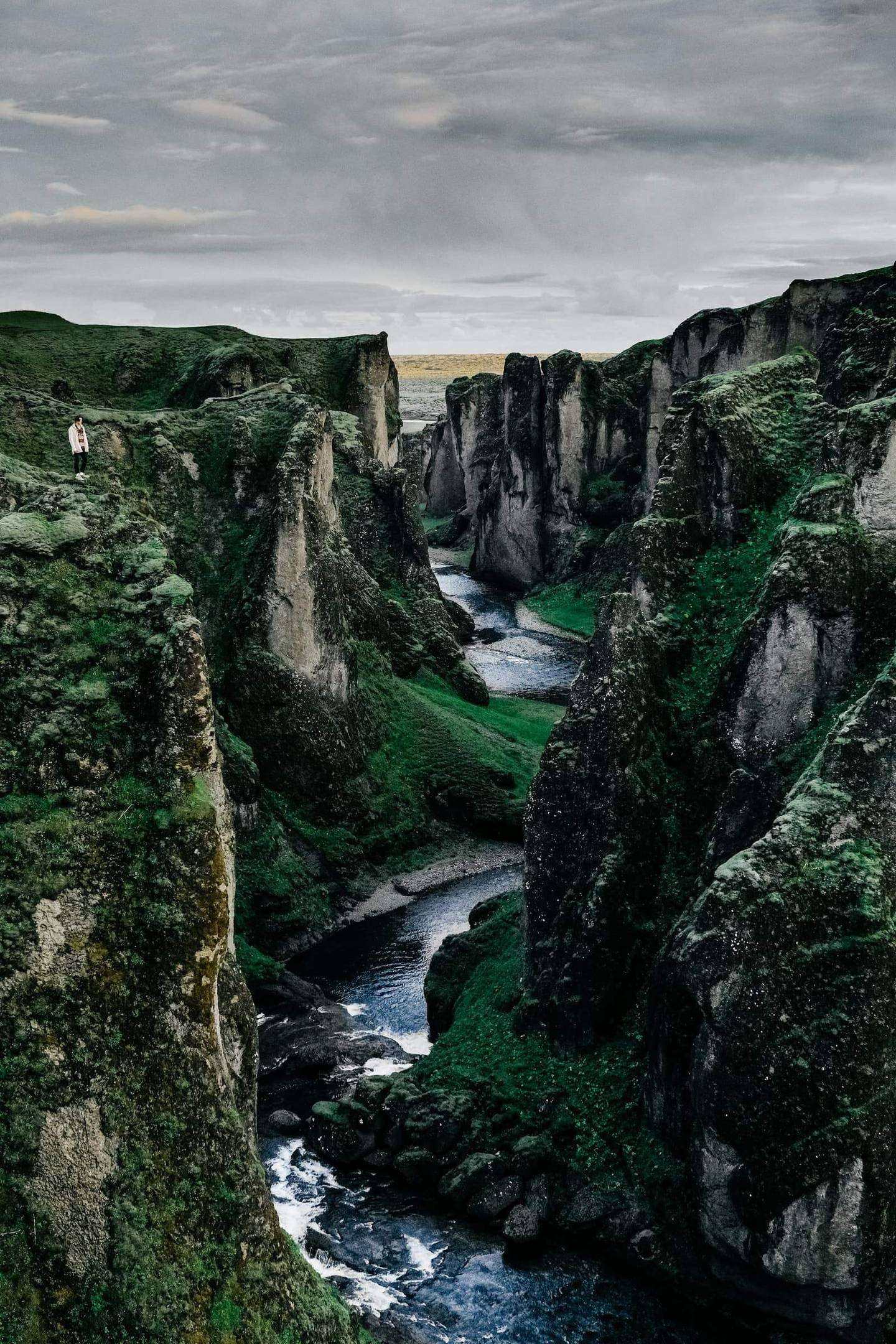
You collect a hired 4x4 at Keflavík, drive Reykjanes, the capital and the south coast, cross the East Fjords to Mývatn, take the highland tracks to Askja, Sprengisandur and Landmannalaugar, finish in the Westfjords and return the vehicle.
Pickup: your hired 4x4 in the downtown Reykjavík hotel area or your hired 4x4 at Keflavík International Airport. Drop-off: your downtown Reykjavík hotel or Keflavík International Airport.
The route: Keflavik Airport, then Reykjavík, then Vík, then Höfn, then Seydisfjordur, then Reykjahlíð, then Hrauneyjar, then Reykjavík, then Patreksfjörður, then Þingeyri, then Ísafjörður, then Keflavik Airport.
The journey at a glance
In short: A self-drive 14-day, 13-night journey of Iceland in a hired 4x4 for adventurous travellers, from Reykjavík and Keflavík through the south, the East Fjords, the highland F-roads and the Westfjords, best from mid-July to early August; a guided super jeep version from Reykjavík reaches the highlands outside the summer opening.
Length
14 days
Season
mid-July to early August
Style
An available journey, adaptable to your dates
Every journey here is a starting point: we adapt the days, the pace and the places to each guest. All the journeys
The whole journey, day by day. The numbered points mark where each day ends and the night is spent; select one to jump to that day.
Iceland begins at the edge of a volcanic peninsula. You collect your hired 4x4 at Keflavík airport, or in Reykjavík if you are already in the city, and drive first to Gunnuhver, 29 km and 31 min from the airport by the routing estimate. Gunnuhver is an area of mud pools and steam vents in the Reykjanes UNESCO Global Geopark, where temperatures of more than 300°C have been recorded, so you watch from a boardwalk and stay on the marked paths. The ground here is alive, and it is a quiet way to arrive.
From Gunnuhver the road runs 46 km and 44 min east to Seltún in the Krýsuvík geothermal field, with bubbling mud pots and a boardwalk through the coloured ground, and then 34 km and 37 min to Reykjavík. Safetravel states that the Grindavík area is still considered hazardous after the eruptions, so you read its advice before the drive and keep away from that area. The evening is free in the city, in the long summer light, with supper by the old harbour. The light changes through the year, so you set the hours by sunrise and sunset for your dates.
Along the way
Keflavik Airport Start of the day
Reykjavík End of the day
The road of the day, on the coast. Select a point to read about the place.
The day, hour by hour
09:00Collect your hired 4x4 at Keflavík airport or in Reykjavík
10:00Gunnuhver, the mud pools and steam vents from the boardwalk
12:30Lunch on the peninsula
14:30Seltún in the Krýsuvík geothermal field
16:30Drive to Reykjavík, 37 min by the routing estimate
19:30Supper by the old harbour
Gunnuhver reaches more than 300°C; watch from the boardwalk and stay on marked paths.
Safetravel says the Grindavík area is still considered hazardous, and you keep away from it.
Keflavík airport to Gunnuhver is 29 km and 31 min by the routing estimate.
Plan B. If a Reykjanes area is closed, the morning becomes the coast road and a longer lunch, and you reach the city earlier.
Night: Reykjavík
Day 2 A day in the capital
Reykjavík is small enough to walk, and you walk it at your own pace. Hallgrímskirkja, whose design draws on Iceland’s basalt columns, rises above the coloured roofs, and its tower gives a view over the city and the bay of Faxaflói. Harpa’s glass façade reflects the changing light of the same bay, and the restaurants around the Old Harbour serve fresh fish. Nothing is driven today, and the hired 4x4 waits in the hotel’s car park while the city is on foot.
Geothermal swimming pools are part of daily life in Reykjavík, and the city’s oldest, Sundhöllin, built in 1937, stands close to Hallgrímskirkja, while Laugardalslaug is the largest. A soak among residents is the best lesson in how the country lives. Supper tonight is a long one, since tomorrow the road leaves the city and runs south and east for three days along the coast. In the long summer light the evening has no edge, and a walk after supper along the shore is easy and unhurried, with the city quiet. The light changes through the year, so you set the hours by sunrise and sunset for your dates.
Along the way
Reykjavík Start of the day
The road of the day, on the coast. Select a point to read about the place.
The day, hour by hour
09:30Leave your hotel on foot for the walk
10:00Hallgrímskirkja and the view from the tower
12:00Lunch around the Old Harbour
14:00Harpa and the waterfront
16:00A soak in a city pool
19:30Supper in the city
Hallgrímskirkja’s tower offers a view over the city; its design draws on basalt columns.
Sundhöllin, the oldest pool, dates from 1937 and stands near the church.
No driving today; the capital is walked.
Plan B. If it rains, the walk becomes a museum morning and a longer pool visit, and the harbour is kept for supper.
Night: Reykjavík
Day 3 South coast waterfalls, and the first night in Vík
192 km, 2 h 59 min.
Waterfalls come first on the south coast, close to the Ring Road. From Reykjavík to Seljalandsfoss is 128 km and 1 h 58 min by the routing estimate, and you can walk behind the falling water. Skógafoss is 29 km and 29 min on, and you feel its spray before you see it. The south coast is accessible all year, with main roads regularly serviced, so the summer day is easy to drive, and you set the pace by your wishes and the light.
Reynisfjara lies beyond Skógafoss, the black sands of the coast near Vík, and the waves there run further up the beach than they seem to, so you keep well back. Vík is 35 km from Skógafoss by road, and supper is in the village. This is the last night in the south, and tomorrow the road runs east for a long day past the great ice cap. Evening in July is light until late, so a walk on the shore after supper is easy. The light changes through the year, so you set the hours by sunrise and sunset for your dates.
Along the way
Reykjavík Start of the day
Vík End of the day
The road of the day, on the coast. Select a point to read about the place.
The day, hour by hour
08:30Leave your Reykjavík hotel in the hired 4x4
10:30Seljalandsfoss, the path behind the water
12:00Skógafoss and lunch
14:30Reynisfjara, well back from the water
17:00Arrive in Vík
19:00Supper in the village
Reykjavík to Vík by the waterfalls is about 192 km and 3 h by the routing estimate.
The south coast route is accessible all year, with main roads regularly serviced.
Stay well back from the water at Reynisfjara.
Plan B. If wind or sea closes the beach, the afternoon is the village shore and a long lunch, and the waterfalls are kept.
Night: Vík
Day 4 Under Vatnajökull to Höfn
264 km, 4 h 10 min.
East of Vík the Ring Road crosses black sand plains under the white of Vatnajökull, the great ice cap. The day is the longest drive of the south: 191 km and 2 h 54 min to Jökulsárlón, and another 73 km and 1 h 16 min to Höfn, with the road itself as the show. You stop at the viewpoints, and the road is the show. At Jökulsárlón, the lagoon fed by the outlet glacier Breiðamerkurjökull, ice drifts toward the sea in the clear summer air.
Ice from the lagoon often washes up on the black beach beside it, which travellers call Diamond Beach, and the park keeps car parks at both. In summer the light on the ice lasts into the evening, so the lagoon is unhurried, and Höfn, the fishing town beyond it, is a short drive in the late light. The day is long, and the last hour is easy: supper in the harbour, and an early night before the East Fjords, which are a long way from anywhere. The light changes through the year, so you set the hours by sunrise and sunset for your dates.
Along the way
Vík Start of the day
Höfn End of the day
The road of the day, on the coast. Select a point to read about the place.
The day, hour by hour
08:00Leave Vík
11:00Jökulsárlón, the lagoon and the glacier
12:30Diamond Beach and lunch
14:30Continue east to Höfn, 76 min by the routing estimate
17:00Arrive in Höfn
19:00Supper by the harbour
Vík to Jökulsárlón is 191 km and 2 h 54 min by the routing estimate.
Ice from the lagoon often ends up on Diamond Beach, next to the lagoon.
Jökulsárlón to Höfn is 73 km and 1 h 16 min.
Plan B. If the drive feels too long, shorten the stops and the lagoon is kept, and the beach is seen from the road.
Night: Höfn
Day 5 Into the East Fjords, to Seyðisfjörður
219 km, 3 h 16 min.
The East Fjords are a country of long water and steep walls, and the road to them is quiet. From Höfn to Djúpivogur is 105 km and 1 h 32 min, and from there to Egilsstaðir another 86 km and 1 h 18 min, so keep the coffee stops long and unhurried. From Egilsstaðir the road climbs and drops 27 km and 26 min into Seyðisfjörður, a village at the head of its fjord with a lively art life, and your night is there.
Skaftfell, the centre for visual art, is open all year in a timber house by the harbour, and it grew out of the friends of the artist Dieter Roth, who spent time in the village late in his life. The hours are on its own website, so check them before the visit. The village is a steep run of coloured houses, and the evening light stays long, so the walk to the end of the fjord is easy after supper, with the water still and pale. The light changes through the year, so you set the hours by sunrise and sunset for your dates.
Along the way
Höfn Start of the day
Seydisfjordur End of the day
The road of the day, on the coast. Select a point to read about the place.
The day, hour by hour
08:30Leave Höfn
10:00Djúpivogur and a coffee stop
12:30Lunch in Egilsstaðir
15:00Over the pass to Seyðisfjörður
16:00Skaftfell and the art centre by the harbour
19:00Supper in the village
Höfn to Seyðisfjörður is 219 km and about 3 h 15 min by the routing estimate.
Skaftfell is open all year; the hours are on its own website.
Dieter Roth’s friends founded the Skaftfell Group.
Plan B. If the pass is closed by fog, you wait at Egilsstaðir and the village is reached in the evening.
Night: Seyðisfjörður
Day 6 Puffins at Borgarfjörður eystri, then north to Mývatn
331 km, 4 h 54 min.
Hafnarhólmi, in the village of Borgarfjörður eystri, is one of the easiest places to meet puffins. The main season runs from mid-April through mid-August, with the peak from May through mid-August. The drive from Seyðisfjörður is 94 km and 1 h 25 min by the routing estimate, and the road ends in the harbour. A boardwalk and viewing platforms stand on the islet, a short walk from the car, and about 10,000 puffins nest there.
From Borgarfjörður the road returns to Egilsstaðir, 72 km and 1 h 08 min, and then runs north-west to Mývatn, 165 km and 2 h 21 min, so the afternoon is long on the Ring Road and the light is the reward. Reykjahlíð, by the lake, is your night, and the next day is the highlands, so supper is early. The day is long, and the puffins are the part to remember: the small clumsy flight, the orange beaks, the burrows in the turf at your feet. Everything after that is road, and you keep the drive north easy, with a stop at the shore of the lake for the first look at Mývatn in the evening light. The light changes through the year, so you set the hours by sunrise and sunset for your dates.
Along the way
Seydisfjordur Start of the day
Reykjahlíð End of the day
The road of the day, on the coast. Select a point to read about the place.
The day, hour by hour
08:00Leave Seyðisfjörður
10:00Hafnarhólmi and the puffin boardwalks
12:30Lunch in Borgarfjörður eystri
14:00Drive to Egilsstaðir, 68 min by the routing estimate
16:00North on the Ring Road toward Mývatn
19:00Supper in Reykjahlíð
The puffin season at Hafnarhólmi runs from mid-April through mid-August.
About 10,000 puffins nest at Hafnarhólmi.
Seyðisfjörður to Reykjahlíð by Borgarfjörður is about 331 km and 4 h 54 min by the routing estimate.
Plan B. If fog or wind keeps the puffins away or the road closed, the morning becomes the village and the fjord shore, and the drive north starts earlier.
Night: Reykjahlíð
Day 7 Askja, by the black desert tracks
Askja is a caldera, a sunken crater, within the central volcano of the Dyngjufjöll mountains, and it lies far from any town. From Reykjahlíð to Möðrudalur is 71 km and 1 h 02 min, and from Möðrudalur to Drekagil another 89 km and 1 h 37 min by the routing estimate, and the last part is a rough track across a black desert, so you take the vehicle class the hire company confirms for the road, and no other. Rangers are stationed at Drekagil in summer.
The easy walk from Vikraborgir to the lake Öskjuvatn is 2.5 km and about two hours, and the crater of Víti is a bathing place for those who wish, though its slope is slippery and its mud is hot. The day is about 320 km in all by the routing estimate, and the track is slower than the estimate. Check the road report from the park and the Road Administration on umferdin.is before you leave, and never drive a mountain road before it is open, whatever the schedule says. The rivers are unbridged, and Safetravel advises that if you are unsure of a crossing, you do not do it. The light changes through the year, so you set the hours by sunrise and sunset for your dates.
Along the way
Reykjahlíð Start of the day
The road of the day, on the coast. Select a point to read about the place.
The day, hour by hour
06:30Leave Reykjahlíð in the highland vehicle
07:45Möðrudalur, the last stop on the Ring Road
10:00Drekagil and the walk toward Öskjuvatn
13:00Lunch at Drekagil
14:00Return across the desert
19:30Back in Reykjahlíð for supper
Askja is a caldera in the Dyngjufjöll mountains; rangers are stationed at Drekagil in summer.
The walk from Vikraborgir to Öskjuvatn is 2.5 km and about two hours, and easy.
The day is about 320 km by the routing estimate, and the track is slower.
Plan B. If the Askja road is closed or the weather is poor, the day becomes Mývatn: the lava of Dimmuborgir and the geothermal baths, and Askja is dropped.
Night: Reykjahlíð
Day 8 Across Sprengisandur to Hrauneyjar
Sprengisandur is the great crossing of the interior, a high desert track between north and south that opens only in summer. The Road Administration says it does not fully open until early July, sometimes later, and is then traversable only with large four-wheel drive vehicles and superjeeps, so today is in the largest class of 4x4 the hire company will allow on the road. The route runs from the north through Bárðardalur and Nýidalur to Hrauneyjar, about 290 km by the routing estimate.
The routing estimate gives 5 h 37 min of driving, and the track is slower, so plan the whole day and eat lunch on the road. The rivers on the route are unbridged, and Safetravel says no insurance covers any damage to a vehicle while crossing a river, which is why you wait for other travellers and drive slowly in low gear if you must cross. Hrauneyjar is a highland lodge at the end of the track, and your night is there, in a long, bright and quiet evening. The light changes through the year, so you set the hours by sunrise and sunset for your dates.
Along the way
Reykjahlíð Start of the day
Hrauneyjar End of the day
The road of the day, on the coast. Select a point to read about the place.
The day, hour by hour
07:30Leave Reykjahlíð and head to Bárðardalur
10:00Onto the track of Sprengisandur
13:00Lunch on the high desert
16:00Nýidalur and the southern half of the track
19:00Arrive at Hrauneyjar
20:30Supper at the lodge
Sprengisandur does not fully open until early July, and in 2021 to 2025 it opened between 21 June and 13 July.
Only large four-wheel drive vehicles and superjeeps can cross it.
No insurance covers vehicle damage in a river crossing.
Plan B. If the track is closed or a river is too high, the crossing is dropped and the day goes by the Ring Road and the south, 465 km and 6 h 51 min by the routing estimate to Reykjavík.
Night: Hrauneyjar
Day 9 Landmannalaugar, then back to Reykjavík
233 km, 4 h 15 min.
From Hrauneyjar to Landmannalaugar is about 41 km and 1 h 02 min by the routing estimate, along the northern Fjallabak road, F208. The Icelandic mountain hut association says that on average you can drive to Landmannalaugar from 20 June until 15 September, and the Road Administration’s table shows the first stretch of the road opening between 23 May and 23 June in 2021 to 2025, so July is safely inside the season. The huts stand at the dark edge of the rhyolite lava field Laugahraun.
Close to the huts a few hot springs make a natural brook warm enough to bathe in, and the banks are boggy, so a wooden path crosses to the water. The walk over the lava field is the heart of the morning, and then the road leaves the highlands for Hella, 98 km and 1 h 45 min, and Reykjavík another 94 km and 1 h 28 min. The day closes in the city, with a warm room and a long supper after the dust and the miles of the track. The light changes through the year, so you set the hours by sunrise and sunset for your dates.
Along the way
Hrauneyjar Start of the day
Reykjavík End of the day
The road of the day, on the coast. Select a point to read about the place.
The day, hour by hour
08:00Leave Hrauneyjar for Landmannalaugar
09:30Landmannalaugar and the lava field of Laugahraun
11:30Bathe in the warm brook
13:00Lunch at the huts
14:30Down to Hella and the Ring Road
18:00Arrive in Reykjavík at your hotel
On average one can drive to Landmannalaugar from 20 June until 15 September.
The huts stand at the edge of the rhyolite lava field Laugahraun.
Landmannalaugar to Reykjavík is about 192 km and 3 h 13 min by the routing estimate.
Plan B. If rain or a flooded river closes the road, you turn back by the paved road and the Ring Road to Reykjavík, and the lava field is kept for a calmer day.
Night: Reykjavík
Day 10 Reykjavík to the Westfjords, by the long road
389 km, 5 h 39 min.
The Westfjords are reached today by road. The ferry across Breiðafjörður, from Stykkishólmur to Brjánslækur, has its own schedule, which the operator changes by season and which was in dry dock until late November in 2026, so this journey does not rely on it. The road runs from Reykjavík by Borgarnes and the Dalir district to Patreksfjörður, 389 km and 5 h 39 min by the routing estimate, and the day is long, with the stops in the green country between.
Patreksfjörður sits on the south side of the Westfjords, the base for the cliffs and the red beach farther west. The Westfjords are remote and have no large town, and the light on the water in the evening is long. Supper is early, since the drive was long, and the next day is the cliffs. The road is checked on road.is each morning, as it is on every day of this journey, and the day’s pace is set by what the road asks, with a stop whenever the country is worth it. The light changes through the year, so you set the hours by sunrise and sunset for your dates.
Along the way
Reykjavík Start of the day
Patreksfjörður End of the day
The road of the day, on the coast. Select a point to read about the place.
The day, hour by hour
07:30Leave your Reykjavík hotel
09:00Borgarnes and a coffee stop
12:00Lunch in the Dalir district
15:00The last stretch into the Westfjords
17:30Arrive in Patreksfjörður
19:00Supper
The Breiðafjörður ferry follows its own seasonal schedule; the road does not depend on it.
Reykjavík to Patreksfjörður is about 389 km and 5 h 39 min by the routing estimate.
The Westfjords tourist board lists Patreksfjörður as one of its main villages.
Plan B. If the road is closed by an accident or a slide, you wait at Búðardalur, and the night is there or at the next open village.
Night: Patreksfjörður
Day 11 Látrabjarg: the puffin cliffs and the red beach
Látrabjarg is the westernmost point of Iceland, a line of cliffs 14 km long and up to 441 m high. Puffins are present from mid-May into August, so in July the ledges are crowded. From Patreksfjörður it is about 59 km and 55 min each way along Route 612, a remote road, and the lighthouse at Bjargtangar stands close to the car park. The puffins are unusually tame, and the edges of the cliff are fragile and loose, so you keep well back.
A red sand beach lies nearby, and the walk down to the sea is easy. This is a quiet corner of the country: the road is long and the light is long, and few people come this far. The day is slow, with a picnic by the cliffs if the wind allows, and the return to Patreksfjörður is in the evening light, in time for supper. The second night in the same village leaves the evening open, with no bag to pack and no road to plan. The light changes through the year, so you set the hours by sunrise and sunset for your dates.
Along the way
Patreksfjörður Start of the day
The road of the day, on the coast. Select a point to read about the place.
The day, hour by hour
09:30Leave Patreksfjörður
11:00Látrabjarg and the puffin ledges, with the lighthouse
13:00Picnic by the cliffs
15:00The red sand beach
17:30Return to Patreksfjörður
19:30Supper
Látrabjarg is 14 km long and up to 441 m high; puffins are present from mid-May into August.
Route 612 is about 59 km and 55 min each way from Patreksfjörður.
The cliff edges are fragile and loose; keep back.
Plan B. If fog or wind makes the cliffs unsafe, the day is the red beach and the shore road, and the puffins are tried again if the plan allows.
Night: Patreksfjörður
Day 12 Dynjandi, and a fjord drive to Þingeyri
118 km, 1 h 45 min.
Dynjandi cascades down approximately 100 m in steps, a natural monument since 1981, in the fjord of Arnarfjörður. The road from Patreksfjörður to Þingeyri passes it, 118 km and 1 h 45 min by the routing estimate, and you stop for the walk up beside the falls. The drive is the kind the Westfjords are known for: a fjord, a pass, another fjord, and almost no other vehicles on the way.
In Arnarfjörður, the pool at Reykjarfjörður is a full-size pool visible from the main road, and the water is warm all year, with a small natural pool just above it. A soak there is the Westfjords at its simplest. Þingeyri, the village on Dýrafjörður, is your night, with supper early and the evening long. Check road.is in the morning, since the pass is the way between the fjords and the day is built around it. The light on the water is long, and the road is empty enough that you can stop wherever a view asks, at a bridge, a beach or a farm gate. The light changes through the year, so you set the hours by sunrise and sunset for your dates.
Along the way
Patreksfjörður Start of the day
Þingeyri End of the day
The road of the day, on the coast. Select a point to read about the place.
The day, hour by hour
09:00Leave Patreksfjörður
10:30Reykjarfjörður and the geothermal pool in Arnarfjörður
12:30Dynjandi and lunch
14:30Over the pass to Dýrafjörður
16:00Arrive in Þingeyri
19:00Supper in the village
Dynjandi cascades down approximately 100 m; it has been a natural monument since 1981.
The pool at Reykjarfjörður is warm all year round.
Patreksfjörður to Þingeyri is about 118 km and 1 h 45 min by the routing estimate.
Plan B. If the pass is closed, the day is the shore of Arnarfjörður and the pool, and you take the long road to Hólmavík and Ísafjörður.
Night: Þingeyri
Day 13 Ísafjörður, and a fjord drive in the empty north
50 km, 0 h 49 min.
Ísafjörður is the largest town of the Westfjords, 50 km and 49 min from Þingeyri by the routing estimate. The day goes slowly, since the distance is short and the fjords are long. The fjord road around Ísafjarðardjúp is quiet, and you choose the headland and the beach by the weather. The aim today is empty country: a fjord with no other car, a natural pool by the sea, a table at the end of the road, and an hour of silence by the water.
The Westfjords offer natural hot pools used by locals all year, and you choose one for the afternoon by the road and the light. Ísafjörður itself has a harbour under steep mountains, and the supper is there. This is the last night of the journey, and tomorrow’s hour of departure is set by the flight, so the evening is for a long supper and for packing slowly, with a last look at the harbour and the fjord walls in the evening light. The light changes through the year, so you set the hours by sunrise and sunset for your dates.
Along the way
Þingeyri Start of the day
Ísafjörður End of the day
The road of the day, on the coast. Select a point to read about the place.
The day, hour by hour
09:00Leave Þingeyri
10:00Arrive in Ísafjörður and walk the harbour
12:00Lunch by the fjord
14:00A fjord drive on the Djúp and a natural pool
17:30Return to Ísafjörður
19:30Last supper
Þingeyri to Ísafjörður is about 50 km and 49 min by the routing estimate.
The Westfjords tourist board lists natural hot pools used throughout the year.
Ísafjörður has daily flights all year round.
Plan B. If fog hides the fjord, the day is the town, a museum and a long lunch, and the drive is moved to the morning of departure.
Night: Ísafjörður
Day 14 Back to Reykjavík and the car return
466 km, 6 h 58 min.
The way out is the long road south. From Ísafjörður to Reykjavík is 415 km and 6 h 7 min by the routing estimate, and to Keflavík airport another 51 km and 51 min, so the day is mostly driving, with the fjords to say goodbye to for the first hour. Visit Iceland says there are daily flights to Ísafjörður all year round, but the hired 4x4 has to be returned where you collected it, so the flight is not part of this plan and the road is.
Leave early, take the coffee stops you want, and keep a margin before the flight home, since a long drive and an airport do not forgive a late start. Return the vehicle at Keflavík airport or in Reykjavík, as booked, and the journey ends there with no further night. Thirteen nights after the mud pools of Gunnuhver, you leave Iceland by the same airport. Check road.is and vedur.is at breakfast, since a closed road changes the order of the day. The light changes through the year, so you set the hours by sunrise and sunset for your dates.
Along the way
Ísafjörður Start of the day
Keflavik Airport End of the day
The road of the day, on the coast. Select a point to read about the place.
The day, hour by hour
07:30Breakfast and check-out in Ísafjörður
08:30Leave Ísafjörður by the fjord road
12:00Lunch on the way, in the Dalir district
15:00Reykjavík, with a stop for fuel and the car return if you leave from the city
16:00On to Keflavík airport, 51 min by the routing estimate
17:00Return the vehicle at the airport
Ísafjörður to Reykjavík is about 415 km and 6 h 7 min by the routing estimate.
Reykjavík to Keflavík airport is about 51 km and 51 min.
Return the vehicle where you collected it; the flight home sets the start.
Plan B. If a road is closed, take the open road and keep to the flight’s time; the hire company is told in advance if you return late.
Night: Ísafjörður (departure, no further night)
While you are there
Festivals, markets and local events change from year to year. Tell us your dates and we will check what is on along this route and fold it in.