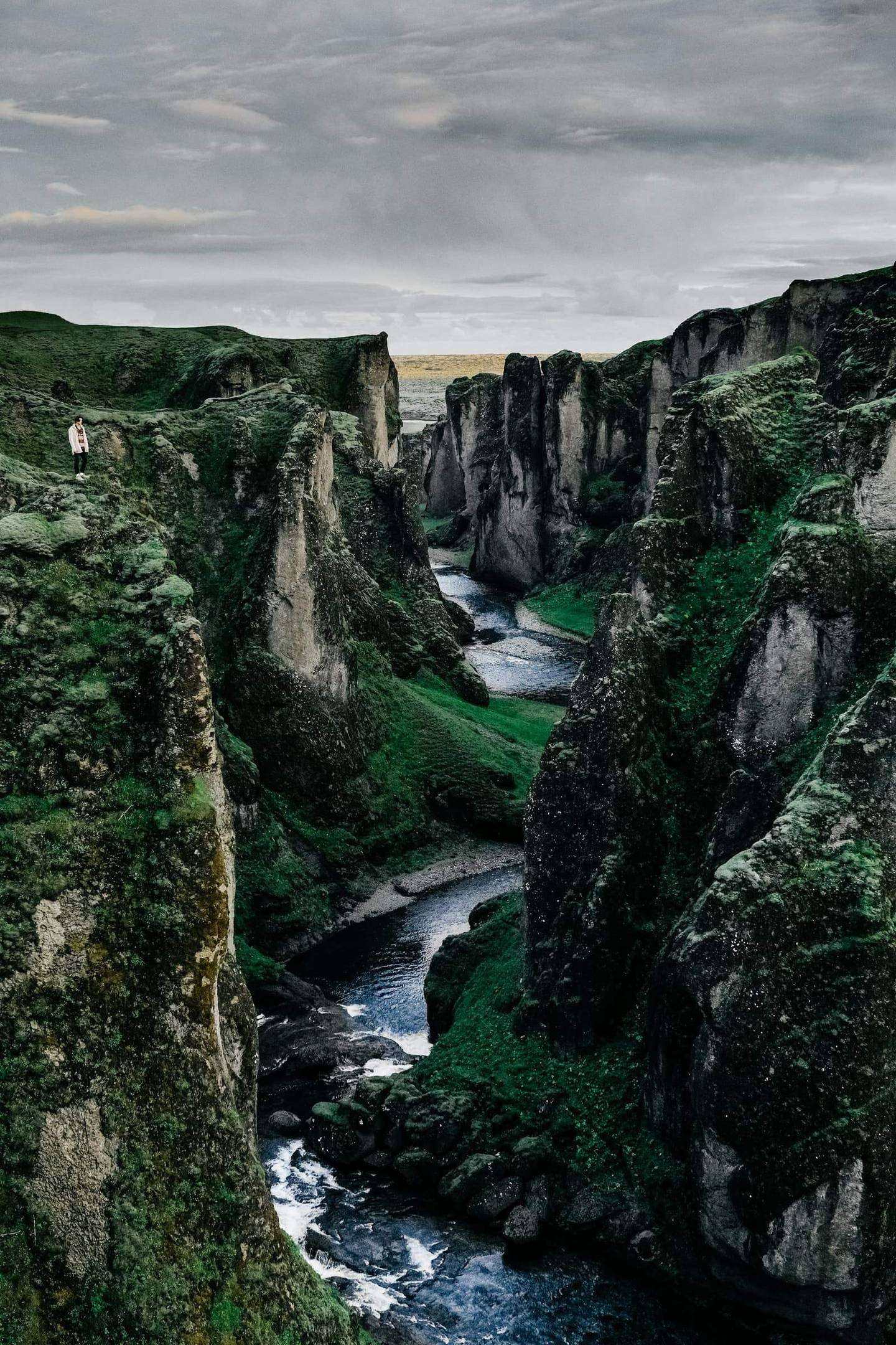
You are met at Keflavík, soak in a geothermal lagoon, then take the Golden Circle and the south coast to the glaciers of Vatnajökull for three nights, and return by Reykjavík to the Snæfellsnes peninsula.
Pickup: your downtown Reykjavík hotel or Keflavík International Airport. Drop-off: your downtown Reykjavík hotel or Keflavík International Airport.
The route: Keflavik Airport, then Reykjavík, then Hella, then Vík, then Skaftafell, then Reykjavík, then Arnarstapi, then Keflavik Airport.
The journey at a glance
In short: A private 10-day, 9-night journey of Iceland's highlights for couples and small groups, from Reykjavík and Keflavík through the Golden Circle, the south coast, Vatnajökull and Snæfellsnes, best from November to March.
Length
10 days
Season
November to March
Style
An available journey, adaptable to your dates
Every journey here is a starting point: we adapt the days, the pace and the places to each guest. All the journeys
The whole journey, day by day. The numbered points mark where each day ends and the night is spent; select one to jump to that day.
Day 1 Keflavík to Reykjavík by way of a geothermal lagoon
72 km, 1 h 10 min.
Iceland begins in warm water. Your private guide meets you in the arrivals hall at Keflavík airport, or at your downtown Reykjavík hotel if you are already in the city, and drives to the geothermal area of Svartsengi on the Reykjanes peninsula, 23 km and 23 min from the airport by the routing estimate. The lagoon there opens at 08:00 in winter by its own page, and a soak is how the long flight leaves your shoulders before the first sight, while the guide waits in the car with the day’s plan.
From Svartsengi the road continues to Reykjavík, about 49 km and 47 min by the routing estimate, to your hotel in the centre. The evening is yours: the old harbour, the concrete bulk of Hallgrímskirkja against the dusk, and a long supper. Reykjanes is a volcanic peninsula, and the Safetravel page for it states that the Grindavík area is still hazardous after the eruptions, so your guide reads it before the drive and changes the order of the day if the advice changes. The light changes through the year, so your guide sets the hours by sunrise and sunset for your dates.
Along the way
Keflavik Airport Start of the day
Reykjavík End of the day
The road of the day, on the coast. Select a point to read about the place.
The day, hour by hour
08:00Your guide meets you at Keflavík airport or your Reykjavík hotel
09:00Drive to Svartsengi, 23 min from the airport by the routing estimate
10:00Soak at the geothermal lagoon at Svartsengi
13:00Lunch near the lagoon
14:30Drive to Reykjavík, 47 min by the routing estimate
19:30Supper in the old harbour district
Svartsengi is 23 km and 23 min from Keflavík airport by the routing estimate.
Safetravel says the Grindavík area is still considered hazardous, and the guide follows its advice.
The lagoon’s own page gives winter hours of 08:00 to 22:00 until 31 December, then 08:00 to 20:00.
Plan B. If the lagoon is closed or the area is restricted, the morning becomes the Reykjanes coast and a longer lunch, and the soak moves to another day.
Night: Reykjavík
Day 2 The Golden Circle, with Gullfoss at dusk
202 km, 3 h 14 min.
Þingvellir is where the Alþingi, the parliament of Iceland, met from 930 AD until 1789. It is a World Heritage site since 2004, and the tectonic plates drift apart in the crevasses of Almannagjá. The morning light is long and flat, and the paths are quiet. From your Reykjavík hotel it is 54 km and 54 min by the routing estimate. Your guide leaves at a quiet hour so that the rift is yours for a time, and the walk down the canyon takes you between two continents in the low winter light.
Geysir lies another 59 km and 60 min east, in the Haukadalur geothermal area, where Strokkur throws up fountains of hot water. Gullfoss follows, 8 km on, where about 100,000 litres of glacial water from the river Hvítá plunge 31 m into the canyon every second, and in winter the trails to the lower platforms are sometimes closed by ice. You see it at dusk, in the amber of a short winter afternoon, before the road to Hella, 82 km and 73 min away. The light changes through the year, so your guide sets the hours by sunrise and sunset for your dates.
Along the way
Reykjavík Start of the day
Hella End of the day
The road of the day, on the coast. Select a point to read about the place.
The day, hour by hour
08:30Your guide collects you at your Reykjavík hotel
10:00Þingvellir and the gorge of Almannagjá
12:30Geysir and Strokkur, then lunch
15:00Gullfoss, the upper platform and the lower if the path is open
16:30Leave Gullfoss at dusk for Hella
18:00Arrive in Hella for supper and your night
The Alþingi met at Þingvellir from 930 AD until 1789; it is a World Heritage site since 2004.
Gullfoss drops 31 m, and Visit Iceland says it is open the whole year.
Gullfoss trails to the lower platforms are sometimes closed by ice.
Plan B. If ice closes the path at Gullfoss, the upper viewpoint stays, and Geysir is the stop that is lengthened.
Night: Hella
Day 3 The south coast, and supper in Vík
110 km, 1 h 46 min.
The south coast is accessible all year round, with its main roads regularly serviced, and the first waterfalls stand close to the Ring Road. From Hella it is 34 km and 32 min to Seljalandsfoss, where a path leads behind the falling water when ice allows, and 29 km and 29 min on to Skógafoss, a wall of water that throws its spray across the field in front. Your guide sets the pace by your wishes, so you can stand at either as long as the light lasts.
The black sands of Reynisfjara lie 35 km and 33 min beyond Skógafoss, near Vík, and the waves there run further up the beach than they seem to, so your guide keeps you well back from the water. Vík itself is 11 km and 12 min from the beach. Supper is in the village, in the early dark, and the night is yours. Winter roads can close without warning, so your guide reads road.is and vedur.is at breakfast, and the day is shaped by them. The light changes through the year, so your guide sets the hours by sunrise and sunset for your dates.
Along the way
Hella Start of the day
Vík End of the day
The road of the day, on the coast. Select a point to read about the place.
The day, hour by hour
08:30Leave Hella with your guide
09:30Seljalandsfoss, the path behind the water if it is open
11:30Skógafoss
13:00Lunch on the way
14:30Reynisfjara and the basalt stacks, well back from the water
17:30Arrive in Vík and supper in the village
The south coast route is accessible all year, with main roads regularly serviced.
From Hella to Vík by way of the waterfalls and the beach is about 110 km and 1 h 45 min.
Stay well back from the water at Reynisfjara.
Plan B. If wind or ice closes the beach, the day turns to the village of Vík and its shore, and the waterfalls are kept.
Night: Vík
Day 4 East along the sands, to the edge of Vatnajökull
141 km, 2 h 00 min.
Past Vík the Ring Road leaves the green coast and runs east across black plains toward the great ice cap of Vatnajökull. From Vík to Kirkjubæjarklaustur is 72 km and 61 min by the routing estimate, and from there to Skaftafell another 69 km and 59 min, so the day is about 141 km and two hours of driving, and the morning in Vík is a slow one, with breakfast and a last look at the sea. Your guide stops where the landscape asks, and the afternoon belongs to the park.
Vatnajökull National Park encompasses Skaftafell, with short and easy trails to the waterfall Svartifoss and to the glacier Skaftafellsjökull, and its visitor centre is open all year. You walk there in the afternoon light, which is soft and low and reaches the ice sideways. This is the first of three nights at the same base, close to the glacier, so nothing about the next two days needs a long drive before breakfast, and the dark here is deep. The light changes through the year, so your guide sets the hours by sunrise and sunset for your dates.
Along the way
Vík Start of the day
Skaftafell End of the day
The road of the day, on the coast. Select a point to read about the place.
The day, hour by hour
09:00Leave Vík with your guide
10:30Kirkjubæjarklaustur and a coffee stop
12:30Lunch on the way
14:00Arrive at Skaftafell and walk to Svartifoss
16:00A short walk toward the glacier front, paths permitting
18:30Supper and your night near Skaftafell
Vík to Skaftafell is about 141 km and two hours of driving by the routing estimate.
Short and easy trails lead to Svartifoss and Skaftafellsjökull.
The Skaftafell visitor centre is open all year.
Plan B. If snow or wind closes the trails, the afternoon becomes the visitor centre and a long rest, and the glacier waits for tomorrow.
Night: Skaftafell
Day 5 A private glacier walk on Vatnajökull
Safetravel says you should never go on a glacier without experience or the proper equipment. It adds that hiring a certified glacier guide is highly recommended, so today a glacier guide leads your private walk on an outlet glacier of Vatnajökull close to Skaftafell. Crampons and ice axes are generally provided, and you bring boots, a waterproof jacket and trousers, a hat and gloves. The pace is set by the ice and by your group, and your road guide waits at the foot.
Visit Iceland says glacier walking is practised year-round. The walk lasts a few hours on uneven blue ice, and the guide chooses the route that morning from the conditions, since crevasses open with little warning. In the afternoon the road leads 54 km and an hour east to Jökulsárlón, where the lagoon lies beside the Ring Road and the icebergs drift to the sea. The day is long and the light is short, so lunch is early and the lagoon is at the end of the day. The light changes through the year, so your guide sets the hours by sunrise and sunset for your dates.
Along the way
Skaftafell Start of the day
The road of the day, on the coast. Select a point to read about the place.
The day, hour by hour
08:30Meet your glacier guide and fit crampons
09:30Walk on the glacier, a few hours
13:00Lunch near Skaftafell
14:30Drive 60 min to Jökulsárlón by the routing estimate
15:30Jökulsárlón, the lagoon in low light
17:30Return to Skaftafell for supper
Safetravel strongly recommends a certified glacier guide for any glacier walk.
Crampons and ice axes are generally provided on glacier tours.
Skaftafell to Jökulsárlón is 54 km and about an hour by the routing estimate.
Plan B. If wind or rain rules out the ice, the glacier walk moves to the next free morning and the day becomes the lagoon and Diamond Beach.
Night: Skaftafell
Day 6 Jökulsárlón at sunrise, and an ice cave
Jökulsárlón at sunrise is a lagoon of ice in slow motion. Breiðamerkurjökull, an outlet glacier of Vatnajökull, calves into it, and the floating pieces drift under the Ring Road to the sea. The national park says glacier ice often washes up on the black beach beside the lagoon, which travellers call Diamond Beach, and in the low winter sun the ice is lit from the side. Your guide leaves in the dark to be there at first light, about an hour from Skaftafell.
Visit Iceland says the natural ice cave season typically runs from November through May, as the cold returns and the meltwater tunnels of summer freeze, and the caves must be visited only on guided tours. Your private visit goes inside a cave in the ice of Vatnajökull, with the equipment the operator provides, on a route the operator and the park assess each day. Cave entrances change, and the guide decides on the morning whether it is safe. The lagoon remains, whatever the weather. The light changes through the year, so your guide sets the hours by sunrise and sunset for your dates.
Along the way
Skaftafell Start of the day
The road of the day, on the coast. Select a point to read about the place.
The day, hour by hour
07:00Leave Skaftafell in the dark
08:30Jökulsárlón and Diamond Beach at first light
10:30Meet your ice cave guide
11:30Into an ice cave in Vatnajökull, if the day’s assessment allows
14:00Lunch near the lagoon
17:00Return to Skaftafell for supper
The natural ice cave season typically runs from November through May.
Ice caves are visited only on guided tours; the guide assesses each cave each day.
Diamond Beach lies next to the lagoon, south of the Ring Road.
Plan B. If the cave is closed, the morning becomes a second lagoon walk and the cave is tried again on the following day if the plan allows.
Night: Skaftafell
Day 7 West along the coast to Reykjavík
327 km, 4 h 46 min.
The road west is the same road you came by, seen the other way, and the light on it is different. From Skaftafell to Reykjavík is 327 km and 4 h 45 min by the routing estimate, so the day is long, and your guide breaks it at Kirkjubæjarklaustur and at Vík, where lunch is in the village you left four days ago. The glacier shrinks behind you in the mirror, and the sea comes back on the left, and the waterfalls you saw in their first light are in their last.
Reykjavík is the city again, with a warm room and a table. The evening is free: the old harbour, the swimming pools that Icelanders use all winter, or only a long supper. Tomorrow starts later than today, so the night is slow. Winter roads can close without warning, so your guide reads road.is and vedur.is at breakfast, and if a stretch is shut, the day is turned or shortened, and you are told before you leave and not on the road. The light changes through the year, so your guide sets the hours by sunrise and sunset for your dates.
Along the way
Skaftafell Start of the day
Reykjavík End of the day
The road of the day, on the coast. Select a point to read about the place.
The day, hour by hour
08:30Leave Skaftafell with your guide
10:30Kirkjubæjarklaustur and a coffee stop
12:30Lunch in Vík
15:00Skógafoss in the late light
17:30Arrive in Reykjavík at your hotel
19:30Supper in the city
Skaftafell to Reykjavík is 327 km and about 4 h 45 min by the routing estimate.
The south coast route is accessible all year, with main roads regularly serviced.
The roads are read at breakfast, since winter roads can close without warning.
Plan B. If a stretch of road closes, the guide turns the day around by the nearest open road and the night may be in Vík or Hella instead.
Night: Reykjavík
Day 8 North-west to the Snæfellsnes peninsula
194 km, 2 h 53 min.
Snæfellsnes lies north-west of Reykjavík, 194 km and 2 h 53 min to Arnarstapi by the routing estimate. On a clear day the white summit of its glacier is visible across the bay from the capital, and the drive is a slow reveal. Snæfellsjökull, a stratovolcano of 1,446 m, was Jules Verne’s inspiration for Journey to the Center of the Earth. The road runs round the peninsula’s southern shore, and your guide stops at the lava coast so that you see the volcano before you reach its foot.
Arnarstapi and Hellnar are two old fishing hamlets joined by a coastal path of 2.5 km that passes the stone arch of Gatklettur. The short walk between them winds through moss-covered lava, and the sea comes in white. You arrive in the afternoon, walk the path in the last of the light, and eat early. The night is on the shore, and it is dark enough here that a clear evening brings the northern lights outside the door, which cannot be promised. The light changes through the year, so your guide sets the hours by sunrise and sunset for your dates.
Along the way
Reykjavík Start of the day
Arnarstapi End of the day
The road of the day, on the coast. Select a point to read about the place.
The day, hour by hour
09:00Your guide collects you at your Reykjavík hotel
11:00Coffee stop on the road north
13:00Lunch on the peninsula
15:00The coast path between Arnarstapi and Hellnar
17:00Check in at Arnarstapi
19:00Supper and the night sky
Snæfellsjökull is a stratovolcano of 1,446 m and Jules Verne’s inspiration for Journey to the Center of the Earth.
The coast path between Arnarstapi and Hellnar is 2.5 km.
Reykjavík to Arnarstapi is about 194 km and 2 h 53 min by the routing estimate.
Plan B. If wind keeps you off the path, the afternoon is the volcano from the car and a long lunch, and the path is walked tomorrow.
Night: Arnarstapi
Day 9 Around the volcano: seals, pinnacles and Kirkjufell
Today is a loop around the foot of the volcano. Djúpalónssandur is a black pebble beach famous for the lifting stones that fishermen used to test their strength, with the rusted iron of a shipwreck on the sand. Lóndrangar, two basalt pinnacles that rise from the sea like a dark castle, are a sanctuary for fulmars and kittiwakes. Harbor seals are a common sight on the golden shoreline of Ytri Tunga, so the guide watches the rocks as you walk, and you do not go closer than the animals allow.
The north shore leads to Grundarfjörður, 52 km and 46 min from Arnarstapi by the routing estimate, and Kirkjufell, the 463 m cone that stands beside the town. The light is lowest here in the afternoon, and the mountain is dark against it. The day closes the circle at Arnarstapi, with the seals, the stones and the cone in mind, and the last supper of the journey is early, by a window that looks at the sea, with a long evening to pack and to remember. The light changes through the year, so your guide sets the hours by sunrise and sunset for your dates.
Along the way
Arnarstapi Start of the day
The road of the day, on the coast. Select a point to read about the place.
The day, hour by hour
09:00Leave Arnarstapi with your guide
10:00Djúpalónssandur and the lifting stones
12:00Lóndrangar and lunch
14:00Ytri Tunga, watching for seals on the rocks
15:30Kirkjufell by Grundarfjörður
18:30Last supper by the sea
Harbor seals are a common sight at Ytri Tunga beach.
Kirkjufell is 463 m high and stands by Grundarfjörður.
Djúpalónssandur is a black pebble beach with the lifting stones of the old fishermen.
Plan B. If wind rules out the beaches, the day is Kirkjufell and the lava coast from the car, and a long lunch.
Night: Arnarstapi
Day 10 Return by Reykjavík to Keflavík
194 km, 2 h 53 min.
The road home follows the south shore of the peninsula and then the Ring Road into Reykjavík, 194 km and 2 h 53 min by the routing estimate from Arnarstapi. Your guide takes you to your downtown Reykjavík hotel if you stay another night in the city, or on to Keflavík airport, another 51 km and 51 min, so that the journey ends where it began. A late flight leaves the morning slow, with breakfast by the sea, and a morning flight starts before the light.
Your guide walks you into the departures hall, and the journey ends there, with no further night. Nine nights ago the first soak was in warm water in the cold, and the ice, the waterfalls and the volcano are behind you. Winter roads can close without warning, so your guide reads road.is and vedur.is the evening before and leaves early if the weather turns, since the flight is the one fixed point of the day and everything else bends around it. The light changes through the year, so your guide sets the hours by sunrise and sunset for your dates.
Along the way
Arnarstapi Start of the day
Keflavik Airport End of the day
The road of the day, on the coast. Select a point to read about the place.
The day, hour by hour
08:00Breakfast and check-out at Arnarstapi
09:00Leave for Reykjavík, 2 h 53 min by the routing estimate
12:30Lunch in Reykjavík, or at your hotel
14:00On to Keflavík, 51 min by the routing estimate
15:00Your guide sees you into the departures hall
Arnarstapi to Reykjavík is about 194 km and 2 h 53 min by the routing estimate.
Reykjavík to Keflavík airport is about 51 km and 51 min.
The flight is the fixed point; the rest of the day moves around it.
Plan B. If the weather turns, your guide leaves earlier and takes the open road, and the lunch is cut to a stop.
Night: Reykjavík (departure, no further night)
While you are there
Festivals, markets and local events change from year to year. Tell us your dates and we will check what is on along this route and fold it in.