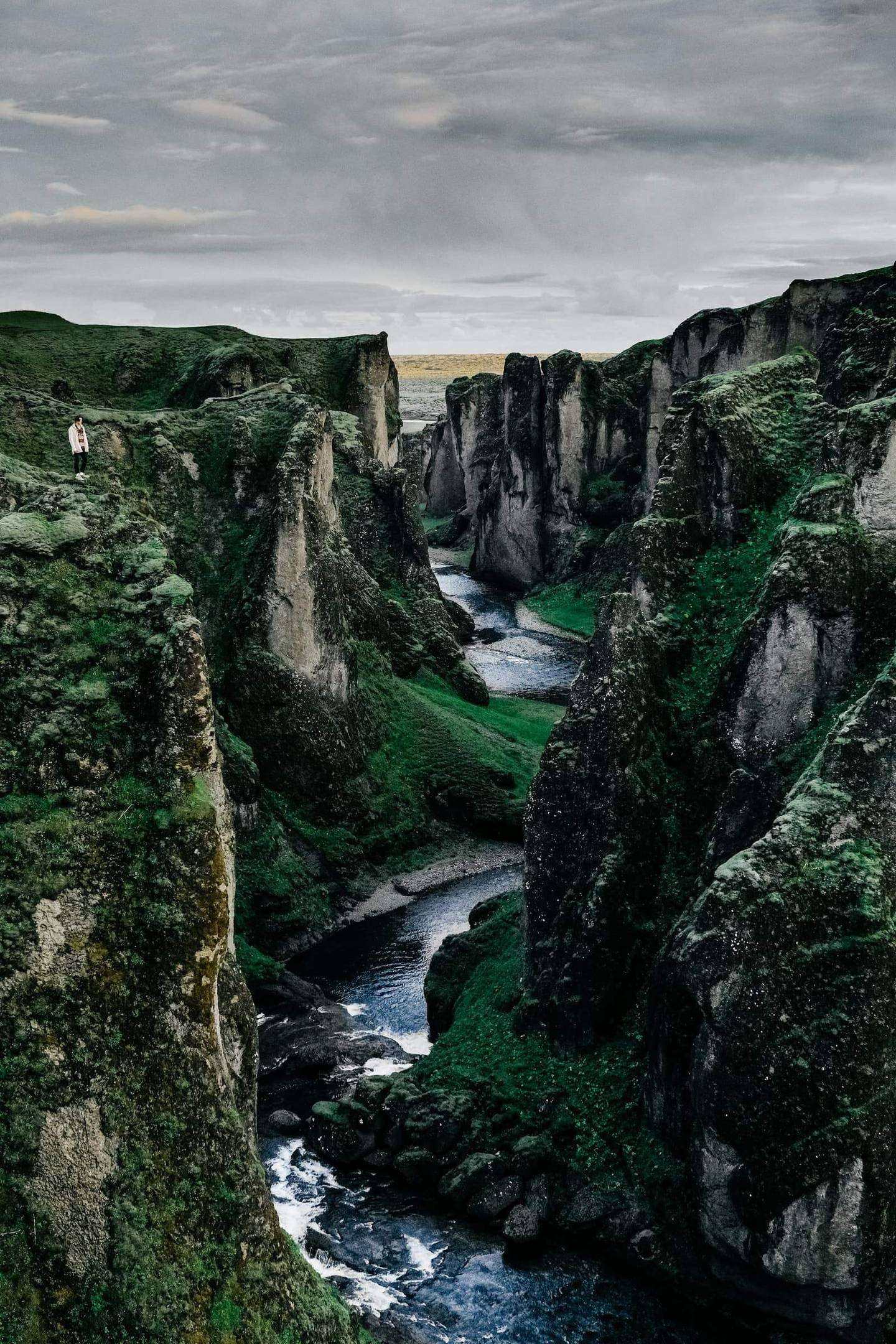
South Coast and the highlands by super jeep: five days, private
You start in Reykjavík, take the Golden Circle to Hella on Day 1, go to Landmannalaugar on Day 2 and Þórsmörk on Day 3, the south coast to Vík on Day 4, and spend Day 5 on the ice before the road home.
Pickup: your downtown Reykjavík hotel or Keflavík International Airport. Drop-off: your downtown Reykjavík hotel or Keflavík International Airport.
The route: Reykjavík, then Þingvellir, then Strokkur, then Gullfoss, then Hella, then Vik, then Hella, then Seljalandsfoss, then Skógafoss, then Reynisfjara, then Vík, then Reykjavík.
The journey at a glance
In short: A five-day private guided journey from Reykjavík with the Golden Circle, a Landmannalaugar day, a Þórsmörk day, the south coast and a day on the ice near Vík. Best in summer. Pickup at your downtown Reykjavik hotel or at Keflavik International Airport.
Length
5 days
Season
summer
Style
An available journey, adaptable to your dates
Every journey here is a starting point: we adapt the days, the pace and the places to each guest. All the journeys
The whole journey, day by day. The numbered points mark where each day ends and the night is spent; select one to jump to that day.
Þingvellir is where the gap between the North American and Eurasian plates runs above ground. The plates diverge by about 2 cm a year across a rift valley of about 10 km, and you walk a path through the gorge of Almannagjá between two walls of rock to Öxarárfoss. The Alþing met here in the open from around 930 until 1798, and the park has been a UNESCO World Heritage site since 2004. Your private guide collects you at your Reykjavík hotel, so the day starts when you do, and the hours of the drive are confirmed before you travel.
Strokkur does not empty between eruptions, so it refills quickly and erupts every few minutes, with jets reaching up to 30 m. The Geysir area is a high-temperature field of about 3 km², and you stand and watch two or three eruptions to learn the rhythm. Gullfoss comes next, two waterfalls on the river Hvítá that drop 11 m and 21 m, 32 m in all, bought by the Icelandic state in 1945 and protected in 1979. From Gullfoss the road runs south to Hella, where your night is chosen by us for the room category and location, and named at booking, subject to final confirmation. Winter roads can close without warning, so the guide checks road.is and safetravel.is before leaving. The light changes through the year, so your guide sets the hours by sunrise and sunset for your dates.
Along the way
Reykjavík Start of the day
Your day starts in Reykjavík, where your private guide collects you at 08:30 at your downtown hotel, a hotel of your choosing, or in the arrivals hall at Keflavik International Airport. The road to Þingvellir is 54.2 km and about 55 minutes from the hotel, or 98.0 km and about 95 minutes from the airport, by the routing estimate. The hours are confirmed before you travel.
Þingvellir A stop
Þingvellir is where the gap between the North American and Eurasian plates runs above ground, in a rift valley of about 10 km. You walk the path through the gorge of Almannagjá, between two walls of rock, to Öxarárfoss. The Alþing met here in the open from around 930 until 1798, and the park has been a UNESCO World Heritage site since 2004.
Strokkur A stop
Strokkur does not empty between eruptions, so it refills quickly and erupts every few minutes, with jets reaching up to 30 m. It stands in the Geysir area, a high-temperature field of about 3 km². You stand and watch two or three eruptions to learn the rhythm, around midday, before lunch and the road on to Gullfoss.
Gullfoss A stop
Gullfoss is two waterfalls on the river Hvítá, dropping 11 m and 21 m, 32 m in all. The Icelandic state bought the falls in 1945 and protected them in 1979. You arrive after lunch, at about 14:30, and the road then runs south toward Hella, leaving Gullfoss at about 16:00.
Hella End of the day
Hella is where the first night falls, about two hours after you leave Gullfoss, at around 18:00 in the timed plan. Your night is chosen by us for the room category and location, named at booking and subject to final confirmation. Winter roads can close without warning, so the guide has checked road.is and safetravel.is before the day began.
The road of the day, on the coast. Select a point to read about the place.
The day, hour by hour
08:30Your guide collects you at your downtown Reykjavik hotel (a hotel of your choosing), 54.2 km and about 55 min to Thingvellir by the routing estimate; or at Keflavik International Airport, 98.0 km and about 95 min to Thingvellir
10:00Þingvellir, the gorge of Almannagjá and Öxarárfoss
12:00Geysir and Strokkur, two or three eruptions
13:30Lunch near Gullfoss
14:30Gullfoss
16:00Leave Gullfoss for Hella
18:00Arrive in Hella for your night
The plates at Þingvellir diverge by about 2 cm a year across a rift valley of about 10 km.
Strokkur erupts every few minutes, with jets reaching up to 30 m.
Gullfoss drops 11 m and then 21 m, 32 m in all.
Plan B. Decide at breakfast, at about 08:00, with road.is and safetravel.is. If weather closes a road, Þingvellir and Gullfoss stay and Geysir is the stop that is shortened.
Night: Hella
Day 2 Landmannalaugar by modified vehicle, with the hot pool
122 km, 2 h 08 min.
Landmannalaugar is reached by F208 and F225, the 4x4 routes named by the hut association. Vegagerðin published the opening of F208 from Sigalda to Landmannalaugar for 2021 to 2025, and in those years it opened between 23 May and 23 June, with an average of 2 June. The hut association gives about 20 June to 15 September for ordinary summer driving, so the day depends on the year. You go guided only, in a modified vehicle with an experienced driver, and we send two vehicles where conditions call for it, which is our operating rule and not an official requirement.
No insurance covers any damage to a vehicle while crossing a river, so if the guide is unsure, you do not cross, and the call is made on the day. The day is long and the hours are not stated in our sources, so we confirm them before you travel. At Landmannalaugar you walk in the hut area and take a dip in the geothermal pool, with time kept for both. Opening dates are estimates driven by snowpack, so the guide checks umferdin.is and vedur.is before you leave Hella, and the day can move to another day of the stay or to a plan B. The light changes through the year, so your guide sets the hours by sunrise and sunset for your dates.
Along the way
Hella Start of the day
Vik End of the day
The road of the day, on the coast. Select a point to read about the place.
The day, hour by hour
07:00Weather and road call with your guide, using umferdin.is, safetravel.is and vedur.is
07:30Leave Hella in a modified vehicle by F208 or F225, whichever is open
11:30Landmannalaugar, a walk in the hut area
13:00Lunch, then a dip in the geothermal pool
15:00Start the return, with the second decision on any river made by the guide
19:00Back in Hella for your night, the time set by the road and the rivers
F208 and F225 are the 4x4 routes to Landmannalaugar, according to the hut association.
No insurance covers vehicle damage in a river crossing, so if unsure, you do not cross.
Our operating rule: guided only, two vehicles where conditions call for them, and a weather call on the day.
Plan B. If F208 or F225 is not open, or a river is too high, the day becomes a lower-level day from Hella, and the guide decides at about 07:00. The route can also move to Þórsmörk day if that road is open.
Night: Hella
Day 3 Þórsmörk by F249 and the Krossa crossing
Þórsmörk is reached by F249, which ends with the Krossa crossing. The hut association says only experienced drivers in robust 4x4 vehicles should attempt it, so you travel guided only, in a modified vehicle with an experienced driver. We send two vehicles where conditions call for it, which is our operating rule for remote crossings. The Langidalur hut sits at 200 m, and the hut association says it is usually open from early May to early October, set by when Vegagerðin opens F249. The way in crosses several rivers, and the hut association calls Krossa often dangerous.
No insurance covers vehicle damage in a river crossing, so the guide goes slowly, in low gear, and does not cross if unsure. In the valley you walk, and walking links lead on to Fimmvörðuháls and Laugavegur. The drive length on F249 is not stated in our sources, so we confirm the hours before you travel. Hella has the bus access to Þórsmörk, which keeps the start of the day short, and your night is in Hella again, chosen by us and subject to final confirmation. The call on the river is made on the day, because the level and the road status can change daily. The light changes through the year, so your guide sets the hours by sunrise and sunset for your dates.
Along the way
Hella Start of the day
The day starts in Hella with a river and road check at 07:00, using road.is, safetravel.is and vedur.is, and you leave at 07:30 by modified vehicle toward F249. Hella has the bus access to Þórsmörk, which keeps the start of the day short. The call on the river is made on the day, because the level and the road status can change daily.
Hella End of the day
Hella is where you return for your night, at about 19:00, though the river and the light set the time. The second decision on the crossing is made by the guide when the return starts, at about 15:30. Your night is in Hella again, chosen by us and subject to final confirmation.
The road of the day, on the coast. Select a point to read about the place.
The day, hour by hour
07:00River and road check with your guide, using road.is, safetravel.is and vedur.is
07:30Leave Hella by modified vehicle toward F249
11:00The Krossa crossing, only if conditions allow, then the valley at Langidalur
12:30Lunch and a short walk in the valley
15:30Start the return, with the second decision on the crossing made by the guide
19:00Back in Hella for your night, the time set by the river and the light
F249 ends with the Krossa crossing; the hut association calls the river often dangerous.
No insurance covers vehicle damage in a river crossing, so if unsure, you do not cross.
Our operating rule: two vehicles where conditions call for them, guided only, and a weather call on the day.
Plan B. If the Krossa crossing is not made, the guide takes you on a walk in the lower valley, and decides at the river at about 11:00. If Þórsmörk is not reached at all, the day is a lower-level day from Hella.
Night: Hella
Day 4 The south coast to Vík
93 km, 1 h 21 min.
Seljalandsfoss is about 60 m high and you walk behind it, so a waterproof jacket helps. Skógafoss drops about 60 m a little further east, and the south coast route is accessible all year round and generally easy to drive in both summer and winter. Your private guide sets the pace by your wishes, because no two guests want the same hours at a waterfall. Check road.is and vedur.is at breakfast, since winter roads can close without warning.
Parts of Dyrhólaey close for nesting, usually from around mid-May to late June. At Reynisfjara the waves come further up the beach than they seem to, so stay well back from the water and do not enter the cave, as every sign says. The sea stacks of Reynisdrangar stand off the beach at Vík, which lies within the Katla Geopark. Vík is where this night falls, and tomorrow is the ice. Your night is chosen by us for the room category and location, and named at booking, subject to final confirmation. The light changes through the year, so your guide sets the hours by sunrise and sunset for your dates.
Along the way
Hella Start of the day
The second day starts in Hella at 08:30, with your guide, and runs east along the south coast. The route is accessible all year round and generally easy to drive in both summer and winter. Check road.is and vedur.is at breakfast, since winter roads can close without warning, and expect the pace to follow your wishes.
Seljalandsfoss A stop
Seljalandsfoss is about 60 m high, and a path leads behind the falling water, so a waterproof jacket helps. It is the first stop of the day, at about 09:30. Your private guide sets the pace by your wishes, because no two guests want the same hours at a waterfall.
Skógafoss A stop
Skógafoss drops about 60 m, a little further east along the south coast road, and you reach it at about 11:00, before lunch on the way. The route here is accessible all year round and generally easy to drive in both summer and winter, so the stop is yours to lengthen or shorten.
Reynisfjara A stop
Reynisfjara is the beach at Vík where the waves come further up the sand than they seem to, so you stay well back from the water and do not enter the cave, as every sign says. Off the beach stand the sea stacks of Reynisdrangar. The timed plan puts you here at about 15:30.
Vík End of the day
Vík lies within the Katla Geopark and is where this night falls, at about 17:30 in the timed plan, and tomorrow is the ice. Your night is chosen by us for the room category and location, named at booking and subject to final confirmation. Your guide sets the hours by sunrise and sunset for your dates.
The road of the day, on the coast. Select a point to read about the place.
The day, hour by hour
08:30Leave Hella with your guide
09:30Seljalandsfoss, the path behind the water
11:00Skógafoss
12:30Lunch on the way
14:00Dyrhólaey headland, where open
15:30Reynisfjara and the sea stacks of Reynisdrangar, well back from the water
17:30Arrive in Vík for your night
Seljalandsfoss is about 60 m high and you walk behind it, so you will get wet.
Reynisfjara waves run further up the beach than they seem to, so keep well back from the water.
Skógafoss drops about 60 m.
Plan B. Decide at breakfast, at about 08:00. If parts of Dyrhólaey are closed for nesting, take the lighthouse road that is open or the beach at Vík instead. If the road closes, the day turns back toward Hella.
Night: Vík
Day 5 Katla ice cave or glacier day, and home
187 km, 2 h 48 min.
Katla Geopark lists guided glacier hikes, ice cave explorations and snowmobiling near Katla, and Vík is one of the three municipalities within it. Ice caves are very dangerous without a trained guide, so the day goes only with a licensed glacier guide company, with crampons and helmets. South Iceland pages describe glacier hikes as mainly a summer activity and ice cave tours as mostly a winter one, from October to April, so which of the two the day holds depends on your month. We send two vehicles where conditions call for it, which is our operating rule.
Your private guide stays with you through the day and brings you back along the south coast to Reykjavík in the evening. Selfoss lies 57 km from Reykjavík and marks the last stretch. The weather call is made on the day, because Safetravel and Vegagerðin advise checking conditions before departure. The hours on the ice and on the road are not stated in our sources, so we confirm them before you travel. The journey ends at your Reykjavík hotel, or at the terminal if you fly home tonight, with no further night. The light changes through the year, so your guide sets the hours by sunrise and sunset for your dates.
Along the way
Vík Start of the day
The day starts in Vík at 08:00 with a weather and road call, and then you meet the licensed glacier guides. Vík is one of the three municipalities within the Katla Geopark. The call is made on the day, because Safetravel and Vegagerðin advise checking conditions before departure.
Reykjavík End of the day
Your private guide stays with you through the day and brings you back along the south coast to Reykjavík in the evening, with Selfoss at 57 km marking the last stretch. At about 20:00 you reach your Reykjavík hotel, 187.0 km and about 2 h 48 min from Vik, or Keflavik International Airport, 228.1 km and about 3 h 27 min. The journey ends there, with no further night.
The road of the day, on the coast. Select a point to read about the place.
The day, hour by hour
08:00Weather and road call with your guide, then meet the licensed glacier guides
09:30Glacier hike or ice cave, by season, with crampons and helmets
13:00Lunch near Vík
14:30Second stop on the ice or the beach, by the guide’s call
16:30Leave Vík with your guide
20:00Your guide drops you at your Reykjavik hotel, 187.0 km and about 2 h 48 min from Vik by the routing estimate, or at Keflavik International Airport, 228.1 km and about 3 h 27 min
Ice caves are very dangerous without a trained guide, so the day goes only with a licensed glacier guide company.
Katla Geopark lists guided glacier hikes and ice cave explorations.
The weather call is made on the day, as Safetravel and Vegagerðin advise.
Plan B. If the ice is closed for weather, the day becomes a walk on the south coast and an early drive home, and the guide decides at about 08:00.
Night: Reykjavík (departure, no further night)
While you are there
Festivals, markets and local events change from year to year. Tell us your dates and we will check what is on along this route and fold it in.