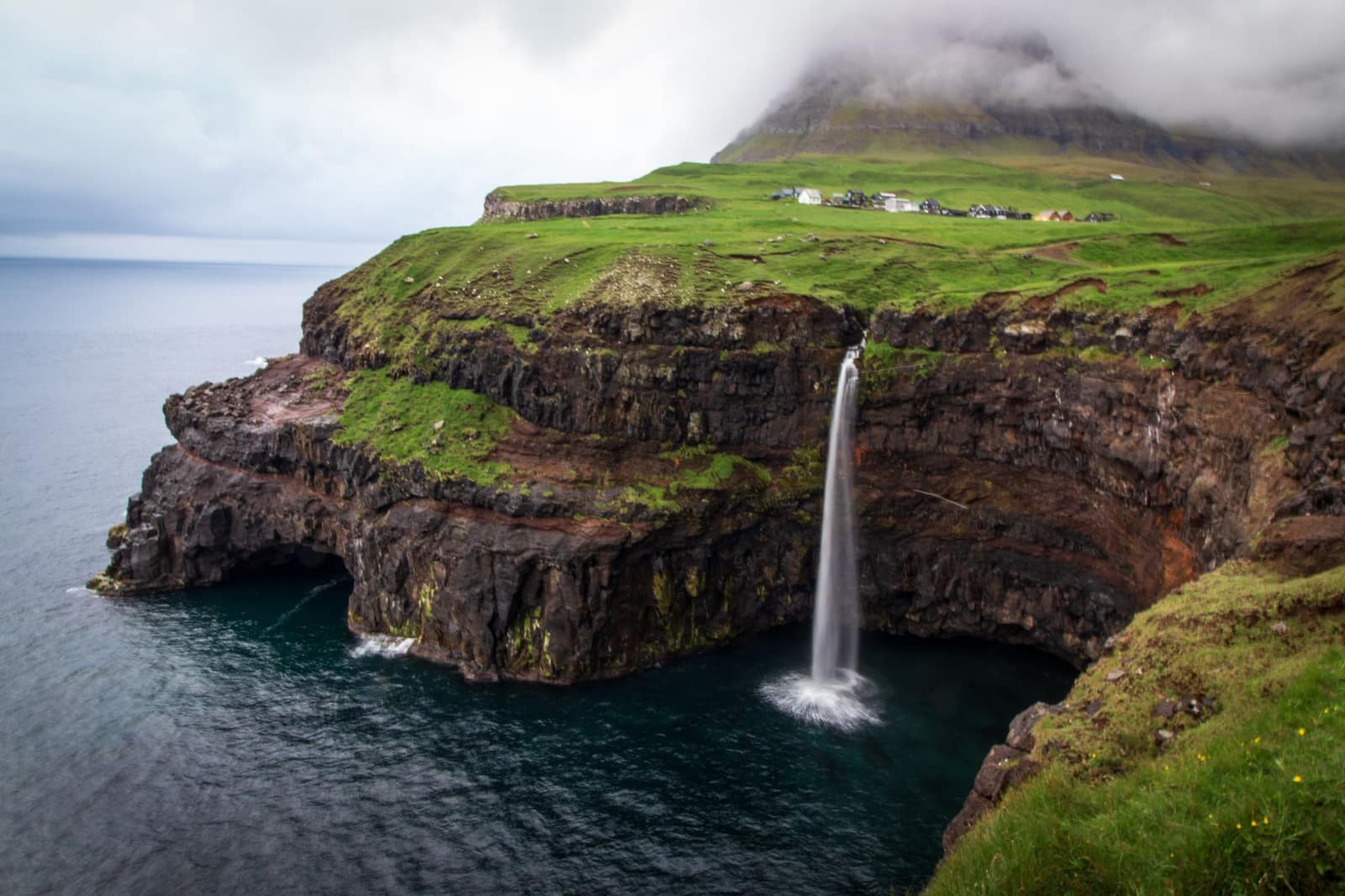
You are met at Vágar airport or your Tórshavn hotel, spend two nights in Tórshavn, one in Gjógv, one in Tórshavn, two in Tvøroyri on Suðuroy and one in Sørvágur, and leave from Vágar airport.
Pickup: Vagar airport, then to your Torshavn hotel for the first night or your hotel in Torshavn. Drop-off: Vagar airport or your hotel, on a night before an early flight.
The route: Vagar Airport, then Tórshavn, then Gjógv, then Tórshavn, then Tvøroyri, then Vagur, then Tvøroyri, then Sørvágur, then Vagar Airport.
The journey at a glance
In short: A private eight-day guided journey in the Faroe Islands for guests who want food, villages, a ridge walk and the far south by ferry, from Vágar airport, best from June to August.
Length
8 days
Season
June to August
Style
An available journey, adaptable to your dates
Every journey here is a starting point: we adapt the days, the pace and the places to each guest. All the journeys
The whole journey, day by day. The numbered points mark where each day ends and the night is spent; select one to jump to that day.
Your guide meets you at Vágar airport and drives you to Tórshavn, 46.7 km and about 51 minutes by the routing estimate. If you have your own hotel in Tórshavn, the journey starts there. The capital sits on the island of Streymoy, and the harbour is its heart, with the old town of Tinganes on the rock between two harbours. Check in, rest, and let the guide take the first walk slowly, since the day has started early for most guests, and nothing is planned that cannot wait.
In the evening your guide sits down with you for a private briefing on the days ahead, the weather, the ferry to the south and the walks, and what to wear for each. Tell us anything you do not eat, since the next days include fermented food and a home-dining table. From June to August the evening light is long, so a late walk along the waterfront is easy, and the harbour is quiet after the day. Dinner is in the town, at a table chosen by us. The light changes through the year, so your guide sets the hours by sunrise and sunset for your dates.
Along the way
Vagar Airport Start of the day
Tórshavn End of the day
The road of the day, on the coast. Select a point to read about the place.
The day, hour by hour
13:00Land at Vágar airport; the time follows your flight
14:00Drive to Tórshavn, 46.7 km, about 51 min by the routing estimate
16:00Check in and rest
18:00Private briefing with your guide
19:30Dinner, then a waterfront walk in the evening light
Vágar to Tórshavn is 46.7 km, about 51 minutes by the routing estimate.
Tinganes sits on the rock between two harbours.
Tell us what you do not eat before the home-dining table.
Plan B. If your flight is late, the briefing moves to breakfast and the waterfront walk to the next evening.
Night: Tórshavn
Day 2 The market, and a tasting of ræst
Tórshavn’s market stands at Vágsbotn, on the harbour, where locals gather to sell their goods, and fresh fish and vegetables from Sandoy are sold there. On the first Sunday of each month local farmers sell meat, vegetables and homemade goods, so the day is best planned for that Sunday, and otherwise the morning is the harbour and the shops. Your guide walks you through it and the old town of Tinganes, where the Faroese government still works in turf-roofed buildings.
The afternoon is a tasting of ræst, the Faroese art of fermentation, in which meat and fish are dried outdoors in the wind and left to ripen. It is one of the most distinctive parts of Faroese food, and the taste is strong, so your guide pairs it with bread and a drink and lets you decide how far to go. The evening is a long dinner of your choosing in the town, and a second waterfront walk if the light is kind. The light changes through the year, so your guide sets the hours by sunrise and sunset for your dates.
Along the way
Tórshavn Start of the day
The road of the day, on the coast. Select a point to read about the place.
The day, hour by hour
09:30Market at Vágsbotn with your guide
11:30Tinganes and the old town
13:00Lunch in Tórshavn
15:00Ræst tasting with your guide
19:00Dinner in Tórshavn
The market at Vágsbotn sells fresh fish and vegetables from Sandoy.
On the first Sunday of each month local farmers sell meat and homemade goods.
Ræst is the Faroese art of fermentation; the taste is strong.
Plan B. If it is not the first Sunday of the month, the market is lighter and the morning is the old town and the harbour.
Night: Tórshavn
Day 3 Saksun, where the sea comes and goes
85 km, 1 h 27 min.
Saksun is a village in a natural amphitheatre high above a tidal lagoon, 47.1 km from Tórshavn, about 49 minutes by the routing estimate. The village has a church built in 1858 and an active sheep farm that is also a museum. At the foot of the village the lagoon fills and empties with the tide, and at low tide it is possible to walk along the sandy shore around the headland. Your guide times the walk by the tide table, and the light on the water changes through the hour. The village stands in a natural amphitheatre above the lagoon, and its sheep farm also works as a museum, so the walk is slow and nobody is hurried back to the car.
From Saksun the road runs on to Gjógv in the north of Eysturoy, 38.1 km and about 38 minutes by the routing estimate,. The evening is a walk in the village and dinner at a table chosen by us. The air is cool off the sea even in summer, so bring a warm layer, and the light stays long. The light changes through the year, so your guide sets the hours by sunrise and sunset for your dates.
Along the way
Tórshavn Start of the day
Gjógv End of the day
The road of the day, on the coast. Select a point to read about the place.
The day, hour by hour
09:00Leave Tórshavn for Saksun, 47.1 km, about 49 min
10:30Walk by the lagoon at low tide, as the tide table allows
13:00Lunch in Saksun
15:00Drive to Gjógv, 38.1 km, about 38 min
19:00Dinner in Gjógv
Saksun lies 47.1 km from Tórshavn by the routing estimate.
At low tide it is possible to walk the sandy shore of the lagoon.
The village church was built in 1858.
Plan B. If rain or mist covers the lagoon, the walk is short and the afternoon is the drive and the village, with the lagoon kept for the return road.
Night: Gjógv
Day 4 A ridge walk and a home-dining table
48 km, 0 h 51 min.
Today’s walk is a ridge hike above Gjógv with a local guide, and the line is chosen on the morning by the weather. The tourist board’s advice for walkers is plain: avoid poor visibility, and do not hike in fog or in darkness. If the cloud is down, the walk is not made, and the day becomes a drive along the coast. The tourist board’s guide to safe hiking adds that cliffs are dangerous and no photo is worth the risk, so the ridge line keeps well back from any edge.
In the evening the road leads 48.0 km back to Tórshavn, about 51 minutes by the routing estimate, and dinner is a home-dining table, a home-cooked meal of traditional Faroese dishes shared with a Faroese family. Tell us beforehand about anything you do not eat. The tourist board describes such meals as sharing stories over a home-cooked meal. The day is long, and the light stays up late in summer, so there is time after dinner to talk with the family. The light changes through the year, so your guide sets the hours by sunrise and sunset for your dates.
Along the way
Gjógv Start of the day
Tórshavn End of the day
The road of the day, on the coast. Select a point to read about the place.
The day, hour by hour
08:30Breakfast in Gjógv and briefing on the ridge walk
09:30Ridge hike with a local guide
14:00Lunch and rest
15:30Drive to Tórshavn, 48.0 km, about 51 min by the routing estimate
19:00Home-dining dinner, booked ahead
The ridge line is chosen by your guide on the morning.
Do not hike in fog or in darkness.
Gjógv to Tórshavn is 48.0 km by the routing estimate.
Plan B. If fog covers the ridge, the hike is not made, and the morning is a coastal walk at sea level.
Night: Tórshavn
Day 5 By ferry to Suðuroy
Suðuroy is the southern island, reached from Tórshavn by the ferry to Tvøroyri on route 7, a crossing that takes two hours. The tourist board describes the island as isolated in the south, and the crossing is the calm part of the journey, with the sea open on both sides. The ferry times are set by the operator’s timetable, which your guide books. Your guide books the crossing. Tvøroyri is the ferry dock for the island, and from it the road winds south toward Sumba, which you reach tomorrow, so today needs no early start and no hurry on arrival. The crossing is the only fixed point of the day, and everything after it can follow the weather.
On arrival at Tvøroyri the afternoon is a slow walk through the town and its harbour. Dinner is at a table chosen by us. Bring a layer for the crossing, since the wind on deck is cold. The light is long in summer, so the evening walk is easy, and your guide has the next day’s route on a map. The light changes through the year, so your guide sets the hours by sunrise and sunset for your dates.
Along the way
Tórshavn Start of the day
Tvøroyri End of the day
The road of the day, on the coast. Select a point to read about the place.
The day, hour by hour
09:00Drive to the ferry terminal in Tórshavn and board
09:30Ferry to Tvøroyri, two hours; the time follows the timetable
12:00Arrive in Tvøroyri and have lunch
14:00Walk the town and the harbour
19:00Dinner in Tvøroyri
The ferry from Tórshavn to Tvøroyri takes two hours.
The ferry is route 7 on the operator’s page.
Your guide books the crossing ahead.
Plan B. If the sea is too high and the ferry is cancelled, your guide rebooks the crossing and the night stays in Tórshavn.
Night: Tvøroyri
Day 6 Sumba, Akraberg and the west cliffs
51 km, 0 h 59 min.
The road south from Tvøroyri leads to Sumba, the southernmost village in the Faroe Islands, 31.6 km and about 36 minutes by the routing estimate. The road goes on to the Akraberg lighthouse, which looks over the open Atlantic. The tourist board suggests returning by the winding road over the pass and not through the tunnel. The west coast of Suðuroy has sheer cliffs, and your guide stops where the ground is safe and the view is long.
Vágur lies 19.7 km from Tvøroyri, about 23 minutes by the routing estimate, with shops, cafés and scenic cliffs close by, and the tourist board suggests a 2.5 hour hike from Vágur to the village of Fámjin, where the church displays the first Faroese flag. The day is long and the roads are narrow, so the pace is slow. Keep back from the cliff edge, since the drop is sheer and the mist can come in. The light is long, and the evening is dinner in Tvøroyri, with the ferry back to Tórshavn waiting for the morning. Bring waterproofs and sturdy shoes, since the wind on the west side is strong and the grass is wet. The light changes through the year, so your guide sets the hours by sunrise and sunset for your dates.
Along the way
Tvøroyri Start of the day
Vagur End of the day
The road of the day, on the coast. Select a point to read about the place.
The day, hour by hour
09:00Drive south to Sumba, 31.6 km, about 36 min
10:30Akraberg lighthouse
13:00Lunch on the road
14:30West coast cliffs, with stops chosen by the guide
19:00Dinner in Tvøroyri
Sumba is the southernmost village in the Faroe Islands.
Tvøroyri to Sumba is 31.6 km by the routing estimate.
Keep back from the cliff edge.
Plan B. If mist closes the cliffs, the day is Vágur and the villages, and the cliffs wait for a clearer hour.
Night: Tvøroyri
Day 7 Back by sea, and on to Vágar
48 km, 2 h 50 min.
The ferry from Tvøroyri to Tórshavn takes two hours, and from Tórshavn the road leads to Sørvágur on Vágar, 48.2 km and about 50 minutes by the routing estimate. The crossing times are set by the operator’s timetable. The day is a travel day, with a long lunch in Tórshavn between the ferry and the road, and the late afternoon is free. Sørvágur lies 2.5 km from the airport, about 6 minutes, so tomorrow’s flight is close.
The evening is dinner in Sørvágur, and your guide goes through the morning with you, the hour of the boat and the hour of the flight. Pack the bags tonight, since the morning is early. The village is quiet, and the light over the harbour is long in summer. Take a short walk after dinner if the sky is clear, and tell your guide if you want an early or a late start tomorrow. The boat is booked for the morning, and the hour is set with the operator the day before. The light changes through the year, so your guide sets the hours by sunrise and sunset for your dates.
Along the way
Tvøroyri Start of the day
Sørvágur End of the day
The road of the day, on the coast. Select a point to read about the place.
The day, hour by hour
09:00Ferry from Tvøroyri to Tórshavn, two hours; the time follows the timetable
12:00Lunch in Tórshavn
14:00Drive to Sørvágur, 48.2 km, about 50 min
16:30Check in and rest
19:00Dinner in Sørvágur
The ferry between Tvøroyri and Tórshavn takes two hours.
Tórshavn to Sørvágur is 48.2 km by the routing estimate.
Sørvágur is 2.5 km from the airport.
Plan B. If the ferry is cancelled, your guide rebooks it and the last night is kept in Tórshavn, with the boat moved.
Night: Sørvágur
Day 8 A last boat under the cliffs
74 km, 1 h 22 min.
The last morning is a boat under the Vestmanna sea cliffs, from May to September several tours run each day, and the trip lasts about two hours. Vestmanna lies 37.4 km from Sørvágur, about 40 minutes by the routing estimate. The boat passes deep grottoes and narrow straits beneath cliffs 700 metres high, where puffins, razorbills, guillemots and fulmars nest in summer, and on a misty morning the cliffs stand out of the white. The skipper decides the route by the swell and the wind, and nobody is rushed on the water. Dress in warm layers, since the air under the cliffs is cooler than on land.
Afterwards there is time for a last Faroese coffee in Vestmanna before the road to Vágar airport, 36.2 km and about 42 minutes by the routing estimate. Your guide has the flight, the hour and the airport written down, and walks you to the terminal. The journey ends there, with no further night. Allow time for the weather, since fog can close the airport, and the day is planned with a margin of two hours before your flight. The light changes through the year, so your guide sets the hours by sunrise and sunset for your dates.
Along the way
Sørvágur Start of the day
Vagar Airport End of the day
The road of the day, on the coast. Select a point to read about the place.
The day, hour by hour
08:30Check-out in Sørvágur and drive to Vestmanna, 37.4 km, about 40 min
09:30Boat under the Vestmanna cliffs, about two hours
12:00A last Faroese coffee in Vestmanna
12:30Drive to Vágar airport, 36.2 km, about 42 min
14:00Your guide sees you to the terminal
Boat tours at Vestmanna run from May to September, about two hours.
Vestmanna to Vágar airport is 36.2 km by the routing estimate.
Fog can close the airport; a margin is held.
Plan B. If the swell is too high, the boat does not sail, and the morning is a walk in Vestmanna and a long coffee before the airport.
Night: Vestmanna (departure, no further night)
While you are there
Festivals, markets and local events change from year to year. Tell us your dates and we will check what is on along this route and fold it in.