You are met at Vágar airport or your Tórshavn hotel, spend two nights in Tórshavn, one in Sørvágur on Vágar and two in Klaksvík, and leave from Vágar airport.
Pickup: Vagar airport, then to your Torshavn hotel for the first night or your hotel in Torshavn. Drop-off: Vagar airport or your hotel, on a night before an early flight.
The route: Vagar Airport, then Tórshavn, then Kirkjubour, then Tórshavn, then Gasadalur, then Sørvágur, then Klaksvík, then Trollanes, then Klaksvík, then Vagar Airport.
The journey at a glance
In short: A private six-day guided journey in the Faroe Islands for guests who want the highlights of Streymoy, Vágar and Kalsoy, from Vágar airport, best from June to August.
Length
6 days
Season
June to August
Style
An available journey, adaptable to your dates
Every journey here is a starting point: we adapt the days, the pace and the places to each guest. All the journeys
The whole journey, day by day. The numbered points mark where each day ends and the night is spent; select one to jump to that day.
Your guide meets you at Vágar airport, the only airport in the Faroe Islands, and drives you to Tórshavn, 46.7 km and about 51 minutes by the routing estimate. If you have your own hotel in Tórshavn, the journey starts there instead, and the guide waits at the hotel. The capital sits on the island of Streymoy, and its old town, Tinganes, is a rocky outcrop between two harbours, covered in turf-roofed houses. The Viking parliament is said to have met there around the year 900.
The afternoon is a slow walk through Tinganes with your guide, and the Faroese Home Rule government still works in these buildings. Dinner is in the town, at a table chosen by us. The days are long from June to August, so the evening stays light, and a late walk along the harbour is easy. Bring a waterproof, since the weather changes in the blink of an eye, and your guide reads the sky for you and sets the next day by it. The light changes through the year, so your guide sets the hours by sunrise and sunset for your dates.
Along the way
Vagar Airport Start of the day
Tórshavn End of the day
The road of the day, on the coast. Select a point to read about the place.
The day, hour by hour
13:00Land at Vágar airport; the time follows your flight
14:00Drive to Tórshavn, 46.7 km, about 51 min by the routing estimate
15:30Check in and walk Tinganes with your guide
17:30Free time on the harbour
19:30Dinner in Tórshavn
Vágar to Tórshavn is 46.7 km, about 51 minutes by the routing estimate.
Tinganes is the historic core of Tórshavn, with turf-roofed buildings.
The Viking parliament is said to have met there around 900.
Plan B. If rain sets in, the walk shortens to Tinganes and the cathedral, and the harbour walk waits for the light after dinner.
Night: Tórshavn
Day 2 Kirkjubøur, and a private dinner
12 km, 0 h 15 min.
Kirkjubøur lies 11.8 km from Tórshavn, about 15 minutes by the routing estimate. It holds the medieval Magnus Cathedral, built in the 1300s, which was for centuries the seat of power on the islands. Beside it stands Roykstovan, a farmhouse of about 900 years, thought to be the oldest wooden house still in use. Your guide takes you through both at your own pace, and the village sits on the shore, with sheep on the slope behind it. The grass-roofed old town of Tórshavn is the morning, and Kirkjubøur is the afternoon.
The evening is a private dinner, a table booked for you alone at a restaurant chosen by us and named at booking. Tell us beforehand about anything you do not eat. After dinner the light stays long in summer, so the drive back is slow. The day has been kept short on purpose, since tomorrow you leave for Vágar, and the first sight of the lake is better for a night’s rest. The light changes through the year, so your guide sets the hours by sunrise and sunset for your dates.
Along the way
Tórshavn Start of the day
Kirkjubour End of the day
The road of the day, on the coast. Select a point to read about the place.
The day, hour by hour
09:30Old town of Tórshavn on foot, with your guide
13:00Lunch in town
14:30Drive to Kirkjubøur, 11.8 km, about 15 min
15:00Magnus Cathedral and Roykstovan
19:00Private dinner at a table booked for you alone
Kirkjubøur lies 11.8 km from Tórshavn by the routing estimate.
Magnus Cathedral was built in the 1300s.
Roykstovan is thought to be the oldest wooden house still in use.
Plan B. If the weather is poor, the village visit shortens and the afternoon is a museum in Tórshavn, with dinner kept as booked.
Night: Tórshavn
Day 3 Gásadalur and the lake over the sea
58 km, 1 h 00 min.
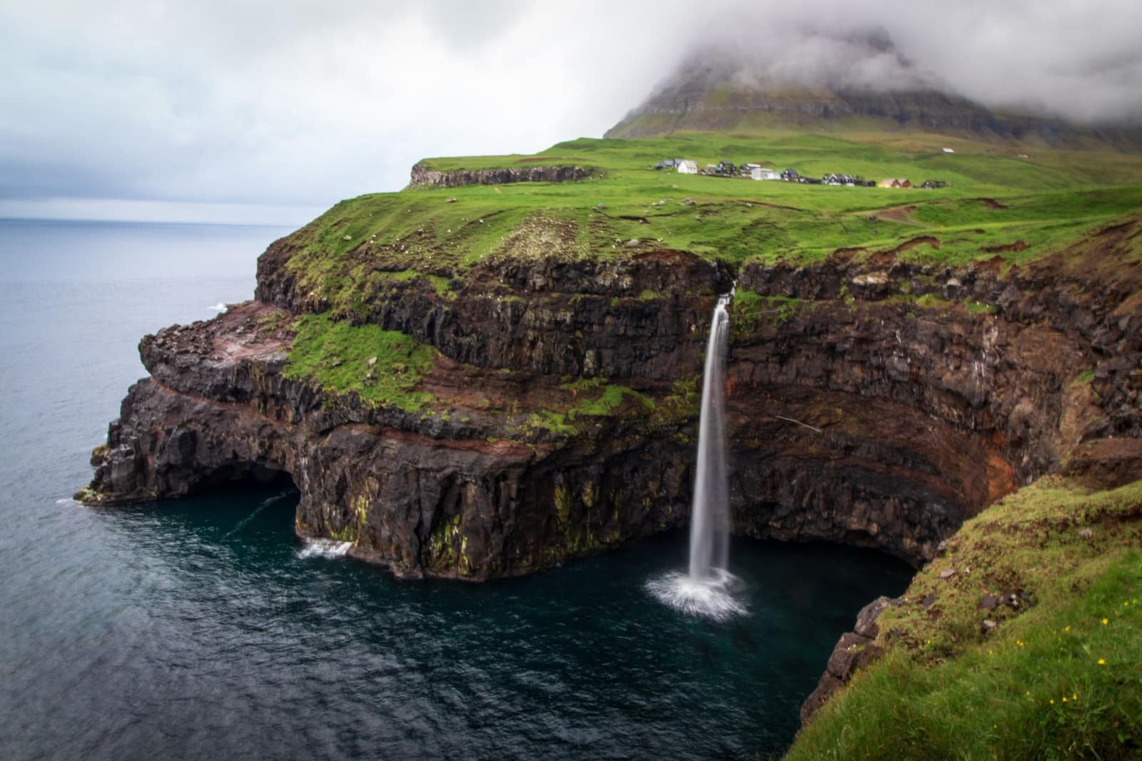
The drive from Tórshavn to Sørvágur on Vágar is 48.2 km, about 50 minutes by the routing estimate, and the day begins on it. Gásadalur is 9.4 km further, and until a tunnel was built in 2004 the village was cut off from the road. The waterfall, Múlafossur, falls straight to the sea beside the houses. Your guide stops where the light is best, and the walk to the village edge is short. From the airport it is about 15 minutes by car.
In the afternoon the walk is to the cliff above Sørvágsvatn, the lake that seems to hang above the ocean. The hike takes about 45 minutes one way, and it is only a five minute drive from the airport. Visitors pay a mandatory fee, and your guide books it beforehand. Take a layer for the wind on the cliff. Stay on the path and keep well back from the edge, since the drop is sheer and the mist can come in without warning. If the sky is clear, the lake and the ocean line up in one frame, and your guide waits for that light. The light changes through the year, so your guide sets the hours by sunrise and sunset for your dates.
Along the way
Tórshavn Start of the day
Gasadalur End of the day
The road of the day, on the coast. Select a point to read about the place.
The day, hour by hour
09:00Leave Tórshavn for Vágar, 48.2 km, about 50 min
11:00Gásadalur and the Múlafossur waterfall
13:00Lunch in Sørvágur
14:30Walk to the cliff above Sørvágsvatn, about 45 min each way
19:00Dinner in Sørvágur
A tunnel to Gásadalur was built in 2004.
The hike to the cliff above Sørvágsvatn takes about 45 minutes one way.
A mandatory fee applies and is booked in advance.
Plan B. If cloud or fog sits on the cliff, the walk is not made, and the afternoon is a drive along the west coast of Vágar.
Night: Sørvágur
Day 4 A boat under the Vestmanna cliffs
107 km, 1 h 52 min.
The sea cliffs of Vestmanna are best seen from the water. Boat tours run from May to September, several times a day, and last about two hours. Your guide books the tour on a departure that suits the morning, and the hour is confirmed at booking. Vestmanna lies 37.4 km from Sørvágur, about 40 minutes by the routing estimate, and on the water you pass deep grottoes and narrow straits beneath cliffs 700 metres high, where puffins, razorbills, guillemots and fulmars nest in summer. Sailing depends on the swell and the wind, and the mist can lie over the water.
After lunch the road runs north to Klaksvík, 69.4 km and about 72 minutes from Vestmanna by the routing estimate, through the tunnels that join the islands. Tomorrow’s ferry to Kalsoy leaves from the harbour here. The evening is a walk along the harbour, and dinner is in the town. The light stays long, and the night in a hotel chosen by us is quiet. The boat day is early, so the evening is short. The light changes through the year, so your guide sets the hours by sunrise and sunset for your dates.
Along the way
Sørvágur Start of the day
Klaksvík End of the day
The road of the day, on the coast. Select a point to read about the place.
The day, hour by hour
09:00Drive from Sørvágur to Vestmanna, 37.4 km, about 40 min
10:00Boat tour under the Vestmanna cliffs, about two hours
13:00Lunch in Vestmanna
14:30Drive to Klaksvík, 69.4 km, about 72 min
19:00Dinner in Klaksvík
Boat tours at Vestmanna run from May to September, several times a day, about two hours.
Vestmanna to Klaksvík is 69.4 km by the routing estimate.
Sailing depends on the swell and the wind.
Plan B. If the swell is too high, the boat does not sail, and the day becomes a drive and a walk on Streymoy, with the boat kept for another hour.
Night: Klaksvík
Day 5 Kalsoy, the lighthouse and Mikladalur
Kalsoy is called the flute for its thin shape and its many road tunnels. The island is reached by the ferry from Klaksvík harbour to Syðradalur, which sails on route 56. The ferry time is set by the operator’s timetable, which your guide books. From Syðradalur the road runs north to Trøllanes, where the tourist board’s own day plan has bus 506 meeting the ferry, and from there a hike leads to the lighthouse at Kallur, at the northern tip, which the tourist board calls particularly impressive. The walk has a mandatory fee, paid on site by card.
Kalsoy has a rich bird life, including puffins, storm petrels and black guillemots, and in summer the cliffs near the lighthouse are the place to look, with sightings never promised. Lunch is in Mikladalur, where a statue of the Seal Woman stands and a café serves lunch on every day but Sunday, Monday and Tuesday, so this day is planned for Wednesday to Saturday. Do not walk in fog or in the dark, and your guide will turn back if the cloud closes in. The ferry brings you back to Klaksvík in the evening, and dinner is in the town. The light changes through the year, so your guide sets the hours by sunrise and sunset for your dates.
Along the way
Klaksvík Start of the day
Trollanes End of the day
The road of the day, on the coast. Select a point to read about the place.
The day, hour by hour
08:30Ferry from Klaksvík to Syðradalur; the time follows the timetable
10:00Road north to Trøllanes
11:00Hike to the Kallur lighthouse
14:00Lunch in Mikladalur
17:00Ferry back to Klaksvík
19:30Dinner in Klaksvík
Kalsoy is reached by the ferry on route 56 from Klaksvík to Syðradalur.
The Kallur lighthouse is at the northern tip of the island.
Do not walk in fog or in the dark.
Plan B. If fog covers the lighthouse, the hike is not made, and the day is the village, the lunch and a drive through the tunnels.
Night: Klaksvík
Day 6 The way back to Vágar
77 km, 1 h 22 min.
The journey ends at Vágar airport, 77.0 km and about 82 minutes from Klaksvík by the routing estimate, through the tunnels that join the northern islands to the west. If you leave from Tórshavn instead, the drop-off is at your hotel there, and the guide hands you to the airport transfer. Your guide has the flight, the hour and the airport written down, and walks you to the terminal. The last morning in Klaksvík is slow, with a coffee on the harbour before the road.
Allow time for the weather, since fog can close the airport, and the day is planned with a margin of two hours before your flight. Check-out is early enough for a flight at noon. The light is long, and an afternoon flight costs you none of the day, so the morning can be used for a short walk in the town. The journey ends there, with no further night, and the islands stay on the horizon from the window of the aircraft. The light changes through the year, so your guide sets the hours by sunrise and sunset for your dates.
Along the way
Klaksvík Start of the day
Vagar Airport End of the day
The road of the day, on the coast. Select a point to read about the place.
The day, hour by hour
08:00Breakfast and check-out in Klaksvík
09:00Coffee on the harbour
10:00Drive to Vágar airport, 77.0 km, about 82 min by the routing estimate
12:00Your guide sees you to the terminal
13:30Flight home
Klaksvík to Vágar airport is 77.0 km, about 82 minutes by the routing estimate.
Fog can close the airport; a two hour margin is held.
Drop-off can be at your hotel instead.
Plan B. If the weather delays your flight, your guide stays with you and moves the transfer or the night.
Night: Klaksvík (departure, no further night)
While you are there
Festivals, markets and local events change from year to year. Tell us your dates and we will check what is on along this route and fold it in.